Perthes, Haute-Marne
Perthes (French pronunciation: [pɛʁt] (![]() listen)) is a commune in the Haute-Marne department in north-eastern France.
listen)) is a commune in the Haute-Marne department in north-eastern France.
Perthes | |
|---|---|
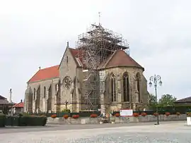 The church in Perthes | |
Location of Perthes 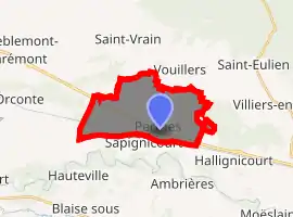
| |
 Perthes  Perthes | |
| Coordinates: 48°39′25″N 4°49′22″E | |
| Country | France |
| Region | Grand Est |
| Department | Haute-Marne |
| Arrondissement | Saint-Dizier |
| Canton | Saint-Dizier-1 |
| Government | |
| • Mayor (2020–2026) | Marie-Claude Saget-Thyes |
| Area 1 | 13.08 km2 (5.05 sq mi) |
| Population (2017-01-01)[1] | 526 |
| • Density | 40/km2 (100/sq mi) |
| Time zone | UTC+01:00 (CET) |
| • Summer (DST) | UTC+02:00 (CEST) |
| INSEE/Postal code | 52386 /52100 |
| Elevation | 121–134 m (397–440 ft) (avg. 128 m or 420 ft) |
| 1 French Land Register data, which excludes lakes, ponds, glaciers > 1 km2 (0.386 sq mi or 247 acres) and river estuaries. | |
World War II
After the liberation of the area by Allied Forces in September 1944, engineers of the Ninth Air Force IX Engineering Command began construction of a combat Advanced Landing Ground outside of the town. Declared operational on 9 September, the airfield was designated as "A-65", it was used by several combat units until October when the units moved forward with the advancing Allies. Afterward, the airfield was closed.[2][3]
References
- "Populations légales 2017". INSEE. Retrieved 6 January 2020.
- Johnson, David C. (1988), U.S. Army Air Forces Continental Airfields (ETO), D-Day to V-E Day; Research Division, USAF Historical Research Center, Maxwell AFB, Alabama.
- Maurer, Maurer. Air Force Combat Units of World War II. Maxwell AFB, Alabama: Office of Air Force History, 1983. ISBN 0-89201-092-4.
| Wikimedia Commons has media related to Perthes (Haute-Marne). |
| Authority control |
|---|
This article is issued from Wikipedia. The text is licensed under Creative Commons - Attribution - Sharealike. Additional terms may apply for the media files.