Saint-Dizier
Saint-Dizier (French pronunciation: [sɛ̃.di.zje]) is a commune in the Haute-Marne department in north-eastern France.
Saint-Dizier | |
|---|---|
Subprefecture and commune | |
 The Notre-Dame church in Saint-Dizier | |
 Coat of arms | |
Location of Saint-Dizier 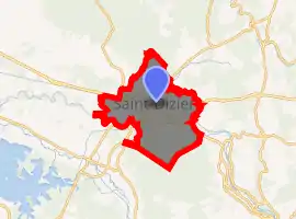
| |
 Saint-Dizier  Saint-Dizier | |
| Coordinates: 48°38′18″N 4°56′59″E | |
| Country | France |
| Region | Grand Est |
| Department | Haute-Marne |
| Arrondissement | Saint-Dizier |
| Canton | Saint-Dizier-1, 2 and 3 |
| Intercommunality | CA Saint-Dizier Der et Blaise |
| Government | |
| • Mayor (2020–2026) | Quentin Briere[1] |
| Area 1 | 47.69 km2 (18.41 sq mi) |
| Population (2017-01-01)[2] | 24,012 |
| • Density | 500/km2 (1,300/sq mi) |
| Time zone | UTC+01:00 (CET) |
| • Summer (DST) | UTC+02:00 (CEST) |
| INSEE/Postal code | 52448 /52100 |
| 1 French Land Register data, which excludes lakes, ponds, glaciers > 1 km2 (0.386 sq mi or 247 acres) and river estuaries. | |
It has a population of 26,300 (2014 figure) and is a subprefecture of the department. Although Saint-Dizier is marginally the most populous commune in Haute-Marne, the préfecture (capital) resides in the somewhat smaller commune of Chaumont.
Geography

Located approximately 120 miles (193 km) east of Paris, halfway to Strasbourg, it is five miles from Western Europe's largest man-made lake, Lake Der-Chantecoq.
Climate
| Climate data for Saint-Dizier (1981–2010 averages) | |||||||||||||
|---|---|---|---|---|---|---|---|---|---|---|---|---|---|
| Month | Jan | Feb | Mar | Apr | May | Jun | Jul | Aug | Sep | Oct | Nov | Dec | Year |
| Record high °C (°F) | 17.7 (63.9) |
22.6 (72.7) |
25.2 (77.4) |
29.4 (84.9) |
31.8 (89.2) |
36.8 (98.2) |
39.0 (102.2) |
40.4 (104.7) |
33.7 (92.7) |
29.2 (84.6) |
23.4 (74.1) |
18.6 (65.5) |
40.4 (104.7) |
| Average high °C (°F) | 6.1 (43.0) |
7.6 (45.7) |
11.7 (53.1) |
15.4 (59.7) |
19.7 (67.5) |
22.8 (73.0) |
25.5 (77.9) |
25.1 (77.2) |
20.8 (69.4) |
16.0 (60.8) |
10.0 (50.0) |
6.6 (43.9) |
15.7 (60.3) |
| Average low °C (°F) | 0.3 (32.5) |
0.3 (32.5) |
2.8 (37.0) |
4.9 (40.8) |
9.1 (48.4) |
12.0 (53.6) |
14.1 (57.4) |
13.7 (56.7) |
10.6 (51.1) |
7.7 (45.9) |
3.6 (38.5) |
1.3 (34.3) |
6.7 (44.1) |
| Record low °C (°F) | −19.5 (−3.1) |
−22.5 (−8.5) |
−13.6 (7.5) |
−6.0 (21.2) |
−3.0 (26.6) |
2.2 (36.0) |
3.2 (37.8) |
3.7 (38.7) |
0.2 (32.4) |
−5.1 (22.8) |
−11.7 (10.9) |
−17.3 (0.9) |
−22.5 (−8.5) |
| Average precipitation mm (inches) | 71.8 (2.83) |
60.5 (2.38) |
66.2 (2.61) |
60.2 (2.37) |
72.4 (2.85) |
65.9 (2.59) |
70.4 (2.77) |
68.8 (2.71) |
74.2 (2.92) |
78.6 (3.09) |
69.5 (2.74) |
85.2 (3.35) |
843.7 (33.22) |
| Average precipitation days | 12.2 | 10.6 | 11.8 | 10.4 | 11.0 | 10.3 | 9.6 | 9.0 | 9.6 | 11.4 | 12.2 | 13.1 | 131.1 |
| Average snowy days | 6.3 | 5.2 | 3.6 | 1.4 | 0.1 | 0.0 | 0.0 | 0.0 | 0.0 | 0.0 | 2.5 | 4.5 | 23.6 |
| Average relative humidity (%) | 86 | 81 | 78 | 73 | 74 | 75 | 74 | 77 | 81 | 85 | 87 | 86 | 79.8 |
| Mean monthly sunshine hours | 66.4 | 80.3 | 136.8 | 174.2 | 210.7 | 220.0 | 228.0 | 220.5 | 166.3 | 117.7 | 58.4 | 47.6 | 1,726.9 |
| Source 1: Météo France[3][4] | |||||||||||||
| Source 2: Infoclimat.fr (humidity and snowy days, 1961–1990)[5] | |||||||||||||
History
Named after an unknown saint (possibly Desiderius of Fontenelle), the town originated as a fortified settlement around a thirteenth-century château, eventually becoming a royal fortress to guard the French kingdom's eastern approaches. The town was besieged and captured by Charles V, Holy Roman Emperor, in the summer of 1544. A fire in 1775 destroyed two-thirds of the town center. The château was owned by the Orléans family until the French Revolution, was a base for German troops during World War II, and currently houses the Municipal Museum.
Notable people
Saint-Dizier is the birthplace of
- Baroque-era musicologist André Pirro
- Organist André Isoir
- Conductor Jean-Paul Penin
- Former world middleweight boxing champion Marcel Thil. A street is named in his honor.
References
- "Répertoire national des élus: les maires". data.gouv.fr, Plateforme ouverte des données publiques françaises (in French). 2 December 2020. Retrieved 11 December 2020.
- "Populations légales 2017". INSEE. Retrieved 6 January 2020.
- "Données climatiques de la station de Saint-Dizier" (in French). Meteo France. Retrieved January 4, 2016.
- "Climat Champagne-Ardenne" (in French). Meteo France. Retrieved January 4, 2016.
- "Normes et records 1961-1990: Saint-Dizier - Robinson (52) - altitude 139m" (in French). Infoclimat. Retrieved January 4, 2016.
External links
| Wikimedia Commons has media related to Saint-Dizier. |
| Authority control |
|---|