Peterhead
Peterhead (![]() listen ; Scottish Gaelic: Ceann Phàdraig,[3] Scots: Peterheid
listen ; Scottish Gaelic: Ceann Phàdraig,[3] Scots: Peterheid ![]() listen )[4] is a town in Aberdeenshire, Scotland. It is Aberdeenshire's biggest settlement (the city of Aberdeen itself not being a part of the district), with a population of 18,537 at the 2011 Census,[5] in addition to being the largest fishing port in the United Kingdom, for total landings by UK vessels, according to a 2019 survey.[6]
listen )[4] is a town in Aberdeenshire, Scotland. It is Aberdeenshire's biggest settlement (the city of Aberdeen itself not being a part of the district), with a population of 18,537 at the 2011 Census,[5] in addition to being the largest fishing port in the United Kingdom, for total landings by UK vessels, according to a 2019 survey.[6]
Peterhead
| |
|---|---|
 Broad Street, looking west to the Town House. The Reform Monument is in view on the left | |
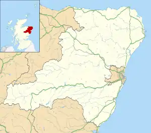 Peterhead Location within Aberdeenshire | |
| Population | 19,270 (mid-2016 est.)[2] |
| OS grid reference | NK135465 |
| • Edinburgh | 120 miles (193 kilometres) |
| • London | 420 mi (676 km) |
| Council area | |
| Lieutenancy area | |
| Country | Scotland |
| Sovereign state | United Kingdom |
| Post town | Peterhead |
| Postcode district | AB42 |
| Dialling code | 01779 |
| Police | Scotland |
| Fire | Scottish |
| Ambulance | Scottish |
| UK Parliament | |
| Scottish Parliament | |
Peterhead sits at the easternmost point in mainland Scotland. It is often referred to as The Blue Toun (locally spelled "The Bloo Toon") and its natives are known as Bloo Touners. They are also referred to as blue mogginers (locally spelled "bloomogganners"), supposedly from the blue worsted moggins or stockings that the fishermen originally wore.
History
Peterhead was founded in 1587 by George Keith, 5th Earl Marischal,[7] and was developed as a planned settlement, then known as "Harbour and Barony of Keith Insche commonly called Peterhead".[7] The twelve original feuars occupied land along Seagate between the pier of Port Henry, to the north, and the Quinzie (Queenie) to the south. The Queenie was a causeway of boulders, covered only by spring tides, which linked the islands of Keith Inch and Greenhill to the mainland.[7] (Today, the Queenie Bridge, which opened in 1954, connects Bridge Street and Greenhill Road. It replaced a swing bridge which had stood on the site since 1850.)[8] The construction of Port Henry in 1593 encouraged the growth of Peterhead as a fishing port and established a base for trade. (Port Henry Road, running east-west, can be found just north of the harbour, off East North Street.)[9] Port Henry, the oldest of Peterhead's three harbours,[10] was constructed along the Seagate shore by Henry Middleton, under the supervision of Keith.[11] It was protected to the north by the Old Pier, which was erected probably before 1593.[10]
The town developed uphill between the shore and Longate, which — until the development of Broad Street in the late 18th century — was the main historic district of the town.[7]
Port Henry was improved in 1631 and repaired before the end of the century and again early in the 18th century. The south pier was increased in height and the west pier was constructed. The southern part was reconstructed between 1775 and 1781 by John Smeaton, with improvements carried out by John Rennie between 1806 and 1810. He also oversaw an addition to the west pier in 1813.[11]
By 1680, Charles McKean notes that Peterhead "had become one of the best fishings on the north coast".[7]
On 22 December 1715, James Francis Edward Stuart, Prince of Wales, arrived in Peterhead from Dunkirk and stayed "in an ancient house in Longate," where he was visited by the Earl Marischal. The Marischal's last Baron Baillie, Thomas Arbuthnot, put the town on alert for war by summoning able-bodied men and their weapons. The prince left for Newburgh, and the town, by forfeiture of the Keiths, suffered for its loyalty.[12] The Earls Marischal estate was forfeited in 1716, sold to York Buildings Company.[10]
In 1775, the "feu superior", the Merchant Maiden Company of Edinburgh, transferred to the Committee of Feuars of Peterhead the Tollbooth, Tollbooth Green and other sundry land.[7] A new Town Hall building replaced the tollbooth. Meanwhile, the enclosed lands of South Bay were being developed into "the beautifully homogeneous district of elegant houses for the accommodation of strangers and sea captains, much of which still survives".[7] Fishermen began to move to Roanheads on the north-east shoulder of the peninsula. Roanheads was laid out in today's form by 1771, and some of the few surviving pantiled houses may be original.[7]
From 1788, the port developed a speciality in whaling. It eventually became Britain's largest whaling port.[10]
In 1815, before the increase in herring popularity, there were 72 vessels registered to Peterhead operating from the port; by 1850 there were over 400.[10]

North Harbour and the dry dock were built by Rennie and Thomas Telford between 1818 and 1822. They were improved fifteen years later. The junction canal was built in 1849, while the south and west piers of North Harbour were built by David Stevenson in 1855. The southern part of North Harbour (Middle Harbour) dates from 1872. It was constructed by David and Thomas Stevenson, with improvements made between 1893 and 1897 by William Shield, a local worker.[11]
A lifeboat station was first established in 1865.[13]
Peterhead convict prison was opened in 1888, gaining a reputation as one of Scotland's toughest prisons.
South Harbour was deepened between 1906 and 1908. The Harbour of Refuge (Admiralty Backwaters) was begun in 1886 by Sir John Coode. It was built by convict labour.
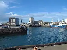
The present harbour, now a Category B listed structure,[11] has two massive breakwaters, enclosing an area of approximately 300 acres (120 ha) in Peterhead Bay. The south breakwater, about 2,700 ft (820 m) long, was constructed in 1892–1912 using convict labour from the prison.[10] Peterhead was, and remains, an important fishing port, and the breakwater gave it an advantage over other fishing ports. The north breakwater, constructed 1912–1956,[14] is approximately 1,500 ft (460 m) long.[15] Peterhead was a Jacobite-supporting town in the Jacobite risings of 1715 and 1745. In particular, it was one of the Episcopalian north-eastern ports where reinforcements, plus money and equipment, were periodically landed from France during the Forty-Five.[16]
A new phase of growth was initiated in the 1970s with Peterhead becoming a major oil industry service centre, and the completion of the nearby St Fergus gas terminal. At this time, considerable land holdings were allocated for industrial development.
From the 1990s onward, the town has suffered from several high-profile company closures and is facing a number of pressures, including Common Fisheries Policy reforms. However, it retains a relatively diverse economy, including food processing, textiles, service industries and, still importantly, fishing. (Over 163,000 tonnes of fish and shellfish, with a value of around £179m, were landed at Peterhead in 2017, employing around 700 fishermen.)[17] The Peterhead Port Authority plans to extend the northern breakwater as a stimulus to the town's economic development. In addition, to assist with business diversification and town centre environmental improvements, the 'Peterhead Project' initiative under the Aberdeenshire Towns Partnership brings together the Council, Scottish Enterprise Grampian, Communities Scotland, commerce and community representatives.
The town's port remains the largest for landings in the United Kingdom. According to a 2019 UK sea fisheries statistical survey, Peterhead port's catch size for the year was 132,000 tonnes. Nearby Fraserburgh was third, behind Lerwick.[6] It was placed 14th in the list of number of fishers based at each port.[18]
Listed buildings
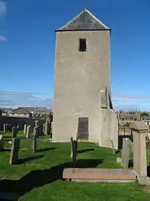
Peterhead has many listed buildings across the three categories of A, B and C. The three Category A listed buildings are Buchan Ness lighthouse (see below),[19] Old St Peter's Church[20] (its graveyard is Category B listed) and the Old Parish Church.[21]
The majority of the listed buildings are on streets that fan out from the harbour, including Harbour Street, Broad Street, Jamaica Street, Maiden Street, Merchant Street, Port Henry Road, Queen Street and St. Andrew Street.
Queen Street was the main street of the new town laid out around 1805.[22]
North Street, which leads up into Roanheads, consists of 19th-century two-storey red granite homes. The dormer-windowed circa-1877 fisher houses in Great Stuart Street were constructed for fishermen quitting Burnhaven (hence its nickname Burnie Street). There are similar houses in Port Henry Road, Gladstone Road and Almanythie Road.[10]
The oldest building in Peterhead is the Fish-House (also known as the Salmon House),[23][24] located on today's Golf Road.[23]
- Harbour Street
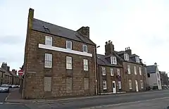
Harbour Street was laid out in 1739, from which year dates Mount Pleasant at number 5, the former home of poet and Peterhead native Peter Buchan.[12]
- 1 Harbour Street, built in the late 18th century. Category B listed
- Broad Street
The former heart of the 19th-century town, Broad Street was bordered by the Town House to the south, Arbuthnot House to the north, and lined on both sides "by good houses, hotels and banks".[12] The slope between Broad Street and the harbour "contains some of the most picturesque urban streets in Scotland," according to historian Charles McKean.[25]
- 32 Broad Street, built in 1858. Category B listed
- 59 Broad Street, built mid-18th century. Category B listed
- 75 Broad Street, built circa 1840. Category B listed
- Reform Monument, built in 1833. Category B listed
- Merchant Street
- 10 Merchant Street, built circa 1800. Category B listed
- St. Peter's Episcopal Church, 22 Merchant Street, built in 1814. Category B listed
- The church hall of the above. Category C listed
- Statue of Field Marshal Keith, built in 1868. Category B listed
Local government
Peterhead is the largest settlement in Buchan, a committee area of Aberdeenshire.
The town was a burgh in the historic county of Aberdeenshire. In 1930 it became a small burgh under the Local Government (Scotland) Act 1929, but in 1975 small burghs were abolished and Peterhead became part of the district of Banff and Buchan within the new Grampian Region. When districts and regions were abolished in 1996, Peterhead became part of the new unitary authority of Aberdeenshire.
Since 1975 Peterhead has had a community council, with limited powers.
Demographics
The 2016 population estimate for the town is 19,270,[26] making Peterhead the largest town in Aberdeenshire. English is the primary language used in the town, although 56.4% of residents can speak Scots.[26]
Social issues
Peterhead has some of the highest levels of deprivation in Aberdeenshire. According to the Scottish Index of Multiple Deprivation, the town centre (specifically a part of the harbour area) received the lowest ranking (1 out of 10) for four of the seven topics. These were Employment, Education/Skills, Housing and Crime. That area also received a ranking of 2 for Income. The other two rankings were a 4 for Health and a 10 for Geographic Access. Overall, this part of the harbour area ranked lowest (1) in the decile and quantile statistics.[27]
By contrast, parts of Ugieside and Peterhead Links ranked markedly higher. Ugieside ranked above 5 in five of the seven topics: Income (7), Employment (6), Health (8), Housing (8) and Crime (10). It received a 4 in Education/Skills and Geographic Access.[27] Peterhead Links, meanwhile, ranked above 5 in all topics.[27]
Young people growing up in Peterhead are ten times more likely to end up in prison than those from Ellon.[28]
Education
Peterhead Academy
Peterhead Academy houses around 1,300 pupils and the school is split into six houses (Arbuthnot, Buchan, Craigewan, Grange, Marischal and Slains), with all the names associated with areas of the town. The school has pupils coming from surrounding villages such as Boddam, Cruden Bay, Hatton, Inverugie, Rora, St Fergus and Crimond. The academy's motto is "Domus Super Petram Aedificata" (A House Built on a Rock). The academy is one of Scotland's largest schools at over 22,920 m2 (246,700 sq ft) of gross internal floor area. The school has multiple subjects such as ICT, English, French/German, Technical, Engineering, Art, Home Economics, and many more.[29]
The building is split in two distinct designs. The older section of the school was built before the Second World War, whilst the newer section of the school with hexagonal designs came after. The latter section of the school shares space with the town's community centre, theatre and sports facilities.
Primary and specialist schools
Peterhead has six primary schools (Clerkhill, Buchanhaven, Meethill, Dales Park, Central, Burnhaven).
There is one special school, Anna Ritchie, which caters for most specific learning difficulties, autism and other disabilities.
Media
Newspapers
Peterhead news appears in The Press and Journal and the Buchan Observer. The Buchanie, as it is known locally, has been published in Peterhead since 1863. The now-defunct Peterhead Sentinel was published between 1858 and 1907.[30]
Radio stations
Waves Radio, 101.2 FM, which first aired in 1997, broadcasts from Blackhouse Way in the Blackhouse Industrial Estate.
Buchan Radio, 107.9 FM, was originally established as the online-only Buchan Community Radio in 2013. It became Buchan Radio in 2017, and launched on FM radio in 2019.[31]
Blueprint for Growth

In 2008, a Blueprint for Growth was published by Aberdeenshire Council[32] – a plan to extend the town beyond its bypass. The plan involved 4,500 homes, 4 new primary schools, a new secondary school and a new hospital to be built in the next 20–25 years – hoping to bring 9,000 people to the town.
In 2016 Aberdeenshire Council launched a regeneration strategy for Peterhead - Peterhead Development Partnership Action Plan 2016 - 2021 covering the themes of Peterhead Economy, Integrating Communities and Connecting, reinforcing and rediscovering Peterhead's town centres.
Lighthouses
.jpg.webp)
Peterhead has four lighthouses, two of which are active. In chronological order of construction, they are:
- Buchan Ness lighthouse (1827; Robert Stevenson) is active. It stands on a small island, accessible by a bridge.[33]
- South Breakwater lighthouse (1833; Robert Stevenson) is active, and it is the easternmost lighthouse on mainland Scotland. It is owned by Peterhead Port Authority.[33]
- Harbour South lighthouse (1849; Thomas Stevenson). Now inactive, it originally stood on the Albert Quay, but it was relocated in 2015 to the junction of the Esplanade and Alexandra Parade.[33]
- Harbour North lighthouse (1908). Now inactive, it is located in front of the Port Authority's control building on West Pier.[33]
Tourism
The harbours, maritime and built heritage, Peterhead Town Trail are the town's principal tourism assets alongside the multi-award winning Peterhead Prison Museum. Recent initiatives include investments in the Peterhead Bay area, which have included the berthing of cruise ships in the harbour. A number of projects are planned under the auspices of the Peterhead Development Partnership and Rediscover Peterhead Business Improvement District initiatives, including tourism strategy development, enhancement of existing attractions, measures to improve the town's physical attractiveness, and improved marketing and promotion.
The former Victorian-era prison, HM Prison Peterhead, that had been closed due to the construction of a new and larger facility has been converted into a museum.[34]
Sport
Peterhead F.C. are an SPFL club who play in the SPFL League One. They won the League Two championship in 2013–14 and 2018–19. The club reached the final of the Scottish Challenge Cup in the 2015–16 season.[35]
Peterhead Golf Club, reputedly the 18th-oldest in the world, sits on the banks of the River Ugie at its estuary with the North Sea, just over a mile to the northwest of the town. It has an 18- and a 9-hole course.
Peterhead RFC are a Scottish Rugby Union team who play at the Lord Catto playing fields.
Transport
Road
Today, Peterhead is contained largely inside the A90, which runs along the western periphery of the town and was built through the area in the late 1980s.[36] It leads to Fraserburgh to the north and Edinburgh to the south. North Road (the A982) connects to the A90 to the north of town, in Ugieside; West Road (the A950) connects to it from downtown; and South Road (also the A982) connects to it south of the town, in the Invernettie area.
The main roads in and out of downtown Peterhead (from north to south) are Ugie Street, Queen Street and West Road (the A950)
- Bus
Peterhead has a number of in-town and out-of-town bus services.[37] The in-town services (run by Stagecoach Bluebird) are the 82 (Chapel Street–Interchange–Community Hospital–Dales Court–Baylands Crescent–Links Terrace–Chapel Street), the 83 (Chapel Street–Interchange–Blackhouse Terrace–Morningside Avenue–Asda–Richmond Avenue–Windmill Road–Chapel Street) and the 84 (Chapel Street–Interchange–Eden Park–Abernethy Road–Invergurie Court–West Road–Chapel Street). The 84 service does not run on Sundays.[37]
Out-of-town buses service Stirling Village (60, X60, 81, 82A, 82S and 747), Longhaven (60, X60, 61, 63 and 747), Hatton (60, X60, 61, X61 and 747), Ellon (60, X60, 61, X61 and 747), Cruden Bay (61, X61, 63 and 747), Newburgh (61, X61 and 63), Balmedie (61 and X61), Aberdeen (60, X60, 61, X61 and 63), Downiehills (66 and 66A), Longside (66 and 66A), Mintlaw (66 and 66A), Old Deer (66 and 66A), Stuartfield (66 and 66A), Maud (66 and 66A), St Fergus (69, 69A and X69), Kirktown (69 and 69A), Crimond (69, 69A and X69), Inverallochy (X69),[38] Lonmay (69), Fraserburgh (69, 69A and X69), St Combs (69A and X69), Cairnbulg (69A), Boddam (81, 82A and 82S), Foveran (747), Belhelvie (747), Dyce (747) and Aberdeen Airport (747). The 60, X60, 63, 69 and 84 do not run on Sundays. The 747 Peterhead to Aberdeen Airport service runs on weekdays only. It also has one return peak journey.[37]
HM Prison Peterhead is serviced by numbers 61, X61, 81, 82A and 82S.[37]
Watermill Coaches runs the Peterhead–HMP Prison–Stirling Village–Boddam route 82S on school days.[37]
A2B dial-a-bus is available on weekdays from 9:45 AM to 1:45 PM.[37]
Air
The nearest airport with scheduled services is Aberdeen Airport. A heliport has been set up at the eastern end of the former RAF Buchan air base. Recreational aviation also takes place from a part of a former runway.[39]
Between 1952 and 2004 the Royal Air Force station RAF Buchan was located near the town. The radar unit ceased to be a RAF station on 1 September 2004 and was downgraded to a Remote Radar Head named RRH Buchan.[40]
Rail
Peterhead is further from a railway station (at 32 miles or 51 km from Aberdeen) than any other town of its size in Great Britain. The town once had two stations, namely Peterhead railway station and Peterhead Docks railway station. Passenger trains on the Formartine and Buchan Railway stopped in 1965 under the Beeching Axe, and freight in 1970. The start of reconstruction of the Borders Railway to Galashiels (early 2013) has begun a local political debate into the possibility of reopening the line from Aberdeen to Fraserburgh and Peterhead.


Twin town
- Ålesund, Norway
Notable people
- Thomas Abernethy, Arctic and Antarctic explorer
- William Aitken, Scottish League footballer
- Jon S. Baird, director
- Eric Temple Bell, mathematician and science fiction author
- Peter Buchan, editor
- Charles Creighton, physician and medical author
- William Gibson, politician
- Alexander Hall, Scottish League footballer
- Arthur D. Hay, judge
- William Hay, architect
- Margaret Jope, biochemist
- George Keith, missionary
- James Keith, soldier
- Marino Keith, Scottish League footballer
- William Keith, colonial governor of Pennsylvania
- George King, botanist
- George Kynoch, engineering businessesman
- Jim Lovie, footballer
- Stuart MacLeod, magician
- Gilbert Mair, sailor and merchant trader
- Donald Manson, 19th-century whaler and harbourmaster of Peterhead
- Frederick Martin, politician
- Jamie McLeary, golfer
- Dugald McTavish Lumsden, soldier
- Peter Mullan, actor and film maker
- James Niven, physician
- James Wales, artist
The town is also mentioned in Jules Verne's science-fiction novel Journey to the Center of the Earth (1864).[41]
See also
- List of Provosts of Peterhead
- Clerkhill
- Buchanhaven – village within Peterhead
- Peterhead power station
- Scotland-Norway interconnector
- Whaling in Scotland
References
- Ainmean-Àite na h-Alba ~ Gaelic Place-names of Scotland
- "Mid-2016 Population Estimates for Settlements and Localities in Scotland". National Records of Scotland. 12 March 2018. Retrieved 30 December 2020.
- According to Iain Mac an Tàilleir's list of placenames, "The name Ceann Phàdraig ["Peter's headland"] is a fairly recent translation from English. The town was known as Inbhir Ùigidh, "mouth of the Ugie" or Inverugie, in the eastern Gaelic speaking areas."
- "Scotslanguage.com - Names in Scots - Places in Scotland".
- "Area Profiles". Scotland's Census 2011. Retrieved 30 December 2013.
- "Brexit trade deal: What does it mean for fishing?" - BBC News, December 2020
- McKean, Charles (1990). Banff & Buchan: An Illustrated Architectural Guide. Mainstream Publications Ltd. p. 150. ISBN 185158-231-2.
- "Historic north-east bridge reopens as part of £50million redevelopment" - Press & Journal, 20 October 2018
- 34-4 Port Henry Road, Peterhead AB42 1LA, UK - Google Maps
- McKean, Charles (1990). Banff & Buchan: An Illustrated Architectural Guide. Mainstream Publications Ltd. p. 152. ISBN 185158-231-2.
- PETERHEAD HARBOUR LB39733 - Historic Environment Scotland
- McKean, Charles (1990). Banff & Buchan: An Illustrated Architectural Guide. Mainstream Publications Ltd. p. 153. ISBN 185158-231-2.
- Brief History of Peterhead Lifeboat Station www.peterheadlifeboat.co.uk, accessed 15 July 2008
- Port History - PeterheadPort.co.uk
- R. Paxton and J. Shipway, (2007) Civil Engineering heritage: Scotland – Highlands and Islands, London: Thomas Telford Ltd. Sample Chapter
- C. Duffy, The 45 (2003), p. 352
- "Official labour market statistics - Nomis.co.uk
- UK Fisheries Statistics (1 MB, PDF) - UK Parliament, 23 November 2020
- BUCHANNESS LIGHTHOUSE LB16367 - Historic Environment Scotland
- OLD ST. PETER'S GRAVEYARD LB3966 - Historic Environment Scotland
- PETERHEAD OLD PARISH CHURCH LB39671 - Historic Environment Scotland
- McKean, Charles (1990). Banff & Buchan: An Illustrated Architectural Guide. Mainstream Publications Ltd. p. 161. ISBN 185158-231-2.
- McKean, Charles (1990). Banff & Buchan: An Illustrated Architectural Guide. Mainstream Publications Ltd. p. 149. ISBN 185158-231-2.
- A History of Peterhead (p.245), Findlay
- McKean, Charles (1990). Banff & Buchan: An Illustrated Architectural Guide. Mainstream Publications Ltd. p. 157. ISBN 185158-231-2.
- Aberdeenshire's Towns - Peterhead - Aberdeenshire Council
- "SIMD (Scottish Index of Multiple Deprivation)". Scottish Index of Multiple Deprivation. Retrieved 18 September 2020.
- King, Joshua. "Peterhead residents 10 times more likely to end up in prison than those from Ellon". Press and Journal. Retrieved 18 September 2020.
- ceu@scotland.gsi.gov.uk, Scottish Government, St. Andrew's House, Regent Road, Edinburgh EH1 3DG Tel:0131 556 8400 (7 December 2011). "School Estates Statistics 2011". www.scotland.gov.uk. Retrieved 3 April 2018.
- Peterhead Sentinel and General Advertiser for Buchan District at the British Newspaper Archive
- Buchan Radio - Buchan Radio: Peterhead's Feel Good Station
- Appendix 1 - Aberdeenshire Council - Committees and Meetings" - Aberdeenshire.gov.uk
- Peterhead Area Lighthouses - ibiblio.org
- "H. M. Convict Prison Peterhead 1888 - Peterhead Prison Museum". Peterhead Prison Museum. Retrieved 13 March 2018.
- Rangers 4–0 Peterhead - BBC Sport, 10 April, 2016
- A90 - Sabre-Roads.co.uk
- "Peterhead Bus Network" (PDF).
- X69 Bus Route & Timetable: Peterhead Back Street - Fraserburgh Bus Station - Stagecoach
- "Buchan Aero Club Longside Airfield - Peterhead".
- "Radar Flight". RAF Boulmer. Retrieved 6 August 2017.
- "Journey to the Center of the Earth by Jules Verne: Chapter 9". www.online-literature.com. Retrieved 13 March 2018.
External links
| Wikivoyage has a travel guide for Peterhead. |
![]() Media related to Peterhead at Wikimedia Commons
Media related to Peterhead at Wikimedia Commons
- Peterhead Scottish Week – Annual gala in town
- Local Authority Covering Peterhead Area
- Peterhead Lifeboat Station
- Peterhead Tourism
- Peterhead Development Partnership
- Rediscover Peterhead Business Improvement District
Settlements and places of interest in Buchan, Aberdeenshire | ||
|---|---|---|
| Primary settlements | 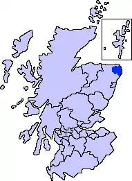 | |
| Other settlements | ||
| Places of interest | ||
Areas and primary settlements in Aberdeenshire (see also: Aberdeen City) | ||
|---|---|---|
| in Banff and Buchan | 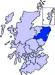 | |
| in Buchan | ||
| in Formartine | ||
| in Garioch | ||
| in Kincardine and Mearns | ||
| in Marr | ||
| Authority control |
|---|