Pheasants Nest, New South Wales
Pheasants Nest is a small village in the Macarthur Region of New South Wales, Australia, in Wollondilly Shire. It has a north bound and south bound roadhouse on the Hume Highway. At the 2016 census, Pheasants Nest had a population of 688 people.[1] Pheasants Nest also serves as a freeway exit between Picton and Yerinbool.
| Pheasants Nest New South Wales | |||||||||||||||
|---|---|---|---|---|---|---|---|---|---|---|---|---|---|---|---|
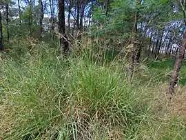 Scrub near Pheasants Nest | |||||||||||||||
Pheasants Nest | |||||||||||||||
| Coordinates | 34°15′21″S 150°38′08″E | ||||||||||||||
| Population | 688 (2016 census)[1] | ||||||||||||||
| Postcode(s) | 2574 | ||||||||||||||
| LGA(s) | Wollondilly Shire | ||||||||||||||
| Region | Macarthur | ||||||||||||||
| State electorate(s) | Wollondilly | ||||||||||||||
| Federal Division(s) | Hume | ||||||||||||||
| |||||||||||||||
Pheasants Nest was named after the Lyrebird, local to the Bargo area, which was mistakenly called a pheasant by early explorers.
Organisations
Pheasants Nest Rural Fire Brigade
The Pheasants Nest Rural Fire Brigade consists of a two bay tin station. Housed in the station is the brigade's Cat 1 Tanker, code name Pheasants Nest 1 and the brigade's Cat 9 vehicle, code name Pheasants Nest 9.
Notes and references
- Australian Bureau of Statistics (27 June 2017). "Pheasants Nest". 2016 Census QuickStats. Retrieved 13 July 2017.

This article is issued from Wikipedia. The text is licensed under Creative Commons - Attribution - Sharealike. Additional terms may apply for the media files.