Piagailoe
Piagailoe Atoll is an uninhabited atoll in the State of Yap in the Federated States of Micronesia, geographically part of the Caroline Islands. It is located 71 kilometers northeast of Lamotrek, 71 kilometers northwest of Satawal and 945 kilometers southeast of Yap island. This atoll lies at the western end of a chain of submarine mountains that extend westwards of the Gray Feather Bank for about 180 km. The Condor Reef, Pikelot and the Oraitilipu Bank belong to this underwater feature as well.[1] In order to distinguish this atoll from Fayu (East Fayu) Atoll in Chuuk State, located about 500 km to the east, this atoll is also known as West Fayu.
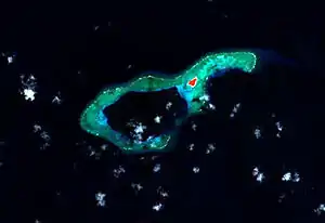 NASA picture of Piagailoe Atoll | |
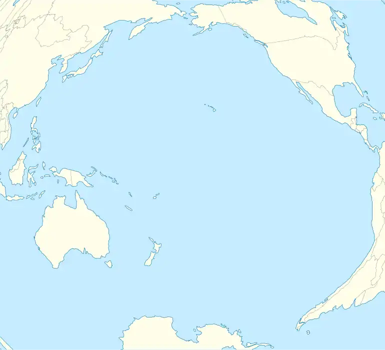 Piagailoe Location of Piagailoe in the Pacific Ocean | |
| Geography | |
|---|---|
| Coordinates | 8°5′00″N 146°44′00″E |
| Length | 7 km (4.3 mi) |
| Width | 3.5 km (2.17 mi) |
| Administration | |
Federated States of Micronesia | |
| State | Yap |
| Municipality | Satawal |
| Demographics | |
| Population | 0 |
The atoll is roughly 7 km long and 3.5 km wide in its widest area. The 5.6 km² lagoon[2] has a passage into it located in the southwestern fringe of the reef. Its maximum depth is 38 m.[3]
There is only one island on the reef, West Fayu Island, with a surface of 6 ha. It is located at the NE end of the reef.
Administratively it belongs to Satawal municipality.,[4] which is also one of the legislative districts of Yap State.[5][6]
References
- "Oceandots". Archived from the original on December 23, 2010. Retrieved 2010-02-08.CS1 maint: bot: original URL status unknown (link)
- Otis W. Freeman, ed., Geography of the Pacific, Wiley 1953
- Geosociety
- Administration
- Pacificworlds - Yap State
- Yap State Code, Title 7, Elections, §111 Election districts
