Pigcawayan
Pigcawayan, officially the Municipality of Pigkawayan (Maguindanaon: Ingud nu Pigkawayan; Iranun: Inged a Pigkawayan; Hiligaynon: Banwa sang Pigkawayan; Cebuano: Lungsod sa Pigkawayan; Tagalog: Bayan ng Pigkawayan), is a 1st class municipality in the province of Cotabato, Philippines. According to the 2015 census, it has a population of 66,796 people. [3]
Pigcawayan | |
|---|---|
| Municipality of Pigkawayan | |
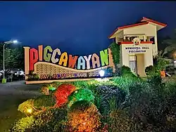 Pigcawayan Municipal hall | |
 Map of Cotabato with Pigcawayan highlighted | |
OpenStreetMap 
| |
.svg.png.webp) Pigcawayan Location within the Philippines | |
| Coordinates: 7°17′N 124°26′E | |
| Country | |
| Region | Soccsksargen (Region XII) |
| Province | Cotabato |
| District | 1st District |
| Founded | September 30, 1953 |
| Barangays | 40 (see Barangays) |
| Government | |
| • Type | Sangguniang Bayan |
| • Mayor | Jean Dino D. Roquero |
| • Vice Mayor | Juanito C. Agustin |
| • Representative | Joselito S. Sacdalan |
| • Electorate | 37,147 voters (2019) |
| Area | |
| • Total | 340.11 km2 (131.32 sq mi) |
| Elevation | 35 m (115 ft) |
| Population | |
| • Total | 66,796 |
| • Density | 200/km2 (510/sq mi) |
| • Households | 15,201 |
| Economy | |
| • Income class | 1st municipal income class |
| • Poverty incidence | 38.81% (2015)[4] |
| • Revenue | ₱159,829,607.94 (2016) |
| Time zone | UTC+8 (PST) |
| ZIP code | 9412 |
| PSGC | |
| IDD : area code | +63 (0)64 |
| Climate type | tropical rainforest climate |
| Native languages | Maguindanao Hiligaynon Cebuano Iranun Tagalog |
| Website | www |
It is sometimes spelled Pigkawayan.
Geography
Pigcawayan is the last municipality of Cotabato Province coming from Davao City to Cotabato City.[5] It is 26 kilometres (16 mi) from Cotabato City, 32 kilometres (20 mi) from Cotabato Airport and 30 kilometres (19 mi) from the nearest seaport which is the Polloc Port of Parang, Maguindanao.
Barangays
Pigcawayan is politically subdivided into 40 barangays. [2]
- Anick (Upper Balogo)
- Upper Baguer (Baguer)
- Balacayon[lower-roman 1]
- Balogo
- Banucagon
- Bulucaon
- Buluan
- Buricain[lower-roman 1]
- Cabpangi
- Capayuran
- Central Panatan
- Datu Binasing[lower-roman 1]
- Datu Mantil[lower-roman 1]
- Kadingilan[lower-roman 1]
- Kimarayag
- Libungan Torreta[lower-roman 1]
- Lower Baguer[lower-roman 1]
- Lower Pangangkalan[lower-roman 1]
- Malagakit
- Maluao
- North Manuangan
- Matilac[lower-roman 1]
- Midpapan I
- Midpapan II
- Mulok
- New Culasi
- New Igbaras
- New Panay
- Patot[lower-roman 1]
- Payong-payong
- Poblacion I
- Poblacion II
- Poblacion III
- Presbitero
- Renibon
- Simsiman[lower-roman 1]
- South Manuangan
- Tigbawan
- Tubon
- Upper Pangangkalan[lower-roman 1]
- Note
- - 12 barangays in Pigcawayan forms part of the Special Geographic Area of Bangsamoro region despite Cotabato and Pigcawayan not being under the administrative jurisdiction of the autonomous region. It was partitioned from Soccsksargen following the two-part plebiscite held in January and February 2019. The Bangsamoro's Development Coordinating Office (DCO) oversees the barangays' affairs.[lower-roman 2]
- "BARMM creates office to administer 63 barangays in North Cotabato". bangsamoro.gov.ph. Retrieved June 30, 2020.
Climate
| Climate data for Pigcawayan, Cotabato | |||||||||||||
|---|---|---|---|---|---|---|---|---|---|---|---|---|---|
| Month | Jan | Feb | Mar | Apr | May | Jun | Jul | Aug | Sep | Oct | Nov | Dec | Year |
| Average high °C (°F) | 31 (88) |
32 (90) |
32 (90) |
32 (90) |
31 (88) |
30 (86) |
29 (84) |
29 (84) |
30 (86) |
30 (86) |
30 (86) |
31 (88) |
31 (87) |
| Average low °C (°F) | 22 (72) |
22 (72) |
23 (73) |
24 (75) |
24 (75) |
24 (75) |
24 (75) |
24 (75) |
24 (75) |
24 (75) |
23 (73) |
22 (72) |
23 (74) |
| Average precipitation mm (inches) | 53 (2.1) |
44 (1.7) |
41 (1.6) |
39 (1.5) |
69 (2.7) |
89 (3.5) |
92 (3.6) |
97 (3.8) |
72 (2.8) |
79 (3.1) |
72 (2.8) |
49 (1.9) |
796 (31.1) |
| Average rainy days | 15.3 | 13.5 | 16.3 | 16.9 | 22.3 | 23.5 | 22.5 | 23.1 | 19.4 | 21.5 | 20.6 | 17.5 | 232.4 |
| Source: Meteoblue [6] | |||||||||||||
Demographics
| Year | Pop. | ±% p.a. |
|---|---|---|
| 1960 | 22,412 | — |
| 1970 | 26,845 | +1.82% |
| 1975 | 24,273 | −2.00% |
| 1980 | 26,475 | +1.75% |
| 1990 | 42,475 | +4.84% |
| 1995 | 46,788 | +1.83% |
| 2000 | 51,008 | +1.87% |
| 2007 | 59,395 | +2.12% |
| 2010 | 59,975 | +0.35% |
| 2015 | 66,796 | +2.07% |
| Source: Philippine Statistics Authority [3] [7] [8][9] | ||
In the 2015 census, the population of Pigcawayan was 66,796 people, [3] with a density of 200 inhabitants per square kilometre or 520 inhabitants per square mile.
History
Before its creation as a separate and independent Political Unit, Pigcawayan together with Alamada and Libungan were component barangays of Midsayap. Pigcawayan, however at that time was more progressive than the two mentioned.
How Pigcawayan got its name remains undocumented, however two versions were given by the early settlers and passed from one generation to another.
The first version was that the place now known as Pigcawayan was a battleground for the Iranons and the Maguindanaoans. Due to this fighting the inhabitants would abandon the place to be occupied by the victors. From this evolved the Muslim word "Pighawaan," which meant an abandoned place.
The second version, refers to an incident when an American school superintendent visited the place. The superintendent encountered people roasting a pig with the use of bamboo pole rotated over live charcoal. The words "pig bamboo," as said by the superintendent, were translated into the local dialect Pigcawayan the present name of the municipality.
Economy
The Municipality of Pigcawayan is primarily an agricultural area. Common industrial activities are rice and corn mills. There are 11 rice mills (electric operated) found in Poblacion (2), Tubon (4), North and South Manuangan (2), Upper Baguer (10), Balogo (1), and Capayuran (1). Aside from these, there are also 2) Baby Cono/Kiskisan that can be found in (13) barangays.
Processed milled rice by Rice Mills are usually brought/sold to Cotabato City, Davao City and in some parts of South Cotabato. Milled rice produced by "Kiskisan/Baby Cono" were usually for households consumption by residents of barangays.
Cottage industries include furniture shops that use wood, bamboo and rattan, as well as rice grinder, mini sawmill and machine shops.
Tourist attractions
- Spanish Tower located at Libungan-Torreta, Pigcawayan. It is a historical place.
- Saljay Integrated Farm located at Presbitero, Pigcawayan; farming and agricultural trips.
- The Shrine of Virgin Mary, located at Rogonan, New Panay, Pigcawayan.
- Payong-Payong Cave, located at Payong-Payong, Pigcawayan; caving.
- Bual Spring, located at Kimarayag, Pigcawayan; swimming.
- Payong-Payong Falls located at Auxiliary, Payong-Payong, Pigcawayan. The waterfalls drop from 8–12 meters high with its source coming from a wide river.
- Agustin Swimming Pool Resort located at Tigbawan, Pigcawayan; camping, swimming and picnic sites.
- Kagiringan Falls located at Kimarayag, Pigcawayan; camping and trekking.
- Rapu-Rapu Falls located at Anick, Pigcawayan. The falls drop into a natural round pool called "kawa-kawa" with an estimated 3 meters in diameter.
- Malagakit Lake Resort Malagakit, Pigcawayan. The lake was judged as the cleanest and greenest inland body of water in the Philippines in 1995.
- Lampaki Cave located at Kimarayag, Pigcawayan. The entrance is 3 meters in height with formations of stalactites and stalagmites inside as well as scattered thick guano. There is a small hole on the top through which the rays of the sun pass.
- Kimarayag Cave located at Campo 1, Kimarayag, Pigcawayan. The cave has stalactites and stalagmites formed like a teeth of a whale.
- Belle's Farm & Resort located at Midpapan I, Pigcawayan; swimming, events (weddings, family reunions, birthdays, etc.)
References
- Municipality of Pigkawayan | (DILG)
- "Province: North Cotabato". PSGC Interactive. Quezon City, Philippines: Philippine Statistics Authority. Retrieved 12 November 2016.
- Census of Population (2015). "Region XII (Soccsksargen)". Total Population by Province, City, Municipality and Barangay. PSA. Retrieved 20 June 2016.
- "PSA releases the 2015 Municipal and City Level Poverty Estimates". Quezon City, Philippines. Retrieved 12 October 2019.
- http://www.cotabatoprov.gov.ph/lgus/pigcawayan
- "Pigcawayan: Average Temperatures and Rainfall". Meteoblue. Retrieved 30 January 2020.
- Census of Population and Housing (2010). "Region XII (Soccsksargen)". Total Population by Province, City, Municipality and Barangay. NSO. Retrieved 29 June 2016.
- Censuses of Population (1903–2007). "Region XII (Soccsksargen)". Table 1. Population Enumerated in Various Censuses by Province/Highly Urbanized City: 1903 to 2007. NSO.
- "Province of North Cotabato". Municipality Population Data. Local Water Utilities Administration Research Division. Retrieved 17 December 2016.
External links
- Pigkawayan Profile at PhilAtlas.com
- Philippine Standard Geographic Code
- Philippine Census Information
Places adjacent to Pigcawayan | |
|---|---|
