Pirie–Torrens corridor
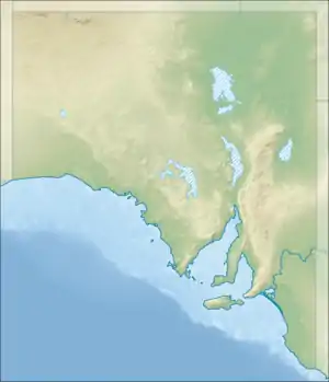
The Pirie–Torrens corridor is an approximately 59 km (37 mi) long intermittent watercourse that serves as the only natural outlet of Lake Torrens, a large normally endorheic salt lake in central South Australia.
| Pirie–Torrens corridor | |
|---|---|
 | |
| Location | |
| Country | Australia |
| State | South Australia |
| Region | Far North |
| Physical characteristics | |
| Source | Lake Torrens |
| • coordinates | 31°56′27.7″S 137°46′15.5″E |
| • elevation | 30 m (98 ft) |
| Mouth | Spencer Gulf |
• location | Emeroo |
• coordinates | 32°24′15.6″S 137°45′16.2″E |
• elevation | 0 m (0 ft) |
| Length | 59 km (37 mi) |
| Discharge | |
| • location | Port Augusta[1] |
| • average | 0.5 m3/s (18 cu ft/s)[1] |
| Basin features | |
| Tributaries | |
| • right | Sandy Creek |
Only on two recorded occasions—in 1836, and again in March 1989—has Lake Torrens filled high enough to flow out through the corridor to its outlet at the head of the Spencer Gulf.[2][3]
References
- Olympic Dam Expansion Draft Environmental Impact Statement 2009 (2009), "Appendix O - Hydrodynamic and Water Quality Sampling in Spencer Gulf: Calibration Report" (PDF), Olympic Dam Expansion Draft Environmental Impact Statement 2009, BMT WBM Pty Ltd., retrieved 9 June 2019
- Bye, John; Stanger, Gordon; Noonan, John (2015). "The major flooding of Lake Torrens in March 1989 (abstract)". Transactions of the Royal Society of South Australia. 139 (2): 171–188. doi:10.1080/03721426.2015.1065467.
- Williams, W.D.; De Deckker, P.; Shiel, R.J. (1998). "The liminology of Lake Torrens, an episodic salt lake of central Australia with particular reference to unique events in 1989" (PDF). Hydrobiologia. 384: 101. doi:10.1023/A:1003207613473. Retrieved 9 June 2019 – via Australian National University.
This article is issued from Wikipedia. The text is licensed under Creative Commons - Attribution - Sharealike. Additional terms may apply for the media files.