Piro, Bhojpur
Piro is a nagar parishad town and corresponding community development block in Bhojpur District, in the Indian state of Bihar. As of 2011, the population of the town of Piro was 33,785, in 5,033 households.[2]
Piro | |
|---|---|
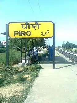 Piro railway station | |
| Nickname(s): White City | |
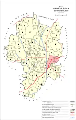 Location in Piro block | |
 Piro Location in Bihar, India  Piro Piro (India) | |
| Coordinates: 25.33°N 84.42°E | |
| Country | PIRO |
| State | Bihar |
| District | Bhojpur |
| Government | |
| • Type | Piro Nagar Parishad |
| • Body | Municipal Corporation |
| • M.L.A | Sudama Prasad |
| Elevation | 72 m (236 ft) |
| Population (2016)[1] | |
| • Total | 43,785 |
| Time zone | UTC+5:30 (IST) |
| PIN | 802207 |
| Telephone code | 06181 |
| Vehicle registration | BR-03 |
| Website | bhojpur |
History
Piro is mentioned in the Ain-i-Akbari as a pargana in the sarkar of Rohtas. It produced a revenue of 3,407,840 dams for the imperial treasury.[3]
Geography
Piro is located at 25.33°N 84.42°E.[4] It has an average elevation of 72 metres (236 feet).
Demographics
| Year | Pop. | ±% |
|---|---|---|
| 1981 | 14,068 | — |
| 1991 | 18,419 | +30.9% |
| 2001 | 25,811 | +40.1% |
| 2011 | 33,785 | +30.9% |
| Source: 2011 Census of India[2] | ||
As of 2001 India census,[5] Piro had a population of 25,638. Males constitute 53% of the population and females 47%. Piro has an average literacy rate of 56%, lower than the national average of 59.5%: male literacy is 65%, and female literacy is 45%. In Piro, 18% of the population is under 6 years of age.
Villages
Piro block contains the following 109 villages:[2]
| Village name | Total land area (hectares) | Population (in 2011) |
|---|---|---|
| Lohain | 166 | 2,000 |
| Newari | 201 | 843 |
| Khairahin | 110 | 616 |
| Kheri Kon | 263 | 2,016 |
| Pharaura | 237 | 1,698 |
| Karauniya | 91 | 1,052 |
| Ear | 404 | 3,821 |
| Kukrahan | 130 | 955 |
| Waina | 296 | 1,585 |
| Danwarua | 148 | 1,436 |
| Tar | 943 | 6,123 |
| Jamuaon | 452 | 5,006 |
| Saneya | 74 | 1,843 |
| Bamhawar | 201 | 4,190 |
| Chaubepur | 85 | 1,041 |
| Marohi | 61 | 340 |
| Chhaurahi Jangal Mahal | 766 | 5,949 |
| Keshwa | 277 | 3,018 |
| Bishambharpur | 14 | 0 |
| Haswa Dehri | 132 | 1,530 |
| Rajapur | 98 | 1,588 |
| Akrua | 395 | 3,309 |
| Kaser | 122 | 844 |
| Barao | 625 | 7,230 |
| Hat Pokhar | 77 | 1,272 |
| Jitaura Jangal Mahal | 969 | 11,292 |
| Rajeyan | 149 | 2,561 |
| Baseya | 230 | 1,943 |
| Mahwari | 75 | 1,081 |
| Doman Dehra | 221 | 2,033 |
| Khambha Dih | 51 | 427 |
| Chanwa | 36 | 0 |
| Puraini Buzurg | 80 | 1,000 |
| Puraini Khurd | 40 | 234 |
| Pitro | 202 | 3,418 |
| Khandani | 262 | 2,266 |
| Khandani Khurd | 146 | 1,516 |
| Angra | 371.1 | 2,384 |
| Pitat | 217.4 | 892 |
| Kothua | 309 | 2,770 |
| Dhanpura | 231 | 1,686 |
| Birpur | 87 | 769 |
| Salakhna | 123.9 | 656 |
| Mahuari | 140 | 1,060 |
| Kewatia | 146 | 1,145 |
| Basdiha | 171 | 1,212 |
| Amehta | 191 | 3,052 |
| Lahthan | 898 | 6,516 |
| Anuwan | 68 | 347 |
| Telar | 214 | 2,930 |
| Agiaon | 373 | 7,545 |
| Baraura | 43 | 192 |
| Beduwa | 31 | 0 |
| Bedauli | 27 | 0 |
| Narhi | 63 | 1,215 |
| Narayanpur | 112 | 1,358 |
| Dihri | 102 | 999 |
| Baghaunr | 99 | 1,343 |
| Sugibal | 86 | 547 |
| Mothi | 168 | 1,567 |
| Mothibal Jangal Mahal | 31 | 375 |
| Jagdishpur Patak | 96 | 769 |
| Bahri Mahadeo | 26.5 | 0 |
| Naek Tola Jangal Mahal | 646 | 6,860 |
| Barauli | 176 | 1,705 |
| Tewari Dih | 68 | 891 |
| Rangal Tola Jangal Mahal | 47 | 669 |
| Sukhrauli | 165 | 1,766 |
| Jagdeopur | 59 | 436 |
| Gogsand | 62 | 937 |
| Kataria | 496 | 3,841 |
| Basmanpur | 179 | 1,894 |
| Amai | 317.9 | 3,826 |
| Tetar Dih | 151 | 1,726 |
| Sahejani | 308 | 2,958 |
| Rasauli | 121 | 1,954 |
| Jamunipur | 103 | 559 |
| Indarpatpur | 36 | 438 |
| Chhechhu Dih | 17 | 492 |
| Moti Dih | 40 | 538 |
| Pachrukhia | 235 | 2,464 |
| Kachnath | 151 | 1,769 |
| Udan Dih | 41 | 484 |
| Ujjain Dehra | 92.9 | 599 |
| Ojhawaliya | 20 | 265 |
| Lohrabad | 29 | 1,601 |
| Gajra Dih | 39 | 0 |
| Deochanda | 169 | 1,170 |
| Tilath | 295 | 2,886 |
| Jaisingh Dih | 170 | 1,470 |
| Manaini | 34 | 238 |
| Tiwari Dih | 99 | 1,177 |
| Itamba Ganesh | 57 | 856 |
| Chilbilia | 92 | 966 |
| Khorain | 27 | 0 |
| Dano Dih | 31 | 0 |
| Bachri | 257 | 3,476 |
| Bharsar | 325 | 2,861 |
| Gobind Dih | 118 | 1,414 |
| Nonar | 677 | 7,835 |
| Baisa Dih | 89.5 | 1,671 |
| Pachman | 250 | 2,344 |
| Katar | 594 | 13,484 |
| Garahatha | 121.8 | 1,120 |
| Harpur | 30 | 0 |
| Narayanpur | 442 | 6,232 |
| Jamaurahi | 150.7 | 2,128 |
| Bhulkua | 151 | 1,427 |
| Kachhuhi | 57 | 776 |
| Dhan Pokhar | 124 | 783 |
References
- "Census of India Search details". censusindia.gov.in. Retrieved 10 May 2015.
- "Census of India 2011: Bihar District Census Handbook - Bhojpur, Part A (Village and Town Directory)". Census 2011 India. pp. 46, 63, 81–83, 90, 92, 516–563, 753, 808–809. Retrieved 7 August 2020.
- Abu'l-Fazl ibn Mubarak; Jarrett, Henry Sullivan (translator) (1891). The Ain-i-Akbari. Calcutta: Asiatic Society of Bengal. p. 157. Retrieved 3 February 2021.
- Falling Rain Genomics, Inc - Piro
- "Census of India 2001: Data from the 2001 Census, including cities, villages and towns (Provisional)". Census Commission of India. Archived from the original on 16 June 2004. Retrieved 1 November 2008.