Plan-d'Aups-Sainte-Baume
Plan-d'Aups-Sainte-Baume (Provençal: Lo Plan d’Aups de la Santa Bauma) is a commune in the Var department in the Provence-Alpes-Côte d'Azur region in southeastern France. It lies to the north of the Sainte-Baume mountain range.
Plan-d'Aups-Sainte-Baume | |
|---|---|
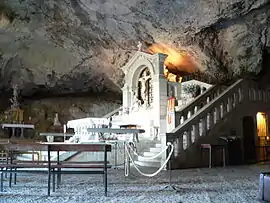 The cave of Sainte-Baume | |
.svg.png.webp) Coat of arms | |
Location of Plan-d'Aups-Sainte-Baume 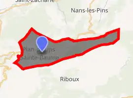
| |
 Plan-d'Aups-Sainte-Baume  Plan-d'Aups-Sainte-Baume | |
| Coordinates: 43°19′46″N 5°43′01″E | |
| Country | France |
| Region | Provence-Alpes-Côte d'Azur |
| Department | Var |
| Arrondissement | Brignoles |
| Canton | Saint-Cyr-sur-Mer |
| Government | |
| • Mayor (2020–2026) | Carine Paillard[1] |
| Area 1 | 24.91 km2 (9.62 sq mi) |
| Population (2017-01-01)[2] | 2,158 |
| • Density | 87/km2 (220/sq mi) |
| Time zone | UTC+01:00 (CET) |
| • Summer (DST) | UTC+02:00 (CEST) |
| INSEE/Postal code | 83093 /83640 |
| Elevation | 510–1,148 m (1,673–3,766 ft) (avg. 700 m or 2,300 ft) |
| 1 French Land Register data, which excludes lakes, ponds, glaciers > 1 km2 (0.386 sq mi or 247 acres) and river estuaries. | |
Second World War
In June 1944, at the aftermath of D-Day when the French Resistance went on an offensive against the German occupiers, the hills near Plan-d'Aups were the site of a bloody battle. Some 200 Maquis had set up a camp there, commanded by SOE agent Robert Burdett. They were attacked by large German forces. Though taken by surprise due to a faulty placing of guards, the Maquis did inflict considerable casualties on the Germans and many of them managed to escape into the surrounding mountains.[3]
See also
References
- "Répertoire national des élus: les maires". data.gouv.fr, Plateforme ouverte des données publiques françaises (in French). 2 December 2020. Retrieved 7 December 2020.
- "Populations légales 2017". INSEE. Retrieved 6 January 2020.
- Evelyn Le Chene, "Watch for Me by Moonlight" (wartime experiences of Robert Burdett), Corgi, London 1974
| Wikimedia Commons has media related to Plan-d'Aups-Sainte-Baume. |
| Authority control |
|
|---|
This article is issued from Wikipedia. The text is licensed under Creative Commons - Attribution - Sharealike. Additional terms may apply for the media files.