La Garde-Freinet
La Garde-Freinet (Provençal: La Gàrdia Frainet) is a commune in the Var department in the Côte d'Azur area in southeastern France.
La Garde-Freinet | |
|---|---|
.jpg.webp) La Garde-Freinet, seen from the fort | |
.svg.png.webp) Coat of arms | |
Location of La Garde-Freinet 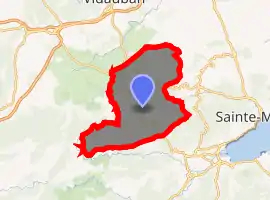
| |
 La Garde-Freinet  La Garde-Freinet | |
| Coordinates: 43°19′03″N 6°28′12″E | |
| Country | France |
| Region | Provence-Alpes-Côte d'Azur |
| Department | Var |
| Arrondissement | Draguignan |
| Canton | Le Luc |
| Government | |
| • Mayor (2020–2026) | Thomas Dombry |
| Area 1 | 76.64 km2 (29.59 sq mi) |
| Population (2017-01-01)[1] | 1,887 |
| • Density | 25/km2 (64/sq mi) |
| Time zone | UTC+01:00 (CET) |
| • Summer (DST) | UTC+02:00 (CEST) |
| INSEE/Postal code | 83063 /83680 |
| Elevation | 60–674 m (197–2,211 ft) |
| 1 French Land Register data, which excludes lakes, ponds, glaciers > 1 km2 (0.386 sq mi or 247 acres) and river estuaries. | |
Location
La Garde-Freinet is a medieval French mountain village, located in the Massif des Maures, 15 km northwest of Saint-Tropez. It is accessible via picturesque winding roads that run through forests of cork, oaks, and chestnuts.
Sights
Established in the 11th century, the village has preserved its character with its field stone houses, old fashioned street names, and a village square framed with restaurants and local art galleries. From atop old Fort Freinet one can see the plains of Saint-Clément and the Argens valley, all the way to the Alps.
People
- André Pousse (1919 - 2005) French actor
See also
References
- "Populations légales 2017". INSEE. Retrieved 6 January 2020.
External links
| Wikimedia Commons has media related to La Garde-Freinet. |
- Tourist Office La Garde Freinet
- Images of La Garde-Freinet (site in French)
| Authority control |
|
|---|
This article is issued from Wikipedia. The text is licensed under Creative Commons - Attribution - Sharealike. Additional terms may apply for the media files.