Pleasantdale, Wyoming
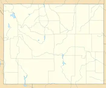
Pleasantdale is an unincorporated community in Campbell County, Wyoming, United States. Pleasantdale is located on Wyoming Highway 50, 18 miles (29 km) southwest of Gillette.
Pleasantdale, Wyoming | |
|---|---|
 Pleasantdale | |
| Coordinates: 44°04′34″N 105°43′10″W | |
| Country | United States |
| State | Wyoming |
| County | Campbell |
| Area | |
| • Total | 1.18969 sq mi (0.753788 km2) |
| • Land | 1.18969 sq mi (0.753788 km2) |
| • Water | 0 sq mi (0 km2) |
| Elevation | 4,944 ft (1,506.93 m) |
| Population (2015)No official census has taken place in Pleasantdale. | |
| • Total | 12 |
| • Estimate ({{{pop_est_as_of}}}) | 12 |
| • Density | 15/sq mi (12/km2) |
| Time zone | UTC-7 (Mountain (MST)) |
| • Summer (DST) | UTC-6 (MDT) |
| Area code(s) | 307 |
| GNIS feature ID | 1597460[1] |
Etymology
The name "Pleasantdale" is thought to be a spin-off of the nearby and older town of "Savageton" to make the town sound more attractive than its neighbor.
References
- "US Board on Geographic Names". United States Geological Survey. 2007-10-25. Retrieved 2008-01-31.
Municipalities and communities of Campbell County, Wyoming, United States | ||
|---|---|---|
| City | 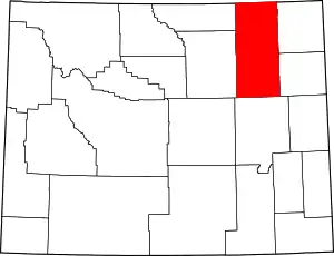 | |
| Town | ||
| CDPs | ||
| Unincorporated communities | ||
| ||
This article is issued from Wikipedia. The text is licensed under Creative Commons - Attribution - Sharealike. Additional terms may apply for the media files.