Campbell County, Wyoming
Campbell County is a county in the U.S. state of Wyoming. As of the 2010 United States Census, the population was 46,133,[1] making it the third-most populous county in Wyoming. Its county seat is Gillette.[2]
Campbell County | |
|---|---|
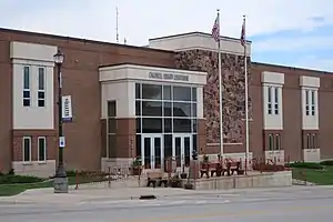 Campbell County Courthouse | |
 Flag | |
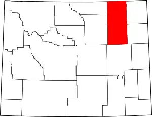 Location within the U.S. state of Wyoming | |
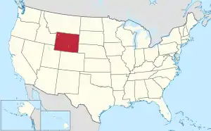 Wyoming's location within the U.S. | |
| Coordinates: 44°14′N 105°33′W | |
| Country | |
| State | |
| Founded | February 21, 1911 |
| Named for | Robert Campbell |
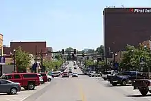
| Seat | Gillette |
| Largest city | Gillette |
| Area | |
| • Total | 4,807 sq mi (12,450 km2) |
| • Land | 4,803 sq mi (12,440 km2) |
| • Water | 4.0 sq mi (10 km2) 0.08%% |
| Population (2010) | |
| • Total | 46,133 |
| • Estimate (2019) | 46,341 |
| • Density | 9.6/sq mi (3.7/km2) |
| Time zone | UTC−7 (Mountain) |
| • Summer (DST) | UTC−6 (MDT) |
| Congressional district | At-large |
| Website | www |
Campbell County comprises the Gillette, WY Micropolitan Statistical Area.
History
Campbell County was created in 1911 from land annexed from Crook and Weston Counties.[3] It was named either for John Allen Campbell, a governor of the Wyoming Territory, or for Robert Campbell, an trapper and fur trader associated with William Henry Ashley.[4]
Geography
According to the US Census Bureau, the county has a total area of 4,807 square miles (12,450 km2), of which 4,803 square miles (12,440 km2) is land and 4.0 square miles (10 km2) (9.6%) is water.[5]
Adjacent counties
- Powder River County, Montana – north
- Crook County – northeast
- Weston County – southeast
- Converse County – south
- Johnson County – southwest
- Sheridan County – west
Major highways
.svg.png.webp) Interstate 90
Interstate 90 I-90 Bus.
 U.S. Highway 14
 U.S. Highway 16
 Wyoming Highway 50
 Wyoming Highway 51
 Wyoming Highway 59
 Wyoming Highway 387
 Wyoming Highway 450
National protected area
Demographics
| Historical population | |||
|---|---|---|---|
| Census | Pop. | %± | |
| 1920 | 5,233 | — | |
| 1930 | 6,720 | 28.4% | |
| 1940 | 6,048 | −10.0% | |
| 1950 | 4,839 | −20.0% | |
| 1960 | 5,861 | 21.1% | |
| 1970 | 12,957 | 121.1% | |
| 1980 | 24,367 | 88.1% | |
| 1990 | 29,370 | 20.5% | |
| 2000 | 33,698 | 14.7% | |
| 2010 | 46,133 | 36.9% | |
| 2019 (est.) | 46,341 | [6] | 0.5% |
| US Decennial Census[7] 1870–2000[8] 2010–2016[1] | |||
2000 census
As of the 2000 United States Census,[9] there were 33,698 people, 12,207 households, and 9,008 families in the county. The population density was 7 people per square mile (3/km2). There were 13,288 housing units at an average density of 3 per square mile (1/km2). The racial makeup of the county was 96.06% White, 0.15% Black or African American, 0.93% Native American, 0.32% Asian, 0.09% Pacific Islander, 1.12% from other races, and 1.34% from two or more races. 3.53% of the population were Hispanic or Latino of any race. 30.3% were of German, 11.4% English, 11.0% Irish, 8.5% American and 6.2% Norwegian ancestry.
There were 12,207 households, out of which 43.10% had children under the age of 18 living with them, 59.80% were married couples living together, 8.80% had a female householder with no husband present, and 26.20% were non-families. Of 12,207 households, 785 were unmarried partner households: 675 heterosexual, 52 same-sex male, and 58 same-sex female.
20.20% of all households were made up of individuals, and 3.90% had someone living alone who was 65 years of age or older. The average household size was 2.73 and the average family size was 3.16.
The county population contained 31.00% under the age of 18, 9.50% from 18 to 24, 32.30% from 25 to 44, 21.90% from 45 to 64, and 5.30% who were 65 years of age or older. The median age was 32 years. For every 100 females there were 105.60 males. For every 100 females age 18 and over, there were 104.10 males.
The median income for a household in the county was $76,576, and the median income for a family was $53,927. Males had a median income of $41,814 versus $21,914 for females. The per capita income for the county was $20,063. About 5.60% of families and 7.60% of the population were below the poverty line, including 7.70% of those under age 18 and 12.40% of those age 65 or over.
2010 census
As of the 2010 United States Census, there were 46,133 people, 17,172 households, and 11,933 families in the county.[10] The population density was 9.6 inhabitants per square mile (3.7/km2). There were 18,955 housing units at an average density of 3.9 per square mile (1.5/km2).[11] The racial makeup of the county was 93.2% white, 1.2% American Indian, 0.6% Asian, 0.3% black or African American, 2.7% from other races, and 2.1% from two or more races. Those of Hispanic or Latino origin made up 7.8% of the population.[10] In terms of ancestry, 32.2% were German, 15.9% were Irish, 10.8% were English, 5.5% were American, and 5.1% were Norwegian.[12]
Of the 17,172 households, 39.0% had children under the age of 18 living with them, 54.0% were married couples living together, 8.6% had a female householder with no husband present, 30.5% were non-families, and 22.4% of all households were made up of individuals. The average household size was 2.66 and the average family size was 3.11. The median age was 31.9 years.[10]
The median income for a household in the county was $76,576 and the median income for a family was $83,965. Males had a median income of $61,393 versus $31,769 for females. The per capita income for the county was $31,968. About 5.9% of families and 6.9% of the population were below the poverty line, including 10.5% of those under age 18 and 3.9% of those age 65 or over.[13]
Communities
Town
Census-designated places
Unincorporated communities
Politics
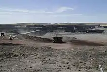
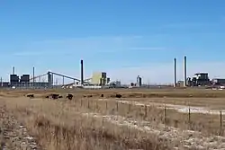
Owing to its coal mining and oil wealth, Campbell County is overwhelmingly Republican. No Democratic presidential candidate has carried Campbell County since Franklin D. Roosevelt won 46 of 48 contemporary states against Alf Landon in 1936. Since 1950, the only Democrat to have won forty percent of the county's vote is Lyndon Johnson in his 1964 landslide victory against Barry Goldwater, and in the subsequent half-century no Democrat has passed one-third of the county's vote. In 2016, indeed, Campbell came to rival Crook and Johnson counties for the unofficial title of “reddest county in the reddest state”, with Donald Trump outpolling Hillary Clinton by a twelve-to-one margin. It is the only county in the state where Trump got >85% of the vote.
| Year | Republican | Democratic | Third parties |
|---|---|---|---|
| 2020 | 86.8% 16,975 | 9.9% 1,935 | 3.4% 656 |
| 2016 | 86.7% 15,778 | 7.3% 1,324 | 6.0% 1,097 |
| 2012 | 85.1% 14,953 | 12.3% 2,163 | 2.6% 455 |
| 2008 | 79.7% 13,011 | 18.3% 2,990 | 2.0% 319 |
| 2004 | 82.2% 12,415 | 16.3% 2,464 | 1.5% 220 |
| 2000 | 81.4% 10,203 | 15.7% 1,967 | 3.0% 370 |
| 1996 | 53.7% 6,382 | 29.2% 3,468 | 17.2% 2,039 |
| 1992 | 47.4% 5,315 | 24.2% 2,709 | 28.4% 3,184 |
| 1988 | 73.6% 6,702 | 25.1% 2,288 | 1.3% 122 |
| 1984 | 83.9% 8,387 | 15.3% 1,525 | 0.8% 83 |
| 1980 | 73.2% 5,613 | 18.3% 1,400 | 8.6% 656 |
| 1976 | 66.2% 3,306 | 32.4% 1,620 | 1.4% 69 |
| 1972 | 78.6% 2,953 | 20.9% 783 | 0.5% 19 |
| 1968 | 66.7% 1,694 | 22.0% 558 | 11.4% 289 |
| 1964 | 57.3% 1,606 | 42.7% 1,196 | |
| 1960 | 64.7% 1,575 | 35.3% 861 | |
| 1956 | 69.2% 1,473 | 30.8% 656 | |
| 1952 | 73.1% 1,823 | 26.7% 666 | 0.2% 5 |
| 1948 | 58.0% 1,201 | 41.3% 856 | 0.7% 14 |
| 1944 | 62.9% 1,514 | 37.1% 894 | |
| 1940 | 57.6% 1,540 | 42.2% 1,128 | 0.3% 7 |
| 1936 | 47.5% 1,322 | 51.5% 1,435 | 1.0% 27 |
| 1932 | 39.0% 1,161 | 58.0% 1,728 | 3.1% 91 |
| 1928 | 66.5% 1,528 | 32.4% 744 | 1.1% 25 |
| 1924 | 52.4% 1,121 | 27.0% 577 | 20.7% 443 |
| 1920 | 66.7% 1,027 | 32.0% 493 | 1.3% 20 |
| 1916 | 38.6% 448 | 59.5% 690 | 1.9% 22 |
| 1912 | 25.1% 186 | 48.8% 361 | 26.1% 193 |
Notable people
- Tom Lubnau, Speaker of the Wyoming House of Representatives
- Sue Wallis, Republican member of the Wyoming House from Campbell County
References
- "State & County QuickFacts". US Census Bureau. Archived from the original on July 8, 2011. Retrieved January 25, 2014.
- "Find a County". National Association of Counties. Archived from the original on May 31, 2011. Retrieved June 7, 2011.
- Long, John H. (2006). "Wyoming: Individual County Chronologies". Wyoming Atlas of Historical County Boundaries. The Newberry Library. Archived from the original on July 18, 2011. Retrieved September 6, 2011.
- Urbanek, Mae (1988). Wyoming Place Names. Missoula MT: Mountain Press Pub. Co. ISBN 0-87842-204-8.
- "2010 Census Gazetteer Files". US Census Bureau. August 22, 2012. Retrieved August 5, 2015.
- "Population and Housing Unit Estimates". Retrieved September 28, 2019.
- "US Decennial Census". US Census Bureau. Retrieved August 5, 2015.
- "Historical Decennial Census Population for Wyoming Counties, Cities, and Towns". Wyoming Department of Administration & Information, Division of Economic Analysis. Retrieved January 25, 2014.
- "U.S. Census website". US Census Bureau. Retrieved May 14, 2011.
- "Profile of General Population and Housing Characteristics: 2010 Demographic Profile Data". US Census Bureau. Archived from the original on February 13, 2020. Retrieved January 12, 2016.
- "Population, Housing Units, Area, and Density: 2010 - County". US Census Bureau. Archived from the original on February 13, 2020. Retrieved January 12, 2016.
- "Selected Social Characteristics in the US – 2006-2010 American Community Survey 5-Year Estimates". US Census Bureau. Archived from the original on February 13, 2020. Retrieved January 12, 2016.
- "Selected Economic Characteristics – 2006-2010 American Community Survey 5-Year Estimates". US Census Bureau. Archived from the original on February 13, 2020. Retrieved January 12, 2016.
- Leip, David. "Atlas of US Presidential Elections". uselectionatlas.org. Retrieved April 5, 2018.
External links
Places adjacent to Campbell County, Wyoming | ||||||||||
|---|---|---|---|---|---|---|---|---|---|---|
| ||||||||||
Municipalities and communities of Campbell County, Wyoming, United States | ||
|---|---|---|
| City | | |
| Town | ||
| CDPs | ||
| Unincorporated communities | ||
| ||
| Authority control |
|---|