Plum Creek (Nanticoke River tributary)
Plum Creek is a 5.56 mi (8.95 km) long 2nd tributary to the Nanticoke River in Wicomico County, Maryland.
| Plum Creek Tributary to Nanticoke River | |
|---|---|
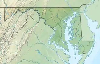 Location of Plum Creek mouth  Plum Creek (Nanticoke River tributary) (the United States) | |
| Location | |
| Country | United States |
| State | Delaware Maryland |
| County | Sussex Wicomico |
| Physical characteristics | |
| Source | Mill Branch divide |
| • location | Columbia, Delaware[1] |
| • coordinates | 38°30′13″N 075°40′07″W[2] |
| • elevation | 46 ft (14 m)[1] |
| Mouth | Nanticoke River |
• location | about 0.5 miles north of Riverton, Maryland[3] |
• coordinates | 38°32′07″N 075°44′46″W[2] |
• elevation | 0 ft (0 m)[3] |
| Length | 5.56 mi (8.95 km)[4] |
| Basin size | 5.45 square miles (14.1 km2)[5] |
| Discharge | |
| • location | Nanticoke River |
| • average | 6.03 cu ft/s (0.171 m3/s) at mouth with Nanticoke River[5] |
| Basin features | |
| Progression | northwest<ref name='geoviewer'> |
| River system | Nanticoke River |
| Tributaries | |
| • left | unnamed tributaries |
| • right | unnamed tributaries |
| Bridges | Columbia Road, San Domingo Road, MD 313 |
Variant names
According to the Geographic Names Information System, it has also been known historically as:[2]
- Plumb Creek
Course
Plum Creek rises in Columbia in Sussex County, Delaware[1] and then flows northwest into Wicomico County, Maryland to join the Nanticoke River about 0.5 miles north of Riverton.[3]
Watershed
Plum Creek drains 5.45 square miles (14.1 km2) of area, receives about 44.3 in/year of precipitation, has a topographic wetness index of 627.39 and is about 13% forested.[5]
See also
- List of Delaware rivers
- List of Maryland rivers
References
- "Get Maps". USGS Topoview. US Geological Survey. Retrieved 13 December 2020.
- "GNIS Detail - Plum Creek". geonames.usgs.gov. US Geological Survey. Retrieved 13 December 2020.
- "Get Maps". USGS Topoview. US Geological Survey. Retrieved 13 December 2020.
- "ArcGIS Web Application". epa.maps.arcgis.com. US EPA. Retrieved 13 December 2020.
- "Plum Creek Watershed Report". US EPA Geoviewer. US EPA. Retrieved 13 December 2020.
Dover (capital) | ||
| Topics |
|  |
| Society |
| |
| Cities | ||
| Towns |
| |
| Counties | ||

This article is issued from Wikipedia. The text is licensed under Creative Commons - Attribution - Sharealike. Additional terms may apply for the media files.