Ponta Jalunga
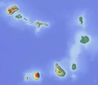
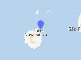
Ponta Jalunga is a headland located nearly a kilometer northeast of the port of Furna on the island of Brava in southwestern Cape Verde. It is the northeasternmost point of the island. The promontory is a rocky area, up to 120 meters high. The headland was mentioned as Pt. Ghelongo in the 1747 map by Jacques-Nicolas Bellin.[3]
| Ponta Jalunga | |
|---|---|
 Ponta Jalunga | |
| Location | Northeastern Brava, Cape Verde near Furna |
| Coordinates | 14°53′27″N 24°40′21″W |
| Offshore water bodies | Atlantic Ocean |
| Length | 1 km |
| Width | 600-700 m |
| Area | about 100 ha |
Cape Verde | |
| |
| Location | Ponta Jalunga Furna Cape Verde |
|---|---|
| Coordinates | 14°53′26.2″N 24°40′25.7″W |
| Year first constructed | 1891 |
| Foundation | masonry base |
| Construction | mansory tower |
| Tower shape | quadrangular tower with external staircase and lantern |
| Markings / pattern | white tower, grey lantern |
| Tower height | 8 metres (26 ft) |
| Focal height | 23 metres (75 ft) |
| Light source | solar power |
| Range | 5 nautical miles (9.3 km; 5.8 mi)[1] |
| Characteristic | Fl (2+1) W 15s. |
| Admiralty number | D2908 |
| NGA number | 24236 |
| Cape Verde number | PT-2184[2] |
Ponta Jalunga Lighthouse
The lighthouse at Ponta Jalunga was constructed in 1891. It is a white masonry tower. It is 8 metres tall and its focal height is at 26 metres above sea level. Its range extends to 9 nautical miles (17 km) and its light source as with many other lighthouses is solar powered.
See also
References
- List of Lights, Pub. 113: The West Coasts of Europe and Africa, the Mediterranean Sea, Black Sea and Azovskoye More (Sea of Azov) (PDF). List of Lights. United States National Geospatial-Intelligence Agency. 2018. p. 427.
- Rowlett, Russ. "Lighthouses of Cape Verde". The Lighthouse Directory. University of North Carolina at Chapel Hill.
- Jacques-Nicolas Bellin (1747). "Carte des Isles du Cap Verd = Kaart van de Eilanden van Kabo Verde" (in French).
The Island of Brava | ||
|---|---|---|
| Communities and settlements |
|  |
| Parishes | ||
| Other geographical features | ||
| Landmarks and points of interests | ||
| |
This article is issued from Wikipedia. The text is licensed under Creative Commons - Attribution - Sharealike. Additional terms may apply for the media files.
