Ponta Nhô Martinho
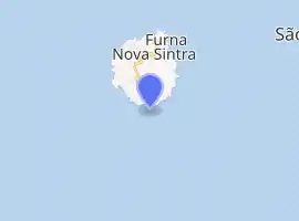
Ponta Nhô Martinho is a headland on the Island of Brava, Cape Verde. It is the southernmost point of Cape Verde. It is located nearly 4 km south of Cachaço, the nearest settlement. Formerly, the point was called Salt Point (Portuguese: Ponta do Sal), for instance in the 1747 map by Jacques-Nicolas Bellin.[3] There is a lighthouse on Ponta Nhô Martinho, which is the southernmost structure in Cape Verde. Its focal plane is 29 metres (95 ft) above sea level.[2]
| Ponta Nhô Martinho | |
|---|---|
 Ponta Nhô Martinho | |
| Location | Southern Brava, Cape Verde |
| Coordinates | 14°48′10″N 24°42′06″W |
| Offshore water bodies | Atlantic Ocean |
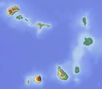
Cape Verde | |
| |
| Location | Ponta Nhô Martinho Brava Cape Verde |
|---|---|
| Coordinates | 14°48′11.98″N 24°42′5.93″W |
| Year first constructed | n/a |
| Foundation | masonry base |
| Construction | masonry tower |
| Tower shape | quadrangular tower with lantern |
| Markings / pattern | white tower, red lantern |
| Tower height | 4 metres (13 ft) |
| Focal height | 29 metres (95 ft) |
| Light source | solar power |
| Range | 9 nautical miles (17 km; 10 mi)[1] |
| Characteristic | Fl (4) W 15s. |
| Admiralty number | D2910 |
| NGA number | 24240 |
| Cape Verde number | PT-2184[2] |
References
- List of Lights, Pub. 113: The West Coasts of Europe and Africa, the Mediterranean Sea, Black Sea and Azovskoye More (Sea of Azov) (PDF). List of Lights. United States National Geospatial-Intelligence Agency. 2015. p. 427.
- Rowlett, Russ. "Lighthouses of Cape Verde". The Lighthouse Directory. University of North Carolina at Chapel Hill.
- Jacques-Nicolas Bellin (1747). "Carte des Isles du Cap Verd = Kaart van de Eilanden van Kabo Verde" (in French).
The Island of Brava | ||
|---|---|---|
| Communities and settlements |
|  |
| Parishes | ||
| Other geographical features | ||
| Landmarks and points of interests | ||
This article is issued from Wikipedia. The text is licensed under Creative Commons - Attribution - Sharealike. Additional terms may apply for the media files.