Porter, Indiana
Porter is a town in Westchester Township, Porter County, in the U.S. state of Indiana.[6] The population was 4,858 at the 2010 census. Porter is in the Indiana Dunes ecosystem, which played a role in the creation of The Nature Conservancy,[7][8] and inspired conservation efforts.[9][10][11][12]
Porter, Indiana | |
|---|---|
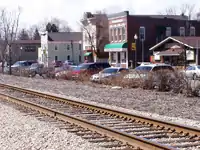 Lincoln Street in Porter | |
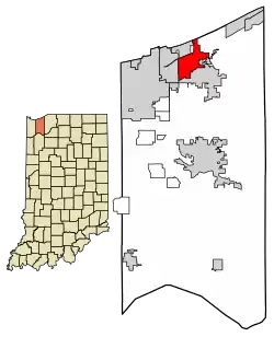 Location of Porter in Porter County, Indiana. | |
| Coordinates: 41°37′34″N 87°4′18″W | |
| Country | United States |
| State | Indiana |
| County | Porter |
| Township | Westchester |
| Area | |
| • Total | 6.46 sq mi (16.73 km2) |
| • Land | 6.18 sq mi (16.00 km2) |
| • Water | 0.28 sq mi (0.74 km2) |
| Elevation | 640 ft (195 m) |
| Population | |
| • Total | 4,858 |
| • Estimate (2019)[4] | 4,834 |
| • Density | 782.71/sq mi (302.20/km2) |
| Time zone | UTC-6 (Central (CST)) |
| • Summer (DST) | UTC-5 (CDT) |
| ZIP code | 46304 |
| Area code(s) | 219 |
| FIPS code | 18-61164[5] |
| GNIS feature ID | 441459 |
| Website | http://www.townofporter.com/ |
Porter is noted for its proximity to Indiana Dunes State Park and for its railroad heritage. Porter was the southern terminus for the Chicago and West Michigan Railway.
History
Porter had its start in the 1850s when the railroad was extended to that point.[13]
Historic sites
The Joseph Bailly Homestead is located in Indiana Dunes National Park on Howe Road, just north of U.S. 20. It is the residence of three generations of the Bailly family. Joseph and Marie Bailly arrived here in 1822 from the St. Joseph River in Michigan. He had been a fur trader on Lake Michigan for nearly 30 years when he set up his family home along the Little Calumet River.[14]
The Chellberg Farm is also a three generation home, but of the family of Anders Kjellburg (Chellberg). He brought his family to this Swedish community in 1869, purchasing 80 acres (32 ha) from the Bailly descendants.[14] The farm is located on Mineral Springs Road, north of U.S. 20.
The Augsburg Swedish Lutheran Church and Cemetery are located on Beam Street, west of town. The Cemetery was begun in 1878.[15]
The Willow Creek Confrontation, an altercation between railroads, occurred in Willow Creek which is in Porter, and is memorialized with a historical marker.
North of Willow Creek is the site of another significant event involving the town's railroads. Porter Junction is where the New York Central Railroad and its subsidiary, the Michigan Central Railroad, crossed each other at grade. (Michigan Central was also involved in the Willow Creek Confrontation noted above. The Pere Marquette Railway also diverted from this location just east of the level crossing, also known as a "diamond".)
In 1921, the crew of a northbound MIC passenger train missed a signal to stop before the "diamonds" in order to let a westbound NYC passenger train through. As a result, the MIC train struck a derail device meant for such a situation so as to prevent the trains from colliding, but in spite of derailing, the MIC train didn't completely stop until after part of it was already obstructing the diamonds. The crew of the NYC train couldn't stop in time, and smashed through one of the MIC's coaches between 45 and 55 mph before derailing itself.
The collision resulted in the grisly deaths of 35 passengers on the MIC train, as well as the deaths of the engineer and fireman on the NYC train. The crash gained such notoriety due to the graphic aftermath that it eventually pushed Congress to mandate the installation of cab signaling in locomotives throughout the United States. The diamond crossing, meanwhile, was removed sometime during the Conrail era.
In addition to the Joseph Bailly Homestead, the Good Fellow Club Youth Camp and Porter Town Hall are listed on the National Register of Historic Places.[16][17]
Geography
Porter is located at 41°37′34″N 87°4′18″W (41.626005, -87.071798).[18]
According to the 2010 census, Porter has a total area of 6.48 square miles (16.78 km2), of which 6.2 square miles (16.06 km2) (or 95.68%) is land and 0.28 square miles (0.73 km2) (or 4.32%) is water.[19]
Demographics
| Historical population | |||
|---|---|---|---|
| Census | Pop. | %± | |
| 1880 | 224 | — | |
| 1910 | 524 | — | |
| 1920 | 699 | 33.4% | |
| 1930 | 805 | 15.2% | |
| 1940 | 1,190 | 47.8% | |
| 1950 | 1,458 | 22.5% | |
| 1960 | 2,189 | 50.1% | |
| 1970 | 3,058 | 39.7% | |
| 1980 | 2,988 | −2.3% | |
| 1990 | 3,118 | 4.4% | |
| 2000 | 4,972 | 59.5% | |
| 2010 | 4,858 | −2.3% | |
| 2019 (est.) | 4,834 | [4] | −0.5% |
| Source: US Census Bureau | |||
2010 census
As of the census[3] of 2010, there were 4,858 people, 1,832 households, and 1,310 families living in the town. The population density was 783.5 inhabitants per square mile (302.5/km2). There were 1,978 housing units at an average density of 319.0 per square mile (123.2/km2). The racial makeup of the town was 94.3% White, 1.1% African American, 0.3% Native American, 0.9% Asian, 1.6% from other races, and 1.7% from two or more races. Hispanic or Latino of any race were 6.6% of the population.
There were 1,832 households, of which 35.6% had children under the age of 18 living with them, 56.3% were married couples living together, 9.7% had a female householder with no husband present, 5.5% had a male householder with no wife present, and 28.5% were non-families. 21.5% of all households were made up of individuals, and 6.1% had someone living alone who was 65 years of age or older. The average household size was 2.65 and the average family size was 3.12.
The median age in the town was 39.1 years. 25.6% of residents were under the age of 18; 7.6% were between the ages of 18 and 24; 27% were from 25 to 44; 29.2% were from 45 to 64; and 10.7% were 65 years of age or older. The gender makeup of the town was 49.5% male and 50.5% female.
2000 census
As of the census[5] of 2000, there were 4,972 people, 1,844 households, and 1,300 families living in the town. The population density was 788.8 people per square mile (304.7/km2). There were 1,966 housing units at an average density of 311.9 per square mile (120.5/km2). The racial makeup of the town was 96.14% White, 0.82% African American, 0.22% Native American, 0.58% Asian, 0.62% from other races, and 1.61% from two or more races. Hispanic or Latino of any race were 4.69% of the population.
There were 1,844 households, out of which 38.4% had children under the age of 18 living with them, 55.8% were married couples living together, 10.8% had a female householder with no husband present, and 29.5% were non-families. 23.3% of all households were made up of individuals, and 5.9% had someone living alone who was 65 years of age or older. The average household size was 2.62 and the average family size was 3.12.
In the town, the population was spread out, with 28.3% under the age of 18, 9.9% from 18 to 24, 32.6% from 25 to 44, 21.5% from 45 to 64, and 7.8% who were 65 years of age or older. The median age was 33 years. For every 100 females, there were 95.4 males. For every 100 females age 18 and over, there were 92.7 males.
The median income for a household in the town was $50,625, and the median income for a family was $60,254. Males had a median income of $50,799 versus $26,055 for females. The per capita income for the town was $24,615. About 4.9% of families and 6.5% of the population were below the poverty line, including 7.7% of those under age 18 and 1.4% of those age 65 or over.
References
- "2019 U.S. Gazetteer Files". United States Census Bureau. Retrieved July 16, 2020.
- "US Board on Geographic Names". United States Geological Survey. 2007-10-25. Retrieved 2008-01-31.
- "U.S. Census website". United States Census Bureau. Retrieved 2012-12-11.
- "Population and Housing Unit Estimates". United States Census Bureau. May 24, 2020. Retrieved May 27, 2020.
- "U.S. Census website". United States Census Bureau. Retrieved 2008-01-31.
- "Porter, Indiana". Geographic Names Information System. United States Geological Survey. Retrieved 2017-04-02.
- Smith, S.H. & Mark, S. (2010). The historical roots of The Nature Conservancy in the Northwest Indiana/Chicagoland Region: From science to preservation. The South Shore Journal, 3, 1-10.
- "Archived copy". Archived from the original on 2016-01-01. Retrieved 2015-11-22.CS1 maint: archived copy as title (link)
- Smith, S. & Mark, S. (2007). The cultural impact of a museum in a small community: The Hour Glass of Ogden Dunes. The South Shore Journal, 2, pp. 16-28.
- "Archived copy". Archived from the original on 2012-11-30. Retrieved 2012-06-11.CS1 maint: archived copy as title (link)
- Smith, S. & Mark, S. (2006). Alice Gray, Dorothy Buell, and Naomi Svihla:Preservationists of Ogden Dunes. The South Shore Journal, 1, 15-21
- . "Archived copy". Archived from the original on 2012-09-13. Retrieved 2012-06-11.CS1 maint: archived copy as title (link)
- History of Porter County, Indiana : a narrative account of its historical progress, its people and its principal interests. Lewis Publishing Company. 1912. p. 188.
- Cultural Sites of Indiana Dunes National Lakeshore, National Park Service, 2006
- Porter County, Interim Report, Indiana Historic Sites and Structures; Historic Landmarks of Indiana, July 1991 Inventory
- "National Register Information System". National Register of Historic Places. National Park Service. July 9, 2010.
- "National Register of Historic Places Listings". Weekly List of Actions Taken on Properties: 8/05/13 through 8/09/13. National Park Service. 2013-08-16.
- "US Gazetteer files: 2010, 2000, and 1990". United States Census Bureau. 2011-02-12. Retrieved 2011-04-23.
- "G001 - Geographic Identifiers - 2010 Census Summary File 1". United States Census Bureau. Archived from the original on 2020-02-13. Retrieved 2015-07-17.
External links
| Wikimedia Commons has media related to Porter, Indiana. |
Municipalities and communities of Porter County, Indiana, United States | ||
|---|---|---|
| Cities | Map of Indiana highlighting Porter County | |
| Towns | ||
| Townships | ||
| CDPs | ||
| Other unincorporated communities | ||
| Ghost towns | ||
| Footnotes | ‡This populated place also has portions in an adjacent county or counties | |
| ||