Porter County, Indiana
Porter County is a county in the U.S. state of Indiana. As of 2010, the population was 164,343.[1] The county seat is Valparaiso.[2] The county is part of Northwest Indiana, as well as the Chicago metropolitan area.
Porter County | |
|---|---|
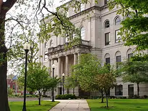 Porter County Courthouse in Valparaiso | |
| Motto(s): "Front Porch of the Dunes" | |
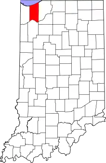 Location within the U.S. state of Indiana | |
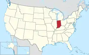 Indiana's location within the U.S. | |
| Coordinates: 41°51′N 87°07′W | |
| Country | |
| State | |
| Founded | 5 February 1836 (authorized) 1837 (organized) |
| Named for | David Porter |
| Seat | Valparaiso |
| Largest city | Portage |
| Area | |
| • Total | 521.8 sq mi (1,351 km2) |
| • Land | 418.2 sq mi (1,083 km2) |
| • Water | 103.6 sq mi (268 km2) 19.9%% |
| Population | |
| • Estimate (2019) | 170,389 |
| • Density | 407.4/sq mi (157.3/km2) |
| Time zone | UTC−6 (Central) |
| • Summer (DST) | UTC−5 (CDT) |
| Congressional district | 1st |
| Website | Official Porter County website |
| Indiana county number 64 | |
Porter County is the site of much of the Indiana Dunes, an area of ecological significance.[3][4][5] The Hour Glass Museum in Ogden Dunes documents the region's ecological significance.[6]
History
The Porter County area was occupied by an Algonquian people dubbed Huber-Berrien.[7] This subsistence culture arrived after the glaciers retreated around 15,000 years ago and the rise of glacial Lake Algonquian, 4–8,000 years ago.[8] The native people of this area were next recorded during the Iroquois Wars (1641–1701) as being Potawatomi and Miami. The trading post system used by the French and then the English encouraged native people to live in central villages along major waterways. Therefore, there are no recorded villages within Porter County's current boundaries. It was not until 1830 when Chiqua's town and Tassinong appear on maps and in records.[7] Chiqua's town is a mile east of Valparaiso on State Route 2, the old Sauk Trail. Tassinong is south of Valparaiso about 5 miles (8.0 km) on State Route 49 at Baum's Bridge Road, the main route across the Great Kankakee Marsh.[9]
After the American Revolutionary War established US sovereignty over the territory of the upper midwest, the new federal government defined the Northwest Territory in 1787 which included the area of present-day Indiana. In 1800, Congress separated Ohio from the Northwest Territory, designating the rest of the land as the Indiana Territory. President Thomas Jefferson chose William Henry Harrison as the governor of the territory, and Vincennes was established as the capital. After the Michigan Territory was separated and the Illinois Territory was formed, Indiana was reduced to its current size and geography. By December 1816 the Indiana Territory was admitted to the Union as a state.
The Indiana State Legislature passed an omnibus county bill[10] on 7 February 1835 that authorized the creation of thirteen counties in northeast Indiana, including Porter.[11] In 1837 the county was organized. It was named for Capt. David Porter, naval officer during the Barbary Wars and the War of 1812.[12][13]
In 1962, Bethlehem Steel built a large integrated steel mill on the shores of Lake Michigan, which is now owned and operated by ArcelorMittal. The construction of the mill, as well as the neighboring Port of Indiana, generated enormous controversy between industrial interests and locals who wanted to conserve the natural shoreline and habitat. Although the activists lost and the steel mill and port were constructed, the US Congress created the Indiana Dunes National Lakeshore in 1966 to protect the area's unique natural habitat.[14]
Geography
Porter County lies on the northern edge of Indiana; its north border is formed by Lake Michigan and its south border is formed by the westward-flowing Kankakee River Its once-tree-covered low rolling hills have been cleared and devoted to agriculture; the only exceptions in Porter County are the drainages carved into the terrain, which are brush-filled. The East Arm Little Calumet River flows westward through the upper portion of Porter County.[15] The highest point, at 870 feet (270 m),[16] is a small hill on the county's east border, 2.75 miles (4.4 km) NW of Westville. The lowest point, at approximately 585 feet (178 m), is along the Lake Michigan shoreline (exact elevation varies due to variation in lake level). According to the 2010 census, the county has an area of 521.78 square miles (1,351.4 km2), of which 418.15 square miles (1,083.0 km2) (or 80.14%) is land and 103.63 square miles (268.4 km2) (or 19.9%) is water,[17] most of it in Lake Michigan.
Adjacent counties
- LaPorte County - east
- Starke County - southeast
- Jasper County - south
- Lake County - west
- Cook County, Illinois - northwest, boundary in Lake Michigan
- Berrien County, Michigan - northeast, boundary in Lake Michigan
Protected areas
- Indiana Dunes National Park (part)
- Indiana Dunes National Park Heron Rookery
- Indiana Dunes State Park
- Moraine Nature Preserve[15]
Major highways
Railroads
Municipalities
.jpg.webp)
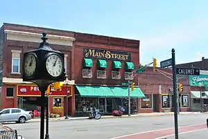
The municipalities in Porter County and their populations as of the 2010 Census:
Cities
- Portage – 36,828
- Valparaiso – 31,730
Towns
- Beverly Shores – 613
- Burns Harbor – 1,156
- Chesterton – 13,068
- Dune Acres – 182
- Hebron – 3,724
- Kouts – 1,879
- Ogden Dunes – 1,110
- Porter – 4,858
- Town of Pines – 708
Census-designated places
- Aberdeen – 1,875
- Lakes of the Four Seasons – 3,097 (7,033 including portion in Lake County)
- Salt Creek Commons – 2,117
- Shorewood Forest – 2,708
- South Haven – 5,282
- Wheeler – 443
Unincorporated communities
Education
.jpg.webp)
Colleges and Universities
Public School Districts
Public schools in Porter County are administered by several districts, most of which cover areas that roughly follow the county's township boundaries:
- Duneland School Corporation – Jackson, Liberty and Westchester townships
- East Porter County School Corporation – Morgan, Pleasant and Washington townships
- Metropolitan School District of Boone Township – Boone Township
- Michigan City Area Schools – Pine Township
- Portage Township Schools – Portage Township
- Porter Township School Corporation – Porter Township
- Union Township School Corporation – Union Township
- Valparaiso Community Schools – Center Township
High Schools and Middle Schools
- Benjamin Franklin Middle School
- Boone Grove High School
- Boone Grove Middle School
- Chesterton High School
- Chesterton Middle School
- Hebron High School
- Hebron Middle School
- Kouts Middle-High School
- Morgan Township Middle/High School
- Portage High School
- Thomas Jefferson Middle School
- Union Township Middle School
- Valparaiso High School
- Washington Township Middle/High School
- Wheeler High School
- William Fegely Middle School
- Willowcreek Middle School
Elementary Schools
- Aylesworth Elementary School
- Bailly Elementary School
- Boone Grove Elementary School
- Brummitt Elementary School
- Central Elementary School (Portage)
- Central Elementary School (Valparaiso)
- Cooks Corners Elementary School
- Crisman Elementary School
- Flint Lake Elementary School
- Hayes Leonard Elementary School
- Hebron Elementary School
- Jackson Elementary School
- John Simatovich Elementary School
- Jones Elementary School
- Kouts Elementary School
- Kyle Elementary School
- Liberty Elementary School
- Liberty Intermediate School
- Memorial Elementary School
- Morgan Elementary School
- Myers Elementary School
- Northview Elementary School
- Parkview Elementary School
- Paul Saylor Elementary School
- Pine Elementary School
- Porter Lakes Elementary School
- South Haven Elementary School
- Thomas Jefferson Elementary School
- Union Center Elementary School
- Washington Township Elementary School
- Westchester Intermediate School
- Yost Elementary School
Public libraries
The county is served by two public library systems:
Hospitals
- Porter Health Care System – 301 beds[20]
- Portage Hospital – Portage
- Porter Regional Hospital – Valparaiso
Climate and weather
| Valparaiso, Indiana | ||||||||||||||||||||||||||||||||||||||||||||||||||||||||||||
|---|---|---|---|---|---|---|---|---|---|---|---|---|---|---|---|---|---|---|---|---|---|---|---|---|---|---|---|---|---|---|---|---|---|---|---|---|---|---|---|---|---|---|---|---|---|---|---|---|---|---|---|---|---|---|---|---|---|---|---|---|
| Climate chart (explanation) | ||||||||||||||||||||||||||||||||||||||||||||||||||||||||||||
| ||||||||||||||||||||||||||||||||||||||||||||||||||||||||||||
| ||||||||||||||||||||||||||||||||||||||||||||||||||||||||||||
In recent years, average temperatures in Valparaiso have ranged from a low of 15 °F (−9 °C) in January to a high of 83 °F (28 °C) in July, although a record low of −25 °F (−32 °C) was recorded in January 1985 and a record high of 105 °F (41 °C) was recorded in July 1934. Average monthly precipitation ranged from 1.82 inches (46 mm) in February to 4.66 inches (118 mm) in June.[21]
Government
The county government is a constitutional body, and is granted specific powers by the Constitution of Indiana and the Indiana Code.
County Council: The legislative branch of the county government; controls spending and revenue collection in the county. Representatives are elected to four-year terms from county districts. They set salaries, the annual budget and special spending. The council has limited authority to impose local taxes, in the form of an income and property tax that is subject to state level approval, excise taxes and service taxes.[22][23]
Board of Commissioners: The executive body of the county; commissioners are elected county-wide, to staggered four-year terms. One commissioner serves as president. The commissioners execute acts legislated by the council, collect revenue and manage the county government.[22][23]
Court: The county maintains a small claims court that handles civil cases. The judge on the court is elected to a term of four years and must be a member of the Indiana Bar Association. The judge is assisted by a constable who is also elected to a four-year term. In some cases, court decisions can be appealed to the state level circuit court.[23]
County Officials: The county has other elected offices, including sheriff, coroner, auditor, treasurer, recorder, surveyor, and circuit court clerk. These officials are elected to four-year terms. Members elected to county government positions are required to declare party affiliations and to be residents of the county.[23]
Porter County is part of Indiana's 1st congressional district. In state government, Porter County is in Indiana Senate districts 4th, 5th and 6th; in Indiana House of Representatives districts 3rd, 4th, 10th, 19th and 20th.
For most of its history, Porter County was a Republican Party stronghold in presidential elections. It has become a swing county in recent years, voting for the national winner in every presidential election since 1980 except for 1992 and 2020.
| Year | Republican | Democratic | Third parties |
|---|---|---|---|
| 2020 | 52.0% 45,008 | 46.0% 39,746 | 2.0% 1,755 |
| 2016 | 49.6% 38,832 | 43.0% 33,676 | 7.3% 5,745 |
| 2012 | 46.9% 34,406 | 50.8% 37,252 | 2.2% 1,645 |
| 2008 | 45.6% 33,857 | 52.8% 39,178 | 1.6% 1,211 |
| 2004 | 53.6% 34,794 | 45.3% 29,388 | 1.1% 691 |
| 2000 | 52.5% 31,157 | 45.1% 26,790 | 2.4% 1,431 |
| 1996 | 42.0% 22,931 | 44.0% 24,044 | 14.0% 7,621 |
| 1992 | 39.7% 22,644 | 36.8% 21,022 | 23.5% 13,401 |
| 1988 | 60.4% 29,790 | 39.3% 19,390 | 0.3% 165 |
| 1984 | 64.1% 32,505 | 35.2% 17,862 | 0.6% 315 |
| 1980 | 64.2% 30,055 | 27.5% 12,869 | 8.3% 3,892 |
| 1976 | 59.8% 25,489 | 38.6% 16,468 | 1.6% 701 |
| 1972 | 74.6% 26,877 | 24.8% 8,943 | 0.6% 210 |
| 1968 | 53.2% 17,328 | 27.4% 8,914 | 19.5% 6,340 |
| 1964 | 52.5% 14,480 | 47.0% 12,975 | 0.6% 152 |
| 1960 | 59.2% 15,666 | 40.5% 10,733 | 0.3% 75 |
| 1956 | 72.7% 14,970 | 27.1% 5,574 | 0.2% 45 |
| 1952 | 68.8% 13,194 | 30.8% 5,909 | 0.5% 87 |
| 1948 | 62.2% 8,907 | 36.1% 5,161 | 1.8% 250 |
| 1944 | 60.5% 8,561 | 39.1% 5,528 | 0.4% 57 |
| 1940 | 58.4% 8,270 | 41.2% 5,840 | 0.4% 51 |
| 1936 | 52.6% 6,278 | 46.6% 5,560 | 0.8% 98 |
| 1932 | 49.5% 5,631 | 48.7% 5,542 | 1.8% 209 |
| 1928 | 70.4% 7,107 | 29.0% 2,921 | 0.6% 62 |
| 1924 | 67.8% 5,613 | 19.8% 1,640 | 12.5% 1,031 |
| 1920 | 72.7% 5,570 | 21.8% 1,671 | 5.5% 423 |
| 1916 | 59.2% 2,913 | 38.0% 1,871 | 2.8% 135 |
| 1912 | 35.3% 1,510 | 31.6% 1,352 | 33.1% 1,418 |
| 1908 | 59.9% 2,940 | 36.4% 1,789 | 3.7% 181 |
| 1904 | 66.4% 3,162 | 30.2% 1,437 | 3.4% 164 |
| 1900 | 59.5% 2,797 | 39.3% 1,848 | 1.2% 57 |
| 1896 | 58.1% 2,853 | 41.2% 2,026 | 0.7% 35 |
| 1892 | 49.7% 2,187 | 44.0% 1,937 | 6.2% 274 |
| 1888 | 52.8% 2,427 | 43.9% 2,018 | 3.3% 150 |
County elected officials
|
|
Demographics
| Historical population | |||
|---|---|---|---|
| Census | Pop. | %± | |
| 1840 | 2,162 | — | |
| 1850 | 5,234 | 142.1% | |
| 1860 | 10,313 | 97.0% | |
| 1870 | 13,942 | 35.2% | |
| 1880 | 17,227 | 23.6% | |
| 1890 | 18,052 | 4.8% | |
| 1900 | 19,175 | 6.2% | |
| 1910 | 20,540 | 7.1% | |
| 1920 | 20,256 | −1.4% | |
| 1930 | 22,821 | 12.7% | |
| 1940 | 27,836 | 22.0% | |
| 1950 | 40,076 | 44.0% | |
| 1960 | 60,279 | 50.4% | |
| 1970 | 87,114 | 44.5% | |
| 1980 | 119,816 | 37.5% | |
| 1990 | 128,932 | 7.6% | |
| 2000 | 146,798 | 13.9% | |
| 2010 | 164,343 | 12.0% | |
| 2019 (est.) | 170,389 | [27] | 3.7% |
| US Decennial Census[28] 1790-1960[29] 1900-1990[30] 1990-2000[31] 2010-2019[1] | |||
2010 Census
As of the 2010 United States Census, there were 164,343 people, 61,998 households, and 43,901 families in the county.[32] The population density was 393.0 inhabitants per square mile (151.7/km2). There were 66,179 housing units at an average density of 158.3 per square mile (61.1/km2).[17] The racial makeup of the county was 91.3% white, 3.0% black or African American, 1.2% Asian, 0.3% American Indian, 2.3% from other races, and 1.9% from two or more races. Those of Hispanic or Latino origin made up 8.5% of the population.[32] In terms of ancestry, 29.1% were German, 18.5% were Irish, 10.1% were Polish, 9.7% were English, 5.8% were Italian, and 5.6% were American.[33]
Of the 61,998 households, 34.1% had children under the age of 18 living with them, 55.7% were married couples living together, 10.4% had a female householder with no husband present, 29.2% were non-families, and 23.3% of all households were made up of individuals. The average household size was 2.60 and the average family size was 3.07. The median age was 38.4 years.[32]
The median income for a household in the county was $47,697 and the median income for a family was $73,065. Males had a median income of $59,542 versus $35,534 for females. The per capita income for the county was $27,922. About 6.6% of families and 9.4% of the population were below the poverty line, including 12.8% of those under age 18 and 5.2% of those age 65 or over.[34]
| Places by population and race[35] | ||||||
|---|---|---|---|---|---|---|
| Place | Population (2010) | White | Black or African American |
Asian | Other [note 1] |
Hispanic or Latino (of any race) |
| Porter County | 164,343 | 91.3% | 3.0% | 1.2% | 4.5% | 8.5% |
| Aberdeen, CDP | 1,875 | 91.1% | 3.3% | 2.6% | 3.0% | 5.4% |
| Beverly Shores, town | 613 | 96.6% | 1.3% | 0.3% | 1.8% | 2.8% |
| Burns Harbor, town | 1,156 | 95.4% | 1.8% | 0.3% | 2.5% | 5.8% |
| Chesterton, town | 13,068 | 92.7% | 1.4% | 2.1% | 3.8% | 6.9% |
| Dune Acres, town | 182 | 95.1% | 1.1% | 2.2% | 1.6% | 1.6% |
| Hebron, town | 3,724 | 95.9% | 1.1% | 0.4% | 2.6% | 6.1% |
| Kouts, town | 1,879 | 97.6% | 0.3% | 0.6% | 1.5% | 5.1% |
| Lakes of the Four Seasons, CDP [note 2] | 7,033 | 93.4% | 1.2% | 1.0% | 4.4% | 8.5% |
| Ogden Dunes, town | 1,110 | 96.1% | 1.1% | 1.3% | 1.5% | 3.2% |
| Portage, city | 36,828 | 83.6% | 7.3% | 0.9% | 8.2% | 16.4% |
| Porter, town | 4,858 | 94.3% | 1.1% | 0.9% | 3.7% | 6.6% |
| Salt Creek Commons, CDP | 2,117 | 94.2% | 1.0% | 1.6% | 3.2% | 8.3% |
| Shorewood Forest, CDP | 2,708 | 89.4% | 3.8% | 4.0% | 2.8% | 3.7% |
| South Haven, CDP | 5,282 | 91.3% | 3.0% | 0.3% | 5.4% | 9.8% |
| Town of Pines, town | 708 | 93.9% | 2.3% | 0.3% | 3.5% | 3.1% |
| Valparaiso, city | 31,730 | 89.9% | 3.3% | 2.1% | 4.7% | 7.1% |
| Wheeler, CDP | 443 | 94.1% | 0.9% | 0.2% | 4.8% | 4.5% |
| Places by population and standard of living[36][37] | ||||
|---|---|---|---|---|
| Place | Population (2010) | Per capita income |
Median household income |
Median home value |
| Porter County | 164,343 | $28,244 | $62,457 | $166,600 |
| Aberdeen, CDP | 1,875 | $46,604 | $100,278 | $303,200 |
| Beverly Shores, town | 613 | $68,750 | $39,906 | $429,200 |
| Burns Harbor, town | 1,156 | $26,337 | $62,500 | $149,700 |
| Chesterton, town | 13,068 | $29,147 | $64,183 | $174,500 |
| Dune Acres, town | 182 | $141,256 | $161,875 | $677,600 |
| Hebron, town | 3,724 | $54,276 | $23,027 | $135,900 |
| Kouts, town | 1,879 | $22,907 | $61,087 | $143,100 |
| Lakes of the Four Seasons, CDP [note 2] | 7,033 | $32,908 | $84,242 | $182,600 |
| Ogden Dunes, town | 1,110 | $59,561 | $106,406 | $343,800 |
| Portage, city | 36,828 | $23,892 | $51,623 | $137,700 |
| Porter, town | 4,858 | $66,304 | $32,210 | $167,100 |
| Salt Creek Commons, CDP | 2,117 | $18,778 | $60,478 | $114,800 |
| Shorewood Forest, CDP | 2,708 | $49,743 | $118,984 | $327,400 |
| South Haven, CDP | 5,282 | $19,355 | $49,746 | $110,800 |
| Town of Pines, town | 708 | $20,255 | $36,111 | $96,600 |
| Valparaiso, city | 31,730 | $24,894 | $50,182 | $165,200 |
| Wheeler, CDP | 443 | $22,481 | $58,229 | $134,900 |
Porter County Cemeteries
Maplewood Cemetery, next to Graceland in Valparaiso, has burials from the 1700s. The Bailly Cemetery was started in 1827.[38] Additional cemeteries were created as the population grew. Early cemeteries were often family owned or church related. As communities grew, community cemeteries developed. The newest cemetery in the county is Angel Crest Cemetery north of Valparaiso, near Indiana State Road 49.
Porter County Parks
Porter County has grown from a single park, Sunset Hill Farm County Park, to four, including: Calumet Trail, Dunn's Bridge County Park, and the newest, Brinkca-Cross Gardens.[39]
- Brinkca-Cross Gardens Pine Township (4 acres (1.6 ha))[40]
- Calumet Trail (9.1 miles (14.6 km) long), parallel to U.S. 12, at the north end of the county. A mixed use trail for walking, running, biking and cross-country skiing.[41]
- Dunn's Bridge County Park on the southern boundary of the county on County Road 500 East, Dunn's Bridge spans the Kankakee River to Jasper county. It is one of the oldest landmarks in the region. Built over a century ago across the Kankakee River by a resident farmer named Dunn, legend suggests its origins may be traced to the famous George Ferris, creator of the first 'Ferris Wheel'. The park provides small boat access to the Kankakee River and a parking lot.[42]
- Sunset Hill Farm County Park (238 acres (96 ha)). Built around the Col. Murray farm, the open meadows are used for festivals and events.[43]
Cultural Activities
Museums
- Alton Goin Museum is operated by the Portage Community Historical Society at Countryside Park in Portage to preserve the city's history, including the Trager farmhouse.[44]
- Bailly Homestead & Chellberg Farm is part of Indiana Dunes National Park.[44]
- Brauer Museum of Art is operated by Valparaiso University and is located in Valparaiso University Center for the Arts. It has the largest collection of works by Junius R. Sloan.[44]
- Depot of Beverly Shores Museum & Art Gallery is a pink stucco museum to preserve Beverly Shores history through rotating exhibits of paintings, drawings, sculpture, ceramics and woodcarving.[44]
- Hour Glass House Museum has the works of local artists.[44]
- Porter County Museum of History maintains the history of Porter County.[44]
- Stagecoach Inn & Panhandle Depot is operated by the Hebron Historical Society in Hebron.[44]
- Westchester Township History Museum is operated by the Westchester Public Library and is located in the George Brown Mansion, the former home of a wealthy family that exhibits local history of the Indiana Dunes.[44]
- Task Force Tips Fire Museum is operated by Task Force Tips in Valparaiso to preserve the history of fire equipment.[44]
Live Theater
- 4th Street Theater is a community theater in Chesterton.[45]
- Chicago Street Theatre is a community theater in Valparaiso.[45]
- Front Porch Music is a music supply store that offers a weekly 'open mic' night and sponsors concerts in Valparaiso.[45]
- Memorial Opera House presents live theater and a variety of other monthly programs.[45]
- Valparaiso Theatrical Company travels to different venues in Porter County presenting live theater with the proceeds benefitting a variety of charities.[45]
- Valparaiso University Center for the Arts is the Valparaiso University's performing arts center.[45]
Bibliography
- Cutler, Harry G. (1912), History of Porter County, Indiana: A Narrative Account of Its Historical Progress, Its People and Its Principal Interests, Volume 1, Chicago, Illinois: Lewis Publishing Company
- Eggleston, Larry G. (2004), Porter County Lakes and Resorts, Arcadia Publishing
- Shults-Gay, Deborah H. (1917), One of the Earliest Authentic Histories of Porter County, Indiana from 1832 to 1876, s.l.: s.n.
Notes
- Other = Combined percentages for American Indian or Alaska Native; Native Hawaiian or Pacific Islander; other races; and two or more races
- Population is 3,097 within Porter County; 3,936 reside in Lake County
References
- "Porter County QuickFacts". US Census Bureau. Archived from the original on 17 July 2011. Retrieved 25 September 2011.
- "Find a County". National Association of Counties. Retrieved 7 June 2011.
- Smith, S. & Mark, S. (2006). Alice Gray, Dorothy Buell, and Naomi Svihla: Preservationists of Ogden Dunes. The South Shore Journal, "Archived copy". Archived from the original on 13 September 2012. Retrieved 13 June 2012.CS1 maint: archived copy as title (link)
- Smith, S. & Mark, S. (2009)
- The Historical Roots of the Nature Conservancy in the Northwest Indiana/Chicagoland Region: From Science to Preservation. The South Shore Journal, 3. "Archived copy". Archived from the original on 1 January 2016. Retrieved 22 November 2015.CS1 maint: archived copy as title (link)
- Smith, S. & Mark, S. (2007). The cultural impact of a museum in a small community: The Hour Glass of Ogden Dunes. The South Shore Journal, 2. "Archived copy". Archived from the original on 30 November 2012. Retrieved 11 June 2012.CS1 maint: archived copy as title (link)
- Tanner, Helen Hornbeck, Atlas of Great Lakes Indian History; University of Oklahoma Press, Norman, Oklahoma (1987) Map 5
- Hough, Jack L., Geology of the Great Lakes; University of Illinois Press, Urbana (1958) p. 276
- Shults-Gay, Deborah H., One of the Earliest Authentic Histories of Porter County, Indiana; From 1832 to 1876 (circa 1917)
- John W Tyndall & OE Lesh, Standard history of Adams and Wells Counties, Indiana. pp. 284-6 (accessed 9 August 2020)
- The counties are Dekalb, Fulton, Jasper, Jay, Kosciusko, Marshall, Newton, Porter, Pulaski, Stark, Steuben, Wells, and Whitley. Newton County was merged with Jasper County in 1839, and was re-authorized as a separate county in 1859.
- Baker, Ronald L.; Marvin Carmony (1995). Indiana Place Names. Bloomington: Indiana University Press. p. 133. ISBN 0-253-28340-X.
- De Witt Clinton Goodrich & Charles Richard Tuttle (1875). An Illustrated History of the State of Indiana. Indiana: R. S. Peale & co. p. 570.
- "The Modern History of the Burns Harbor Steel Mill". NWI Steel Heritage Museum. Retrieved 26 October 2018.
- Porter County IN (Google Maps, accessed 24 August 2020)
- (PeakBagger.com, accessed 24 August 2020)
- "Population, Housing Units, Area, and Density: 2010 - County". US Census Bureau. Archived from the original on 13 February 2020. Retrieved 10 July 2015.
- "Porter County Public Library". Retrieved 10 June 2014.
- "Westchester Public Library". Retrieved 27 June 2014.
- "Porter Health Care System". Archived from the original on 14 July 2014. Retrieved 6 June 2014.
- "Monthly Averages for Valparaiso IN". The Weather Channel. Retrieved 27 January 2011.
- Indiana Code. "Title 36, Article 2, Section 3". IN.gov. Retrieved 16 September 2008.
- Indiana Code. "Title 2, Article 10, Section 2" (PDF). IN.gov. Retrieved 16 September 2008.
- Leip, David. "Atlas of US Presidential Elections". uselectionatlas.org. Retrieved 5 April 2018.
- "Commissioners". Porter County. Retrieved 30 January 2017.
- Official Porter County website
- "Population and Housing Unit Estimates". Retrieved May 21, 2020.
- "US Decennial Census". US Census Bureau. Retrieved July 10, 2014.
- "Historical Census Browser". University of Virginia Library. Retrieved July 10, 2014.
- "Population of Counties by Decennial Census: 1900 to 1990". US Census Bureau. Retrieved July 10, 2014.
- "Census 2000 PHC-T-4. Ranking Tables for Counties: 1990 and 2000" (PDF). US Census Bureau. Retrieved July 10, 2014.
- "Profile of General Population and Housing Characteristics: 2010 Demographic Profile Data". US Census Bureau. Archived from the original on 13 February 2020. Retrieved 10 July 2015.
- "Selected Social Characteristics in the US – 2006-2010 American Community Survey 5-Year Estimates". US Census Bureau. Archived from the original on 14 February 2020. Retrieved 10 July 2015.
- "Selected Economic Characteristics – 2006-2010 American Community Survey 5-Year Estimates". US Census Bureau. Archived from the original on 14 February 2020. Retrieved 10 July 2015.
- US Census Bureau. American Community Survey, Profile of General Population and Housing Characteristics 2010, Table DP-1, 2010 Demographic Profile Data. U.S. Census website. Retrieved 14 June 2014.
- US Census Bureau. 2008-2012 American Community Survey 5-Year Estimates, Table DP03, Selected Economic Charactaristics. US Census website. Retrieved 14 June 2014.
- US Census Bureau. 2008-2012 American Community Survey 5-Year Estimates, Table DP04, Selected Housing Charactaristics. US Census website. Retrieved 14 June 2014.
- Bailly Cemetery, at Baileytown, near Porter, Westchester Township, Porter County Indiana; Cemetery of the Pioneer family of Honore Gratien Joseph Bailly de Messein and Marie LeFevre, Burials 1827 to 1918; compiled by Olga Mae Schiemann; Chicago, Illinois; 1952
- "Porter County Parks and Recreation". Retrieved 6 June 2014.
- "Porter County Parks and Recreation - Binkca-Cross Gardens". Retrieved 6 June 2014.
- "Porter County Parks and Recreation - Calumet Trail". Retrieved 6 June 2014.
- "Porter County Parks and Recreation - Dunn's Bridge County Park". Retrieved 6 June 2014.
- "Porter County Parks and Recreation - Sunset Hill Farm County Park". Retrieved 6 June 2014.
- Indiana Dunes Country Activities Guide, The Official Guide to Porter County, Indiana; The Indiana Dunes: 2015, p. 19
- Indiana Dunes Country Activities Guide, The Official Guide to Porter County, Indiana; The Indiana Dunes: 2015, pp. 22-23
External links
- Official Porter County website
- Porter County GenWeb – county history and genealogy website
- Porter County Municipal Airport (VPZ)
- Center Township Trustee Website (Information about township assistance for those experiencing financial difficulties.)
| Wikimedia Commons has media related to Porter County, Indiana. |
Places adjacent to Porter County, Indiana | ||||||||||
|---|---|---|---|---|---|---|---|---|---|---|
| ||||||||||
Municipalities and communities of Porter County, Indiana, United States | ||
|---|---|---|
| Cities | Map of Indiana highlighting Porter County | |
| Towns | ||
| Townships | ||
| CDPs | ||
| Other unincorporated communities | ||
| Ghost towns | ||
| Footnotes | ‡This populated place also has portions in an adjacent county or counties | |
| ||
| Major city |  | |
|---|---|---|
| Cities (over 30,000 in 2010) | ||
| Towns and villages (over 30,000 in 2010) |
| |
| Counties | ||
| Regions | ||
| Sub-regions | ||

| Authority control |
|---|