Potter, Nebraska
Potter is a village in Cheyenne County, Nebraska, United States. As of the 2010 census, the village population was 337.
Potter, Nebraska | |
|---|---|
 Potter seen from Exit 38 on Interstate 80 | |
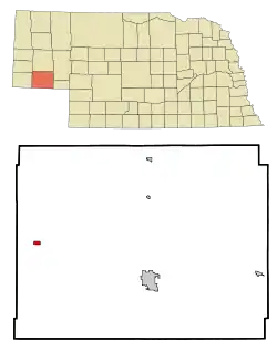 Location of Potter, Nebraska | |
| Coordinates: 41°13′4″N 103°18′53″W | |
| Country | United States |
| State | Nebraska |
| County | Cheyenne |
| Area | |
| • Total | 1.44 sq mi (3.73 km2) |
| • Land | 1.44 sq mi (3.73 km2) |
| • Water | 0.00 sq mi (0.00 km2) |
| Elevation | 4,400 ft (1,341 m) |
| Population | |
| • Total | 337 |
| • Estimate (2019)[3] | 292 |
| • Density | 202.92/sq mi (78.33/km2) |
| Time zone | UTC-7 (Mountain (MST)) |
| • Summer (DST) | UTC-6 (MDT) |
| ZIP code | 69156 |
| Area code(s) | 308 |
| FIPS code | 31-39870[4] |
| GNIS feature ID | 0832328[5] |
History
Potter got its start in the year 1870, following construction of the railroad through the territory.[6] It was named for General Potter, a railroad shareholder.[7]
On July 6, 1928, Potter received the largest hailstone ever recorded, which measured approximately 17 inches (43.2 centimeters) in diameter and weighed approximately 1.5 pounds (680 grams).[8] Another hailstone of that diameter measurement was recovered in Aurora, Nebraska on June 22, 2003.[9]
Geography
Potter is located at 41°13′4″N 103°18′53″W (41.217830, -103.314788).[10]
According to the United States Census Bureau, the village has a total area of 0.46 square miles (1.19 km2), all land.[11]
Demographics
| Historical population | |||
|---|---|---|---|
| Census | Pop. | %± | |
| 1920 | 486 | — | |
| 1930 | 515 | 6.0% | |
| 1940 | 387 | −24.9% | |
| 1950 | 421 | 8.8% | |
| 1960 | 554 | 31.6% | |
| 1980 | 369 | — | |
| 1990 | 388 | 5.1% | |
| 2000 | 390 | 0.5% | |
| 2010 | 337 | −13.6% | |
| 2019 (est.) | 292 | [3] | −13.4% |
| U.S. Decennial Census[12] | |||
2010 census
As of the census[2] of 2010, there were 337 people, 151 households, and 101 families residing in the village. The population density was 732.6 inhabitants per square mile (282.9/km2). There were 175 housing units at an average density of 380.4 per square mile (146.9/km2). The racial makeup of the village was 96.1% White, 1.2% Native American, and 2.7% from other races. Hispanic or Latino of any race were 4.5% of the population.
There were 151 households, of which 26.5% had children under the age of 18 living with them, 56.3% were married couples living together, 6.0% had a female householder with no husband present, 4.6% had a male householder with no wife present, and 33.1% were non-families. 30.5% of all households were made up of individuals, and 13.2% had someone living alone who was 65 years of age or older. The average household size was 2.23 and the average family size was 2.79.
The median age in the village was 45.8 years. 22.3% of residents were under the age of 18; 4.4% were between the ages of 18 and 24; 20.4% were from 25 to 44; 37.1% were from 45 to 64; and 15.7% were 65 years of age or older. The gender makeup of the village was 48.1% male and 51.9% female.
2000 census
As of the census[4] of 2000, there were 390 people, 159 households, and 104 families residing in the village. The population density was 799.0 people per square mile (307.3/km2). There were 170 housing units at an average density of 348.3 per square mile (134.0/km2). The racial makeup of the village was 97.95% White, 0.26% Native American, 0.77% from other races, and 1.03% from two or more races. Hispanic or Latino of any race were 2.31% of the population.
There were 159 households, out of which 37.1% had children under the age of 18 living with them, 54.7% were married couples living together, 5.7% had a female householder with no husband present, and 34.0% were non-families. 30.8% of all households were made up of individuals, and 15.1% had someone living alone who was 65 years of age or older. The average household size was 2.45 and the average family size was 3.10.
In the village, the population was spread out, with 31.0% under the age of 18, 4.6% from 18 to 24, 28.2% from 25 to 44, 21.8% from 45 to 64, and 14.4% who were 65 years of age or older. The median age was 36 years. For every 100 females, there were 91.2 males. For every 100 females age 18 and over, there were 92.1 males.
The median income for a household in the village was $28,750, and the median income for a family was $37,000. Males had a median income of $26,932 versus $24,500 for females. The per capita income for the village was $14,344. About 13.5% of families and 17.8% of the population were below the poverty line, including 19.5% of those under age 18 and 20.8% of those age 65 or over.
References
- "2019 U.S. Gazetteer Files". United States Census Bureau. Retrieved July 26, 2020.
- "U.S. Census website". United States Census Bureau. Retrieved 2012-06-24.
- "Population and Housing Unit Estimates". United States Census Bureau. May 24, 2020. Retrieved May 27, 2020.
- "U.S. Census website". United States Census Bureau. Retrieved 2008-01-31.
- "US Board on Geographic Names". United States Geological Survey. 2007-10-25. Retrieved 2008-01-31.
- "Potter, Cheyenne County". Center for Advanced Land Management Information Technologies. University of Nebraska. Retrieved August 3, 2014.
- Fitzpatrick, Lillian L. (1960). Nebraska Place-Names. University of Nebraska Press. p. 41. ISBN 0803250606. A 1925 edition is available for download at University of Nebraska—Lincoln Digital Commons.
- ftp://ftp.library.noaa.gov/docs.lib/htdocs/rescue/mwr/056/mwr-056-08-0313.pdf
- "Largest Hailstone in U.S. History Found," National Geographic News, August 4, 2003
- "US Gazetteer files: 2010, 2000, and 1990". United States Census Bureau. 2011-02-12. Retrieved 2011-04-23.
- "US Gazetteer files 2010". United States Census Bureau. Archived from the original on 2012-01-25. Retrieved 2012-06-24.
- "Census of Population and Housing". Census.gov. Retrieved June 4, 2015.