Prairie Grove, Arkansas
Prairie Grove is a city in Washington County, Arkansas, United States. The population was 4,380 at the 2010 Census. It is part of the Northwest Arkansas region, and home to Prairie Grove Battlefield State Park. The park spans a large amount of land and contains a visitor center, museum, several monuments, a driving tour and a collection of period buildings and homes.
Prairie Grove, Arkansas | |
|---|---|
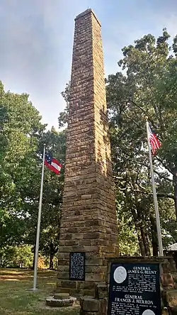 Monument to the Battle of Rhea's Mill at Prairie Grove Battlefield State Park | |
 Seal | |
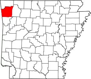
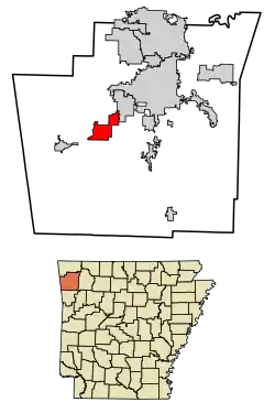 Location of Prairie Grove in Washington County, Arkansas. | |
| Coordinates: 35°58′37″N 94°18′58″W | |
| Country | United States |
| State | Arkansas |
| County | Washington |
| Incorporated | 1888 |
| Government | |
| • Mayor | Sonny Hudson |
| Area | |
| • Total | 9.33 sq mi (24.16 km2) |
| • Land | 9.28 sq mi (24.04 km2) |
| • Water | 0.05 sq mi (0.12 km2) |
| Elevation | 1,165 ft (355 m) |
| Population (2010) | |
| • Total | 4,380 |
| • Estimate (2019)[2] | 6,740 |
| • Density | 726.21/sq mi (280.38/km2) |
| Time zone | UTC-6 (Central) |
| • Summer (DST) | UTC-5 (Central) |
| ZIP code | 72753 |
| Area code(s) | 479 |
| FIPS code | 05-57170 |
| GNIS feature ID | 0078091 |
| Website | http://www.prairiegrovearkansas.org/ |
History
Prairie Grove was the site of the Battle of Prairie Grove during the American Civil War. Confederate forces under General Thomas C. Hindman attempted to prevent the juncture of two Federal forces under Generals James G. Blunt and Francis J. Herron. The result of the battle was a tactical stalemate which assured permanent Union control of northwest Arkansas. The battlefield is now a State Military Park.
A post office has been in operation at Prairie Grove since 1867.[3] Prairie Grove was platted in 1877.[4]
A 100-foot wind turbine near Prairie Grove was installed in the early 2000s.[5]
Testicular cancer
The Natural Resources Defense Council released an issue paper stating between that 1997 and 2001, Prairie Grove was the center of a cluster of testicular cancer cases. No clear cause has been identified but the NRDC notes the town is near a closed nuclear reactor and a low-level radioactive landfill. Arsenic from industrialized chicken manure is another possible source. In 2004, residents sued one of the poultry farms and the poultry feed manufacturer for spreading contaminated manure throughout Prairie Grove. The lawsuit did not assign blame and the cause of the cancer cluster has never been definitively determined.[6][7][8]
Geography
According to the United States Census Bureau, the city has a total area of 2.1 square miles (5.4 km2), all land.
Demographics
| Historical population | |||
|---|---|---|---|
| Census | Pop. | %± | |
| 1890 | 412 | — | |
| 1900 | 551 | 33.7% | |
| 1910 | 774 | 40.5% | |
| 1920 | 861 | 11.2% | |
| 1930 | 743 | −13.7% | |
| 1940 | 887 | 19.4% | |
| 1950 | 939 | 5.9% | |
| 1960 | 1,056 | 12.5% | |
| 1970 | 1,582 | 49.8% | |
| 1980 | 1,708 | 8.0% | |
| 1990 | 1,761 | 3.1% | |
| 2000 | 2,540 | 44.2% | |
| 2010 | 4,380 | 72.4% | |
| 2019 (est.) | 6,740 | [2] | 53.9% |
| U.S. Decennial Census[9] | |||
As of the census[10] of 2010, there were 4,380 people, 1,658 households, and 1,197 families residing in the city. The racial makeup of the city was 91.08% White, 0.80% Black or African American, 2.90% Native American, 0.70% Asian, 0.10% Pacific Islander, 1.50% from other races, and 2.10% from two or more races. 4.50% of the population were Hispanic or Latino of any race.
There were 1,658 households, out of which 36.6% had children under the age of 18 living with them, 56.1% were married couples living together, 12.4% had a female householder with no husband present, and 27.8% were non-families. 40.0% of all households were made up of individuals, and 24.5% had someone living alone who was 65 years of age or older. The average household size was 2.64 and the average family size was 3.11.
Culture, contemporary life, and points of interest
Prairie Grove is "wet", allowing sales of beer but not liquor in restaurants, except for an approximately 1 square mile (2.6 km2) area around downtown, which voted to go dry in the early 1950s. The city will vote in March 2020 whether to allow sales of liquor in the wet areas as well.[11]
The two most well known attractions in Prairie Grove are the Prairie Grove Battlefield State Park and the Telephone Booth, a working c. 1960 phonebooth across the street from the park.[12]
Prairie Grove also has several historical buildings including North Mock Street as well as the Southern Mercantile Building.
Education
Prairie Grove School District is separated into four different schools; Prairie Grove Elementary, Middle, Junior High and High School facilities. The school mascot is The Tigers. The school colors are Black, Gold, and White.
Notable people
- Jalen Beeks, pitcher for Arkansas Razorbacks baseball from 2013 to 2014, and in Major League Baseball from 2018–present
- Mark Martin, Arkansas Secretary of State from 2011 to 2019 and member of the Arkansas House of Representatives for part of Washington County from 2005 to 2011; Prairie Grove resident
- Margaret Pittman, a noted bacteriologist known for her work in helping to formulate and test the effectiveness of the whooping cough vaccine, as well as groundbreaking research into the immunology and microbiology of infectious diseases. She was born near Prairie Grove in 1902.
References
- "2019 U.S. Gazetteer Files". United States Census Bureau. Retrieved June 30, 2020.
- "Population and Housing Unit Estimates". United States Census Bureau. May 24, 2020. Retrieved May 27, 2020.
- History of Benton, Washington, Carroll, Madison, Crawford, Franklin, and Sebastian Counties, Arkansas. Higginson Book Company. 1889. p. 321.
- History of Benton, Washington, Carroll, Madison, Crawford, Franklin, and Sebastian Counties, Arkansas. Higginson Book Company. 1889. p. 265.
- Holtmeyer, Dan (2018-05-21). "Lone turbine in Prairie Grove a remnant of Arkansas wind power". Arkansas Online. Retrieved 2019-06-01.
- "Health Alert: Disease Clusters Spotlight the Need to Protect People from Toxic Chemicals" (PDF). Nrdc.org. Retrieved 2016-05-12.
- Kirby, David (March 30, 2011). "Arsenic in Chicken Feed: A Possible Cancer Cluster Source?". Huffington Post.
- Urban, Peter. "Senate hearing on cancer clusters Tuesday". arkansasnews. Archived from the original on 25 October 2014. Retrieved 18 September 2014.
- "Census of Population and Housing". Census.gov. Retrieved June 4, 2015.
- "U.S. Census website". United States Census Bureau. Retrieved 2008-01-31.
- Kutter, Lynn (December 25, 2019). "Council Places Liquor By The Drink On Election Ballot". Washington County Enterprise-Leader. 80 (52). Farmington: Northwest Arkansas Newspapers LLC. p. 1. OCLC 931943106. Retrieved December 27, 2019.
- "National Register Information System – Prairie Grove Airlight Outdoor Telephone Booth (#15000291)". National Register of Historic Places. National Park Service. November 2, 2013. Retrieved December 27, 2019.
External links
- City of Prairie Grove, Arkansas official website
- Encyclopedia of Arkansas History & Culture entry: Prairie Grove (Washington County)