Pulau River
The Pulau River (Indonesian: Sungai Pulau, Dutch: Eilandenrivier) is a major river in the south of Papua province of Indonesia. With a total length of 403 km (250 mi).[1]
| Pulau River Eilandenrivier | |
|---|---|
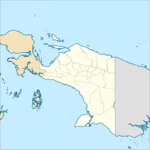 Location of river mouth | |
| Native name | Sungai Pulau, Sungai Eilanden, Eilandenrivier, Bets, Sungai Pulau-pulau, Sungei Pulau (Indonesian) |
| Physical characteristics | |
| Source | |
| • location | Maoke Mountains, Indonesia |
| • coordinates | 4°49′26″S 140°24′51″E |
| • elevation | 4,000 m (13,000 ft) |
| Mouth | |
• location | Arafura Sea |
• coordinates | 5°45′35″S 138°07′17″E |
• elevation | 0 m (0 ft) |
| Length | 403 km (250 mi) |
| Basin size | 45,600 km2 (17,600 sq mi) |
| Discharge | |
| • average | 1,590 m3/s (56,000 cu ft/s) |
| • maximum | 4,800 m3/s (170,000 cu ft/s) |
Name
It was previously known as the Eilanden River based on Dutch colonial expedition maps,[2] and was still shown with this name on some government maps in the 2010s.[3][4]
Hydrology
The Pulau River has its source in the Jayawijaya Mountains near Puncak Mandala, around 4000 meters in elevation. It flows south out of the mountains, and then follows a south-southwesterly course to the Arafura Sea on the Casuarina Coast.[2] Important tributaries include the Baliem River (formerly Vriendschaps River), Wildeman River, Kampung River and Brazza River.
Geography
The river flows in the southern area of Papua with predominantly tropical rainforest climate (designated as Af in the Köppen-Geiger climate classification).[5] The annual average temperature in the area is 22 °C. The warmest month is January, when the average temperature is around 24 °C, and the coldest is June, at 20 °C.[6] The average annual rainfall is 5547 mm. The wettest month is May, with an average of 594 mm rainfall, and the driest is July, with 384 mm rainfall.[7]
References
- Sungai Eilanden – Geonames.org.
- "1916 Netherlands New Guinea Map". G. Kolff & Co.
- "Peta Struktur Ruang". Archived from the original on 20 October 2018. Retrieved 31 July 2018.
- DIREKTORAT JENDERAL BINA USAHA KEHUTANAN KEMENTERIAN KEHUTANAN
- Peel, M C; Finlayson, B L; McMahon, T A (2007). "Updated world map of the Köppen-Geiger climate classification". Hydrology and Earth System Sciences. 11. doi:10.5194/hess-11-1633-2007.
- "NASA Earth Observations Data Set Index". NASA. 30 January 2016.
- "NASA Earth Observations: Rainfall (1 month – TRMM)". NASA/Tropical Rainfall Monitoring Mission. 30 January 2016.