Digul
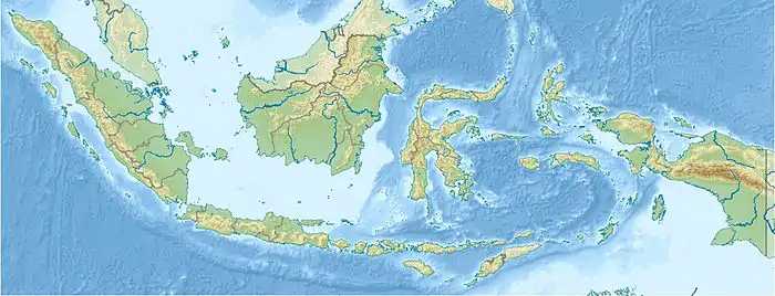
The Digul River (Dutch: Digoel) is a major river in southern Papua province, Indonesia, on the island of New Guinea. It is the fourth longest river in New Guinea after Sepik River, Fly River and Mamberamo River. With a total length of 853 km (530 mi) and has a drainage basin of 45,900 km2 (17,700 sq mi).[1]
| Sungai Digul Oewamba Rivier, Digoel-rivier, Oewimboe, Digoel Oewimboe, Digoel-Kian, Uwimbu, Digul | |
|---|---|
 | |
 Location of river mouth 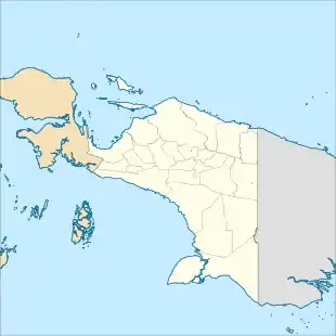 Digul (Papua (province)) | |
| Native name | Digul River |
| Location | |
| Country | Indonesia |
| Province | Papua |
| Physical characteristics | |
| Source | Maoke Mountains |
| • elevation | 12,000 ft (3,700 m) |
| Mouth | |
• location | Arafura Sea |
• coordinates | 7°7′S 138°42′E |
• elevation | 0 ft (0 m) |
| Length | 853 km (530 mi) |
| Basin size | 45,900 km2 (17,700 sq mi) |
| Discharge | |
| • average | 4,000 m3/s (140,000 cu ft/s) |
| • maximum | 10,600 m3/s (370,000 cu ft/s) |
History
The swamplands upstream were known by the name "Boven-Digoel" (Above the Digul, in Dutch) and hosted a penal colony at Tanahmerah (Red Earth) in the early 20th century, when Indonesia was a colony of Holland. As a result of the abortive 1926 revolt by the Communist Party of Indonesia (PKI), the Dutch exiled 823 of the most troublesome revolutionaries here.[2]
Hydrology
Rising on the southern slopes of Maoke Mountains, the Digul flows first south and then west to empty into the Arafura Sea. For much of its length it travels across a low region of extensive swamps and creates a delta near Dolak (Frederik Hendrik) Island. The river has a length of 853 km (530 mi) and is navigable as far as Tanahmerah.
Geography
| Sungai Digul | ||||||||||||||||||||||||||||||||||||||||||||||||||||||||||||
|---|---|---|---|---|---|---|---|---|---|---|---|---|---|---|---|---|---|---|---|---|---|---|---|---|---|---|---|---|---|---|---|---|---|---|---|---|---|---|---|---|---|---|---|---|---|---|---|---|---|---|---|---|---|---|---|---|---|---|---|---|
| Climate chart (explanation) | ||||||||||||||||||||||||||||||||||||||||||||||||||||||||||||
| ||||||||||||||||||||||||||||||||||||||||||||||||||||||||||||
| ||||||||||||||||||||||||||||||||||||||||||||||||||||||||||||
The river flows in the southern area of Papua with predominantly tropical monsoon climate (designated as Am in the Köppen-Geiger climate classification).[4] The annual average temperature in the area is 22 °C. The warmest month is April, when the average temperature is around 24 °C, and the coldest is June, at 20 °C.[3] The average annual rainfall is 3072 mm. The wettest month is January, with an average of 464 mm rainfall, and the driest is July, with 28 mm rainfall.[5]
References
- Sungai Digul - Geonames.org.
- Brackman, A.C., Indonesian Communism: A History, 1963, Praeger Press
- "NASA Earth Observations Data Set Index". NASA. 30 January 2016.
- Peel, M C; Finlayson, B L; McMahon, T A (2007). "Updated world map of the Köppen-Geiger climate classification". Hydrology and Earth System Sciences. 11. doi:10.5194/hess-11-1633-2007.
- "NASA Earth Observations: Rainfall (1 month - TRMM)". NASA/Tropical Rainfall Monitoring Mission. 30 January 2016.
