Pulikkal
Pulikkal or Cherukavu is a village in Malappuram district in the state of Kerala, India.[1]
Pulikkal | |
|---|---|
Village | |
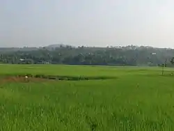
 Paddyfields in Pulikkal | |
| Country | |
| State | Kerala |
| District | Malappuram |
| Population (2001) | |
| • Total | 35,050 |
| Languages | |
| • Official | Malayalam, English |
| Time zone | UTC+5:30 (IST) |
| PIN | 673637 |
| Vehicle registration | KL-10 |
Proposed Karipur-Kondotty Municipality
The proposed Karipur-Kondotty Municipality comprises:[2]
- Kondotty panchayat (villages of Kondotty, and part of Karipur)
- Nediyiruppu panchayat (villages of Nediyiruppu, and part of Karipur)
- Pallikkal panchayat (villages of Pallikkal, and part of Karipur)
- Pulikkal panchayat
- Cherukavu panchayat
- Vazhayur panchayat
Total Area: 122.99 km2
Total Population (1991 Census): 152,839
Demographics
As of 2001 India census, Pulikkal had a population of 35050 with 17481 males and 17569 females.[1]
Cherukavu Panchayath
Most parts of Pulikkal town fall under the jurisdiction of Cherukavu Panchayath administration. The word Pulikkal is used to refer to the town and the word Cherukavu is used only by the bureaucracy. The actual center of Cherukavu village is in Kannamvettikkavu, five kilometers away from Pulikkal town.
Currencyless Village
In 2016, Pulikkal was declared as one of the eight currency less villages of Kerala because of the complete acceptance of e-wallet, e-commerce and debit card based transactions. The government is giving training to the village people for using online financial transactions. The drive was especially significant in wake of the Government of India demonetization drive of 2016.[3]
Suburbs and Villages
Valiyaparamba
- Siyamkandam
- Periyambalam and Andiyoorkunnu
- Alungal and Kottappuram
- Thalekkara and Neettanimmal
Transportation
Pulikkal village connects to other parts of India through Feroke town on the west and Nilambur town on the east. National highway No.66 passes through Pulikkal and the northern stretch connects to Goa and Mumbai. The southern stretch connects to Cochin and Trivandrum. State Highway No.28 starts from Nilambur and connects to Ooty, Mysore and Bangalore through Highways.12,29 and 181. The nearest airport is at Kozhikode. The nearest major railway station is at Feroke.
References
- "Census of India : Villages with population 5000 & above". Registrar General & Census Commissioner, India. Retrieved 10 December 2008.
- "Talks on Karipur airport development today". The Hindu. 3 November 2004. Retrieved 3 May 2015.
- http://www.mathrubhumi.com/print-edition/kerala/alappuzha-malayalam-news-1.1598245