Perinthalmanna
Perinthalmanna is a town, a municipality, and the headquarters of the Perinthalmanna taluk in Malappuram district, Kerala, India. The town is located 23 kilometres (14 mi) south-west to the city of Malappuram and 24 kilometres (15 mi) away from Manjeri. It is one of the major commercial centers in the district, even though it doesn't form a part of the Malappuram metropolitan area. The town is home to several medical institutions.[2] The town is home to one of the three off-centres of Aligarh Muslim University in India, which is popularly known as AMU Malappuram Campus.[3][4] Kodikuthimala, one of the popular tourist destinations in the state, is also located here.[5][2] The town was the headquarters of Valluvanad Taluk, which was one of the two Taluks included in Malappuram Revenue Division at the time, in the erstwhile Malabar District during British Raj.[6]
Perinthalmanna
പെരിന്തൽമണ്ണ | |
|---|---|
Town | |
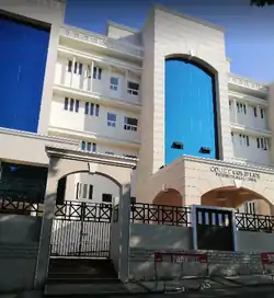 Perinthalmanna Munsif Court complex | |
 Perinthalmanna Location in Kerala, India  Perinthalmanna Perinthalmanna (India) 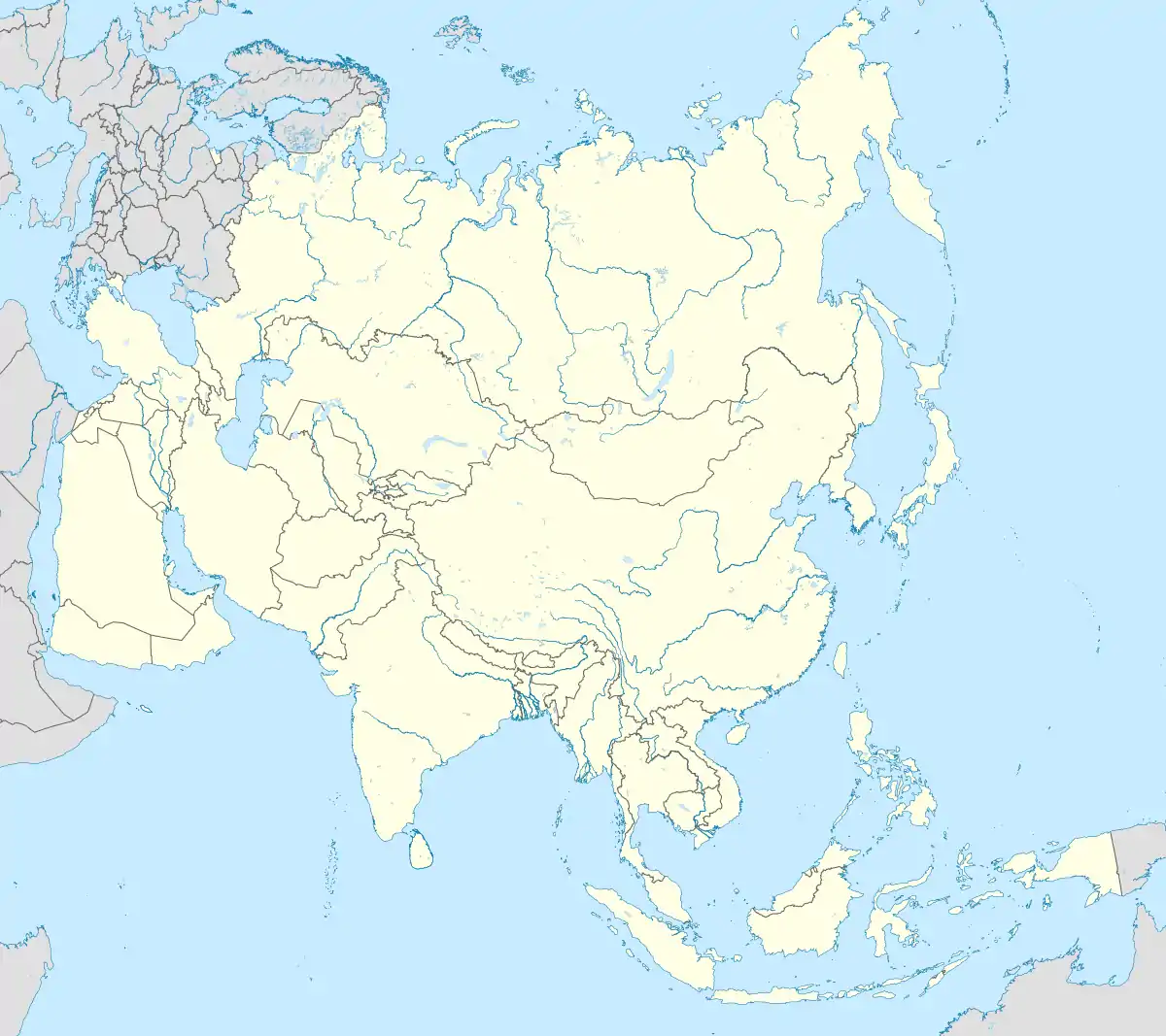 Perinthalmanna Perinthalmanna (Asia) .svg.png.webp) Perinthalmanna Perinthalmanna (Earth) | |
| Coordinates: 10.9765415°N 76.2269231°E | |
| Country | |
| State | Kerala |
| District | Malappuram |
| Taluk | Perinthalmanna |
| Government | |
| • Type | Municipality |
| • Body | Perinthalmanna Municipality |
| Area | |
| • Total | 34.41 km2 (13.29 sq mi) |
| Population (2011)[1] | |
| • Total | 49,723 |
| • Density | 1,445/km2 (3,740/sq mi) |
| Languages | |
| • Official | Malayalam, English |
| Time zone | UTC+5:30 (IST) |
| PIN | 679322 |
| Telephone code | 04933 |
| Vehicle registration | KL-53 |
| State Assembly Constituency | Perinthalmanna |
| Lok Sabha Constituency | Malappuram |
| Website | www |
History
This place was originally part of the Valluvanad Swaroopam dynasty.[7]
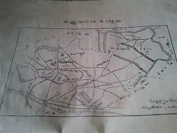
Valluvanad was an erstwhile princely state in the present state of Kerala, that extended from the Bharathappuzha river in the South to the Panthaloor Mala in the North. On the west, it was bounded by the Arabian Sea at Ponnani and on the east by the Attapadi Hills during their zenith in the early Middle Ages. The capital of erstwhile Valluvanad was at the present-day town of Angadipuram[2] which located 3 km west of Perinthalmanna.
According to local legends, the last Cheraman Perumal ruler gave a vast extension of land in South Malabar during his journey to Mecca to one of their governors, Valluvakonathiri, and left for pilgrimage.[7] Valluvanad was famous for the Mamankam festivals, held once in 12 years and the endless wars against the Samoothiri of Kozhikode.[7]
During the last decades of the eighteenth century, the region came under the control of the vast Kingdom of Mysore. The town served as the headquarters of the Valluvanad Taluk in the erstwhile Malabar District during British Raj.[6] Perinthalmanna, along with the towns of Malappuram, Manjeri, and Tirurangadi, was one of the main centres of the Malabar Rebellion of 1921.[8] Now it is one of the important commercial centres in Malappuram district.
Geo Statistics

Perinthalmanna became a Grama Panchayat in 1933 under the Malabar District board. The town was later upgraded into a municipality on 10 February 1990.[2] As of 2011 India census, Perinthalmanna had a population of 49,723 spreading an area of 34 km2 (13 sq mi).[1] Perinthalmanna serves as the headquarters of one of the two revenue divisions included in the district, having the jurisdiction over Perinthalmanna, Eranad, and Nilambur taluks.
Civic administration
The town is administered by the Perinthalmanna Municipality, headed by a chairperson. For administrative purposes, the town is divided into 34 wards,[9] from which the members of the municipal council are elected for five years. The municipality comes under the jurisdiction of the Perinthalmanna police station, which was formed on 1 September 1988.[10] The station has the jurisdiction over the villages of Perinthalmanna, Pathaikara, Angadipuram, Elamkulam, Aliparamba, Anamangad, Arakkuparamba, Thazhekode, and parts of Pulamantol, and Valambur.[10]
Perinthalmanna Municipality Election 2020[11]
| S.No. | Party Name | Party symbol | Number of Councillors |
|---|---|---|---|
| 01 | LDF | 17 | |
| 02 | UDF | 09 | |
| 03 | Independents |  | 08 |
Demographics
Religion in Perinthalmanna (2011)[12]
Total population under municipality limits is 49,723 according to the 2011 census.[1] Males form 47.3% and females 52.7%.[1] Malayalam is the widely spoken language in the town. Perinthalmanna has been a multi-ethnic and multi-religious town since the early medieval period. The Muslims form the largest religious group, followed by Hindus and Christians.[12] The municipality of Perinthalmanna has an average literacy rate of 95.3%, which is higher than the state average of 94.0%.[1]
Notable Persons
- Poonthanam, author of the poem Njanappana
- E.M.S. Namboodiripad, the first Chief Minister of Kerala, born in Elamkulam
- Neralattu Rama Poduval,
- Nalakath Soopy, MLA for 26 years from 1980- 2006 and former Minister for Education
- Cherukadu a notable Marxist writer born at Eravimangalam
- Manjalamkuzhi Ali, the current MLA from the constituency
- P. Sreeramakrishnan, Speaker of Kerala Legislature
Transportation
Road
Perinthalmanna is situated on Kozhikode - Palakkad National Highway 966.
Shornur - Perinthalmanna State Highway 23 ends by joining NH 966 at Perinthalmanna. Perumbilavu - Nilambur State Highway 39 also passes through the town, another important road is State Highway 53 which connects Palakkad to Perinthalmanna via Cherpulassery. Valanchery - Nilambur State Highway 73 also passes through Perinthalmanna.
The town is facilitated by a KSRTC Sub Depot and 3 private bus stands.
Rail
Angadippuram Railway Station is a major railway station on the Nilambur - Shornur Line which located 2.5 km west of Perinthalmanna town.
Trains are available from here to Nilambur, Shornur, Palakkad, Kottayam and Kochuveli.
Air
The nearest airport to Perintalmanna is Karipur Airport (45 km).
See also
References
| Wikimedia Commons has media related to Perinthalmanna. |
- "Malappuram census handbook" (PDF). censusindia.gov.in.
- "Perinthalmanna - About city". Kudumbasree. Retrieved 11 December 2020.
- Kunju, Shihabudeen (1 March 2017). "AMU Malappuram Centre To Celebrate Annual Day On March 2". NDTV. Retrieved 20 December 2020.
- "Aligarh Muslim University Malappuram Off-centre". amu.ac.in.
- "The Ooty of Malappuram - Kodikuthimala". Deccan Chronicle. 18 April 2014. Retrieved 20 December 2020.
- 1951 census handbook - Malabar district (PDF). Chennai: Government of Madras. 1953. pp. 1–2.
- "princelystatesofindia.com". Archived from the original on 16 March 2012. Retrieved 19 July 2016.
- Sreedhara Menon, A. (2007). A Survey of Kerala History (2007 ed.). Kottayam: DC Books. ISBN 9788126415786.
- "Perinthalmanna municipality". lsgkerala. Retrieved 30 November 2020.
- "Perinthalmanna PS". Kerala police. Retrieved 30 November 2020.
- "LOCAL BODY ELECTIONS KERALA - TREND 2020". Retrieved 16 December 2020.
- "Religion – Kerala, Districts and Sub-districts". Census of India 2011. Office of the Registrar General.