Malappuram district
Malappuram (/mələppurəm/ (![]() listen)) is one of the 14 districts in the Indian state of Kerala, with a coastline of 70 km (43 mi). It is the most populous district of Kerala, which is home to around 13% of the total population of the state.[13] The district was formed on 16 June 1969, spanning an area of about 3,554 km2 (1,372 sq mi). It is the third-largest district of Kerala by area. It is also the largest district of Kerala bounded by Western Ghats and Arabian Sea on the eastern and the western borders respectively. It is the third major contributing district to the Gross State Domestic Product of Kerala as of 2019, after Ernakulam and Thiruvananthapuram.[14]
listen)) is one of the 14 districts in the Indian state of Kerala, with a coastline of 70 km (43 mi). It is the most populous district of Kerala, which is home to around 13% of the total population of the state.[13] The district was formed on 16 June 1969, spanning an area of about 3,554 km2 (1,372 sq mi). It is the third-largest district of Kerala by area. It is also the largest district of Kerala bounded by Western Ghats and Arabian Sea on the eastern and the western borders respectively. It is the third major contributing district to the Gross State Domestic Product of Kerala as of 2019, after Ernakulam and Thiruvananthapuram.[14]
Malappuram district | |
|---|---|
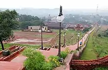 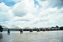 .jpeg.webp) 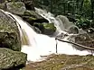  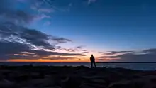 Clockwise from top: Kottakkunnu, Biyyam backwater lake, A countryside near Tirur, Ponnani beach, A waterfall near Nilambur, Kuttippuram bridge | |
| Nickname(s): | |
|
Location in Kerala, India | |
| Coordinates: 11.03°N 76.05°E | |
| Country | |
| State | Kerala |
| District formation | 16 June 1969 |
| Founded by | Government of Kerala |
| Headquarters | Malappuram |
| Subdistricts | |
| Government | |
| • District collector | K.Gopalakrishnan, IAS[5] |
| • District police chief | U. Abdul Kareem, IPS[6] |
| • District Panchayat President | M.K Rafeekha[7] |
| • Members of Lok Sabha | |
| Area | |
| • District | 3,554 km2 (1,372 sq mi) |
| Area rank | 3rd |
| Highest elevation (Mukurthi) | 2,594 m (8,510 ft) |
| Population (2018) | |
| • District | 4,494,998[8] |
| • Rank | 1st |
| • Density | 1,265/km2 (3,280/sq mi) |
| • Urban | 44.18%[9] |
| • Metro | 1,729,522[9] |
| Demonym(s) | Malapuramite[10] |
| Demography | |
| • Language (2011) | |
| • Religion (2011) |
|
| Human Development | |
| • Sex ratio (2011) | 1098 ♀/1000♂[9] |
| • Literacy (2011) | 93.57%[9] |
| Time zone | UTC+5:30 (IST) |
| ISO 3166 code | IN-KL |
| Vehicle registration |
|
| Website | malappuram |
The eastern part of the district is hilly and the western part is coastal region. Eranad, Kondotty, Nilambur, Perinthalmanna, Ponnani, Tirur, and Tirurangadi, are the seven subdistricts (Taluks) included in the district. Malayalam is the most spoken language. Religions practised in the district include Islam, Hinduism, and Christianity. The district has witnessed significant emigration, especially to the Arab states of the Persian Gulf during the Gulf Boom of the 1970s and early 1980s, and its economy depends significantly on remittances from a large Malayali expatriate community.[15] It was the first e-literate district and the first cyber literate district of India.[16][17] Malappuram metropolitan area is the fourth-largest urban agglomeration of Kerala and the 25th largest of India with a population of 1.7 million.[18] 44.2% of the district's population reside in the urban areas according to the 2011 census of India.
Malappuram was the headquarters of the British troops in the erstwhile Malabar District during British Raj. Malappuram was also one of the five divisions of the British Malabar district, along with Thalassery, Kozhikode, Palakkad, and Fort Cochin divisions.[19] The port town of Ponnani was one of the major ports in the Malabar Coast during the medieval period.[20] During the early medieval period, the district was home to two of the four major kingdoms that ruled Kerala. Perumpadappu was the hometown of the Kingdom of Cochin, which is also known as Perumbadappu Swaroopam, and Nediyiruppu was the hometown of the Zamorin of Calicut, which is also known as Nediyiruppu Swaroopam.
Etymology
The term, Malappuram, which means "over the hill" in Malayalam, derives from the geography of Malappuram, the administrative headquarters of the district.[21][22] Several smaller hills are located in the midland area of the district such as Arimbra hills, Amminikkadan hills, Pandalur hills, and Chekkunnu hills.[23] However, the coastal area is an exception for the general hilly nature.
History
The remains of some pre-historic symbols including Dolmens, Menhirs, and Rock-cut caves have been found from various parts of the district. Rock-cut caves have been found from Puliyakkode, Thrikkulam, Oorakam, Melmuri, Ponmala, Vallikunnu, and Vengara.[24] The ancient maritime port of Tyndis, which was a centre of trade with Ancient Rome, is roughly identified with Ponnani, Tanur, and Kadalundi-Vallikkunnu.
After the disintegration of Perumal kingdom, a number of city-states emerged in the region, including Valluvanad, Vettathunadu (Tanur), Parappanad and Nediyiruppu (Eranad) (ruled by the Zamorins).[25][26] Descriptions about the rulers of Eranad and Valluvanad regions can be seen in the Jewish copper plates of Bhaskara Ravi Varman (around 1000 CE) and Viraraghava copper plates of Veera Raghava Chakravarthy (around 1225 CE).[24] The Zamorin of Calicut originally belonged to Nediyiruppu in Eranad before he shifted his seat to the neighbouring Kozhikode. In the early medieval period, the Rajas of Parappanad, Vettathunad, and a larger portion of Valluvanad became vassals of the Zamorin. By 1400 CE, almost whole of the district was under him.[24] The Mamankam festival, which had a special political importance in the medieval Kerala, was held at Tirunavaya in the district.
Under the Zamorin, the regions included in the district emerged as major centres of trade with Arab merchants in medieval Kerala. Parappanangadi, Tirurangadi, Tanur, and Ponnani were important among the trade settlements under the rule of the Zamorin, according to the 16th century historical work Tuhfat Ul Mujahideen. Thrikkavil Kovilakam in Ponnani served as a second home for Zamorin. Ponnani acted as the naval headquarters of his kingdom.[27] Archaeological relics found in Kottakkal include the remnants of palaces of the eastern branch of the Zamorin reign (Kizhakke Kovilakam). Malappuram was the headquarters of Para Nambi, who was a local chieftain of the Zamorin.[28] Manjeri Kovilakam at Manjeri was the seat of the ruling families under Zamorin.[29] The Arabs had the monopoly of trade in the early middle ages.[29]
The squadron of Vasco da Gama left Portugal in 1497, rounded the Cape and continued along the coast of East Africa, where a local pilot was brought on board who guided them across the Indian Ocean, reaching Kozhikode in May 1498.[30] The Zamorin had provided the Portuguese all facilities for trade.[24] However, the Portuguese provocations on the Arab properties lead to a conflict between the Zamorin and the Portuguese. Furthermore, Ponnani, which was the second headquarters of the Zamorin, was an important target of the Portuguese.[24] In 1507, the Portuguese Viceroy Francisco de Almeida raided Ponnani and started building a fortress there in 1585.[24] The district witnessed several battles between Kozhikode naval chiefs, known as the Kunhali Marakkars, and the Portuguese for the monopoly in spice trade. The Kunjali Marakkars are credited with organizing the first naval defense of the Indian coast.[31][32] Tanur town was one of the earliest Portuguese colonies in the Indian subcontinent. The towns of Ponnani and Parappanangadi were burnt by the Portuguese in the years 1525 and 1573-74 respectively.[27] The Tuhfat Ul Mujahideen written by Zainuddin Makhdoom II (born around 1532) in Ponnani during 16th-century CE is the first-ever known book fully based on the history of Kerala, written by a Keralite. It is written in Arabic and contains pieces of information about the resistance put up by the navy of Kunjali Marakkar alongside the Zamorin of Calicut from 1498 to 1583 against Portuguese attempts to colonize Malabar coast.[33] It was first printed and published in Lisbon. A copy of this edition has been preserved in the library of Al-Azhar University, Cairo.[34][35][36] As the Portuguese tried to establish a monopoly in the spice trade, bitter naval battles against the Zamorin became a common sight.[37] The continuous wars lead by the Portuguese on one side and the Zamorin who had the support of the Arab merchants, and the local Nair and Mappila soldiers on the other side, lead to the decline of Arab monopoly of foreign trade in the coastal towns. The rise of the Dutch monopoly in the subsequent decades caused the Portuguese dominance also to decline. The cultural renaissance followed by the unrest of the 16th century produced the poets such as Thunchaththu Ezhuthachan and Poonthanam Nambudiri, who were instrumental in the development of Malayalam literature into the current form, and Melpathur Narayana Bhattathiri, who was also a member of the medieval Kerala school of astronomy and mathematics.
By the middle of 17th century, the Dutch had monopoly of foreign trade in the ports of Kerala, except for small English factories at Ponnani and Kozhikode.[24] Though the arrival of William Keeling in 1650 was a beginning for the monopoly of the British East India Company in the region, they weren't able to establish supremacy until 1792.[24] During the 18th century, the de facto Mysore kingdom rulers Hyder Ali and Tipu Sultan unified all smaller feudal states in the Northern Kerala and they were made part of the Kingdom of Mysore. For a short span of time in 1766, Manjeri was the headquarters of Sultan Hyder Ali.[38] The Battle of Tirurangadi was a series of engagements that took place between the British army and Tipu Sultan between 7 and 12 December 1790 at Tirurangadi, during the Third Anglo-Mysore War.[39] In 1792, Tipu Sultan was defeated by English East India Company through Third Anglo-Mysore War, and the Treaty of Seringapatam was agreed. As per this treaty, most of the Malabar Region, including the present-day Malappuram district, was integrated into the English East India Company. The oldest teak plantation of the world at Conolly's plot is just 2 km (1.2 mi) from Nilambur town. It was named in memory of Henry Valentine Conolly, the then district collector of Malabar.[40] The first railway line in the state started its function from Tirur to Beypore on 12 March 1861, with the oldest Railway Station at Tirur.[41][42]
The district was the venue for many of the Mappila revolts (uprisings against the British East India Company in Kerala) between 1792 and 1921. It is estimated that there were about 830 riots, large and small, during this period. During 1841-1921 there were more than 86 revolts against the British officials alone.[43] The district was included in the subdistricts of Eranad, Valluvanad, and Ponnani in South Malabar during the British rule. The Malabar Special Police was headquartered at Malappuram. The British had established Haig Barracks on the top of Malappuram city, at the bank of the Kadalundi River, to station their forces.[44] The Malabar district political conference of Indian National Congress held at Manjeri on 28 April 1920 strengthened Indian independence movement and national movement in British Malabar.[45] That conference declared that the Montagu–Chelmsford Reforms were not able to satisfy the needs of British India. It also argued for land reform to seek solutions for the problems caused by the tenancy that existed in Malabar. However, the decision widened the drift between extremists and moderates within the Congress. The conference resulted in the dissatisfaction of landlords with the Indian National Congress. It caused the leadership of the Malabar district Congress Committee to come under the control of the extremists who stood for labourers and the middle class.[46]

Malabar Rebellion was the last and important among the revolts. The Battle of Pookkottur adorns an important role in the rebellion.[47][48] After the army, police, and British authorities fled, declaration of independence took place over 200 villages in Eranad, Valluvanad, Ponnani, and Kozhikode taluks by 28 August 1921.[49] However less than six months after the declaration of autonomy, the East India Company reclaimed the territory and annexed it to the British Raj. The Wagon tragedy (1921) is still a saddening memory of the Malabar rebellion, where 64 prisoners died on 20 November 1921.[50]
The erstwhile Madras presidency became Madras State following the independence of India in 1947. Malappuram revenue division was one of the five revenue divisions in the erstwhile Malabar District with the jurisdiction of Eranad (Manjeri) and Valluvanad (Perinthalmanna) Taluks. The other four revenue divisions in the Malabar district were Thalassery, Kozhikode, Palakkad, and Fort Cochin.[19] On 1 November 1956, the state of Kerala was formed on linguistic basis. The district of Malappuram was formed with four subdistricts (Eranad, Perinthalmanna, Tirur, and Ponnani), four towns, fourteen developmental blocks, and 95 Gram panchayats at the time.[51] Later, Tirur Taluk was bifurcated to form Tirurangadi Taluk, and Eranad Taluk was trifurcated to form two more Taluks namely Nilambur and Kondotty. In the 1970s, the oil reserves in the Persian Gulf countries were opened to commercial extraction and thousands of unskilled workers migrated to the gulf. They sent money home, supporting the rural economy, and by the late 20th century, the region attained First World health standards and near-universal literacy.[52]
Geography
.JPG.webp)
Bounded by Kozhikode district to the northwest, Wayanad district to the northeast, Nilgiri hills to the east, Palakkad district to the southeast, Thrissur district to the southwest, and Arabian Sea to the west, Malappuram has a total geographical area of 3,554 km2, which ranks third in the state in terms of area. The district possesses 9.15% of the total area of the state. The district is located at 75°E - 77°E longitude and 10°N - 12°N latitude on the geographical map. Similar to other parts of Kerala, Malappuram also has a coastal area (lowland) bounded by Arabian Sea on the west, a midland at the centre, and a hilly area (highland), bounded by Western Ghats on the east. Unlike other districts of Kerala, hilly areas are widely seen in the midland area too.
Topography
On the basis of topography, geology, soils, climate, and natural vegetation, the district is divided into 5 sub-micro regions:
- Malappuram coast
- Malappuram undulating plain
- Chaliyar river basin
- Nilambur forested hills
- Perinthalmanna undulating uplands.

The Malappuram coast lies all along the coastal tract of Malappuram from Vallikunnu at the north to Perumpadappu at the south. It makes its boundaries with the Kozhikode coast to the north, Malappuram undulating plain to the east, the Thrissur coast to the south, and the Lakshadweep Sea to the west. The region is drained by the major rivers like Chaliyar, Kadalundi, Bharathappuzha, Tirurpuzha, etc. canals and backwaters. The coastal plain slopes towards the west very gently. [53] The major towns including Ponnani, Edappal, Tirur, Tanur, Tirurangadi, and Parappanangadi lies in this region. The maximum height of this region is located at Kalpakanchery village (104 m) in Tirur Taluk.[53]
The Malappuram undulating plain, lying parallel to the coast, makes it boundaries with Nadapuram-Mavur undulating plains to the north, Chaliyar river basin, and Perinthalmanna undulating uplands to the east, Pattambi undulating plain to the south and Malappuram coast to the west. Nenmini hill (478 m) at Kannamangalam is the highest point and the Vazhayur in the northern part (95 m) is the lowest in the region. A number of small hills and slopes are seen here.[53]
The Chaliyar River Basin makes its boundaries by Nilambur forested hills to its north and east, Perinthalmanna undulating uplands to the south, and Malappuram undulating plain to its east. It falls under the middle course of Chaliyar and has ups and downs in the form of isolated hills.[53]
The Nilambur forested hills, also known as the Nilambur valley, make its boundary with Kozhikode forested hills and Wayanad forested hills to the north, Tamil Nadu to the east, Mannarkad-Palakkad forested hills to the south, and the Chaliyar river basin to the west. It is a part of the Western Ghats. Several peaks having an elevation of more than 1000m from the sea level are seen here.[53] The highest altitude of this region is at Mukurthi (2594 m), which lies east of the Karimpuzha Wildlife Sanctuary on the border of Kerala with Tamil Nadu. The lowest point is located at Mampad (115 m).[53] The hilly forested area of Nilambur forms a part of the Nilgiri Biosphere Reserve.
The Perinthalmanna undulating uplands make its boundary with Chaliyar river basin to the north, Mannarkad-Palakkad forested hills to the east, Palakkad Gap to the south, and Malappuram undulating plain to the west. A number of small isolated hills are seen here. Kodikuthimala is one among them. The Kadalundi River drains this region. The maximum height of the region is 610 m at Vadakkangara.[53]
Coastline
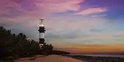
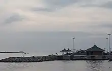
Malappuram ranks fifth in the length of coastline among the districts of Kerala having a coastline of 70 km (11.87% of the total coastline of the state).[54] Ponnani, Tanur, Parappanangadi, and Kootayi, which lies in the western part of the district, are the major fishing centres. The sea coast of the district is filled with marine wealth.[53] Apart from being a favourite destination of the Arab traders earlier, Ponnani was also a captivating destination for many Muslim spiritual leaders, who were instrumental in introducing Islam here. The port city is also known as The Little Mecca of Malabar.[55] During the months of February/April, thousands of migratory birds arrive here. Located close to Ponnani is Biyyam Kayal, a placid, green-fringed waterway with a water sports facility. The Conolly Canal meets with Arabian sea at Puthuponnani. The coastal town of Tanur was the capital of the Kingdom of Vettathunad in the early medieval period, and is known for Keraladeshpuram Temple. Parappanangadi was the seat of the ruling families of Parappanad kingdom in the early medieval period.
Rivers
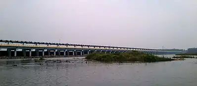
Major rivers flowing through the district are Chaliyar, Kadalundi River, Bharathappuzha, and Tirur River. Chaliyar has a total length of about 168 km. and a drainage area of 2,818 km2 (1,088 sq mi). It passes through Nilambur, Mampad, Edavanna, Areekode, and Vazhakkad in district and then flows through Kozhikode-Malappuram district border and empties itself into the Arabian sea at Beypore. Karimpuzha, the largest tributary of Chaliyar, and Thuthapuzha, one of the largest tributaries of Bharathappuzha, also flow through district. Kadalundi River passes through Melattur, Pandikkad, Malappuram, Panakkad, Parappur, Tirurangadi, Parappanangadi, Vallikkunnu, and empties itself into Arabian sea at Kadalundi. It has a length of 130 km, with a catchment area of 1,114 km2 (430 sq mi) and a total runoff of 2189 million cubic feet. Bharathappuzha has a total length of 209 km. It flows through Thootha, Elamkulam, Pulamanthole, and joins the main river at Pallippuram. Then it again reaches the district at Thiruvegappura after flowing through some neighbouring districts. Bharathappuzha empties itself into the Arabian Sea at Ponnani. Tirunavaya, Kuttippuram, Thavanur, and Ponnani are some important towns on the bank of Bharathappuzha. Tirur River is 48 km long. It joins with Bharathappuzha at Padinjarekara near Ponnani. Besides these large rivers, the district has a small river called Purapparamba River, which is just 8 km long. It is connected to major rivers via Conolly Canal.[53][56] Several larger and smaller tributaries of the major rivers described above also flows through the district.
Climate
The temperature of the district is almost steady throughout the year. It has a tropical climate. It gets significant rainfall in most of the months, with a short dry season. According to Köppen and Geiger, this climate is classified as Am. The average annual temperature in Malappuram is 27.3 °C. In a year, the average rainfall is 2,952 millimetres (116.2 in). Summer usually runs from March until May; the monsoon begins in June and ends in September. Malappuram receives both southwest and northeast monsoons. Winter is from December to February.[57]
| Climate data for Malappuram | |||||||||||||
|---|---|---|---|---|---|---|---|---|---|---|---|---|---|
| Month | Jan | Feb | Mar | Apr | May | Jun | Jul | Aug | Sep | Oct | Nov | Dec | Year |
| Average high °C (°F) | 32.0 (89.6) |
32.9 (91.2) |
34.0 (93.2) |
33.8 (92.8) |
32.7 (90.9) |
29.3 (84.7) |
28.1 (82.6) |
28.7 (83.7) |
29.7 (85.5) |
30.3 (86.5) |
31.1 (88.0) |
31.4 (88.5) |
34.0 (93.2) |
| Average low °C (°F) | 21.8 (71.2) |
22.8 (73.0) |
24.4 (75.9) |
25.4 (77.7) |
25.1 (77.2) |
23.5 (74.3) |
22.8 (73.0) |
23.3 (73.9) |
23.3 (73.9) |
23.4 (74.1) |
23.1 (73.6) |
21.9 (71.4) |
21.8 (71.2) |
| Average precipitation mm (inches) | 1 (0.0) |
9 (0.4) |
16 (0.6) |
101 (4.0) |
253 (10.0) |
666 (26.2) |
830 (32.7) |
398 (15.7) |
233 (9.2) |
281 (11.1) |
140 (5.5) |
24 (0.9) |
2,952 (116.2) |
| Source: [58] | |||||||||||||
Flora and fauna
The district contains a diverse wildlife and a number of small hills, forests, rivers, and streams flowing to the west, backwaters and paddy, areca nut, cashew nut, pepper, ginger, pulses, coconut, banana, tapioca, and rubber plantations. Conolly's plot, the world's oldest teak plantation, is located at Nilambur. Nilambur is also known for Teak Museum. Bamboo trees are widely seen near to the Nilambur Teak Plantations. A bioresource natural park is associated with the Teak Museum.
Out of the 3,554 km2 area of district, 1,034 km2 (399 sq mi) (29%) constitutes forest area. It may be denser or less dense.[59] The northeastern part of district has a vast forest area of 758.87 km2 (293.00 sq mi). In this, 325.33 km2 (125.61 sq mi) is reserved forests and the rest is vested forests. Of these, 80% is deciduous whereas the rest is evergreen. The forest area is mainly concentrated in Nilambur subdistrict, which shares its boundary with the hilly district of Wayanad, Western Ghats, and the hilly areas (Nilgiris) of Tamil Nadu. Trees like teak, rosewood, and mahogany are seen in Nilambur forest area. Bamboo hills are widely seen in the forest. Karimpuzha wildlife sanctuary in the district is the largest wildlife sanctuary in the state.[60][61] The New Amarambalam Reserved Forest, which is a part of the Karimpuzha Wildlife Sanctuary, has a variety of fauna. A variety of animals including elephants, deer, tigers, blue monkeys, bears, boars, rabbits, birds, and reptiles are found in forests. Forest products like honey, medicinal herbs, and spices are also collected from here. Forests are protected by two divisions- Nilambur north and Nilambur south. The Kerala Forest Research Institute has a subcentre at Nilambur. Important types of fish found in the coastal and inland areas of the district include Prawn, Oil Sardine, Silver belly, Shark, Catfish, Mackerel, Skate, Chemba, Soll fish, Seer fish, and Ribbonfish.[53]
Nilambur Teak is the first forest produce to get its own GI tag.[62] Tirur Vettila, a type of Betel found in Tirur, has also obtained GI tag.[63] About 50 Acre of Mangroves forest is found in Vallikkunnu, located in coastal area of the district. A major part of Kadalundi Bird Sanctuary lies in district.[64] Kadalundi-Vallikkunnu community reserve is the first community reserve in Kerala. It has now been declared as an eco-tourism centre.[65] Tirunavaya is known for its lotus fields.[66]
Administration

The headquarters of the district administration is at Uphill, Malappuram. The district administration is headed by the District collector. He is assisted by five deputy collectors with responsibility for general matters, land acquisition, revenue recovery, land reforms, and elections. Additional District Magistrate in the rank of Deputy Collector (General) provides support to District Collector in all the administrative activities.[69]
Malappuram revenue district has two divisions- Tirur and Perinthalmanna. For sake of rural administration, 94 Gram Panchayats are combined in 15 Block Panchayats, which together form the Malappuram District Panchayat. Besides this in order to perform urban administration better, 12 municipal towns are there.[70]
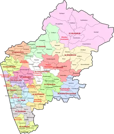
For the representation of Malappuram in Kerala Legislative Assembly, there are 16 assembly constituencies in district. These are included in 3 Lok Sabha constituencies. Malappuram has the highest number of assembly constituencies in state. Of these, Eranad, Nilambur and Wandoor assembly constituencies together form a part of Wayanad (Lok Sabha constituency), whereas Tirurangadi, Tanur, Tirur, Kottakkal, Thavanur and Ponnani are included in Ponnani (Lok Sabha constituency). The remaining seven assembly constituencies together form Malappuram (Lok Sabha constituency).[70][71] The district is further divided into 138 villages which together form 7 subdistricts.[72]
Revenue divisions
Ponnani, Tirur, and Tirurangadi subdistricts lie in the coastal region. Perinthalmanna, Eranad, and Kondotty lie in midland whereas the Nilambur subdistrict lies on the high range. The subdistricts of Ponnani, Tirur, Tirurangadi, and Kondotty are included in the Tirur revenue division whereas the remaining three combine to form the Perinthalmanna revenue division. Nilambur is the largest subdistrict in Kerala. The Taluk administration is headed by a Tehsildar.
.svg.png.webp)
| Subdistrict (Taluk) |
Area (in km2) |
Total population (2011) |
Villages | Urbanisation (2011) |
|---|---|---|---|---|
| Ponnani | 200 | 379,798 | 11 | 57.36% |
| Tirur | 448 | 928,672 | 30 | 48.73% |
| Tirurangadi | 290* | 631,906 | 17 | 90.40% |
| Kondotty | 258* | 410,577 | 12 | 43.10% |
| Eranad | 491* | 581,512 | 23 | 37.93% |
| Perinthalmanna | 506 | 606,396 | 24 | 21.73% |
| Nilambur | 1,343 | 574,059 | 21 | 8.08% |
| Sources: 2011 Census of India,[73] Official website of Malappuram district[74] | ||||
Local governance
The rural district is divided into 94 Gram Panchayats which are included in 15 blocks namely Areekode, Kalikavu, Kondotty, Kuttipuram, Malappuram, Mankada, Nilambur, Perinthalmanna, Perumpadappu, Ponnani, Tanur, Tirur, Tirurangadi, Vengara, and Wandoor.[75] These blocks combine to form the Malappuram district Panchayat, which is the apex district body of rural governance. Out of the 32 wards for the district Panchayat, the UDF won 27 in the 2015 elections, while LDF won the remaining 5.[76] Malappuram District Panchayat is the largest district Panchayat as well as the largest local body in the state. The 94 Gram Panchayats are again divided into 1,778 wards.[77] Census towns (small towns with urban features) also come under the jurisdiction of Gram Panchayats. Though the draft notifications for the formation of new Gram Panchayats namely Anamangad, Ananthavoor, Arakkuparamba, Ariyallur, Chembrassery, Elankur, Karipur, Kootayi, Kurumbalangode, Marutha, Pang, Vaniyambalam, and Velimukku were published in 2015, they are yet to be formed.[78] With their formation, the number of Gram Panchayats in the district will become 106.
For the ease of urban administration, 12 municipalities (Statutory towns) are there in the district. These municipalities are divided into 479 wards from which a representative is elected from each for a duration of five years.[79]
| Municipality[67] | Wards[80] | Population (2011)[81] |
Chairperson [82] | Political Party |
Pre-poll Alliance | |
|---|---|---|---|---|---|---|
| 1 | Manjeri | 50 | 97,102 | V. M. Subaida | IUML | UDF |
| 2 | Ponnani | 51 | 90,491 | C. P. Muhammad Kunhi | CPI(M) | LDF |
| 3 | Parappanangadi | 45 | 71,239 | V. V. Jameela | IUML | UDF |
| 4 | Tanur | 44 | 69,534 | Subaida | IUML | UDF |
| 5 | Malappuram | 40 | 68,088 | C. H. Jameela | IUML | UDF |
| 6 | Kondotty | 40 | 59,256 | K. C. Sheeba | IUML | UDF |
| 7 | Tirurangadi | 39 | 56,632 | K. T. Raheeda | IUML | UDF |
| 8 | Tirur | 38 | 56,058 | K. Bava | Ind. | LDF |
| 9 | Perinthalmanna | 34 | 49,723 | M. Muhammad Salim | CPI(M) | LDF |
| 10 | Kottakkal | 32 | 48,342 | K. K. Nasar | IUML | UDF |
| 11 | Nilambur | 33 | 46,342 | Padmini Gopinath | INC | UDF |
| 12 | Valanchery | 33 | 44,437 | C. K. Rufeena | IUML | UDF |
The District Planning Committee of Malappuram consists of two members from municipalities, 10 members from the District Panchayat, and one Panchayat-nominated member besides a Chairman and a Secretary. The Chairman post is reserved for a District Panchayat ex-officio and the secretary post for a District Collector ex-officio.[83]
State legislature
16 out of the 140 members for the Kerala Legislative Assembly are elected from the district.[84] In the 2016 elections, UDF won 12 of them, while the LDF bagged the remaining seats.
| Assembly Constituency |
Political Party |
Pre-poll Alliance |
Elected Representative |
|---|---|---|---|
| Kondotty | IUML | UDF | T. V. Ibrahim |
| Eranad | IUML | UDF | P. K. Basheer |
| Nilambur | Independent | LDF | P. V. Anvar |
| Wandoor | INC | UDF | A. P. Anil Kumar |
| Manjeri | IUML | UDF | M. Ummer |
| Perinthalmanna | IUML | UDF | Manjalamkuzhi Ali |
| Mankada | IUML | UDF | T. A. Ahmed Kabir |
| Malappuram | IUML | UDF | P. Ubaidulla |
| Vengara | IUML | UDF | K. N. A. Khader |
| Vallikunnu | IUML | UDF | P. Abdul Hameed |
| Tirurangadi | IUML | UDF | P. K. Abdu Rabb |
| Tanur | INL | LDF | V. Abdurahiman |
| Tirur | IUML | UDF | C. Mammutty |
| Kottakkal | IUML | UDF | K. K. Abid Hussain Thangal |
| Thavanur | Independent | LDF | K.T. Jaleel |
| Ponnani | CPI(M) | LDF | P. Sreeramakrishnan |
Parliament
| Parliamentary Constituency |
Political Party |
Pre-poll Alliance |
Elected Representative |
|---|---|---|---|
| Wayanad (minor portion) | INC | UDF | Rahul Gandhi |
| Malappuram | IUML | UDF | P. K. Kunhalikutty |
| Ponnani (major portion) | IUML | UDF | E. T. Mohammed Basheer |
Law and Order
The judicial headquarters of the district is at Manjeri. 24 courts function under Manjeri judicial district including Manjeri, Malappuram, Tirur, Perinthalmanna, Parappanangadi, Ponnani, and Nilambur.[85] The headquarters of Malabar Special Police (formed in 1884), a Paramilitary unit under Kerala Police, is at Malappuram. The Malappuram Police Unit is subdivided into 3 Sub Divisions and 34 Police Stations.
Malappuram Police District, along with Palakkad, Thrissur city, and Thrissur rural police districts, comes under the jurisdiction of Thrissur Range Police.[86] The District Police Office, District Special Branch, District Crime Records Bureau, District 'C' Branch, Narcotic Cell, District Police Control Room, Cyber Cell, Women Cell, and Telecommunication Unit are at Malappuram. The coastal police station is at Ponnani whereas the District Armed Reserve Camp is situated at Padinhattummuri. The traffic Units of Malappuram police unit are centered at Malappuram, Manjeri, Kondotty, Perinthalmanna, and Tirur.[87]
Economy
The Gross District Value Added (GDVA) of the district in the fiscal year 2018-19 is estimated as ₹ 698.37 billion, and the growth in GDVA, compared to that in the previous year was 11.30%. The district ranks third in GDVA among the districts of Kerala, after Ernakulam and Thiruvananthapuram, as of 2018–19.[14] The Net District Value Added (NDVA) of the district in the year 2018-19 was ₹ 631.90 billion and the annual growth rate was 11.59%. The Per capita GDVA is calculated as ₹ 154,463 in the fiscal year. The growth rate of GDVA was 18.12% in 2017–18, 9.49% in 2016–17, 7.86% in 2015–16, 8.83% in 2014–15, 14.08% in 2013–14, and 9.70% in 2012–13. It shows a zigzag trend.[14]
The economy of Malappuram significantly depends upon the emigrants. Malappuram has the highest number of emigrants in the state. According to the 2016 economic review report published by the Government of Kerala, every 54 per 100 households in the district are emigrant households.[88] Most of them work in the Middle East. They are major contributors to the district economy. The headquarters of KGB is situated at Malappuram.[89]
Economic minerals
Laterite stone is widely seen in midland area of the district. The Angadipuram Laterite has gained recognition as a National Geo-heritage Monument.[90] Archean Gneiss is the most seen geological formation of the district. Quartz magnetite, which is seen in Porur is one among the minerals found in the district having economical importance. Quartz gneisses are seen in the regions of Nilambur, Edavanna, and Pandikkad. Garneliforus Quartz is seen in the areas of Manjeri and Kondotty. Charnokite rocks are found in Nilambur and Edavanna. Dykes consisting of plagioclase, feldspar, and pyroxene in typical laterite texture are there at Manjeri. Deposits of good quality iron ore have reported from Eranad region. The deposits of lime shells have found from the coastal areas of Ponnani and Kadalundinagaram. The coastal sands of Ponnani and Veliyankode contain a high amount of heavy minerals, ilmenite and monazite. Kaolinite have been found from the Taluks of Ponnani and Perinthalmanna. The deposits of Ball clay have found from Thekkummuri village. Parts of Nilambur subdistrict are included in the hidden goldfields of Wayanad. Explorations done at the valley of the river Chaliyar in Nilambur has shown reserves of the order of 2.5 million cubic meters of placers with 0.1 gram per cubic meter of gold.[53] Bauxite was discovered from some parts of the district like Kottakkal, Parappil, Oorakam, and Melmuri.[91] Karuvarakundu, which means Place of the Blacksmith, derives its name from iron-ore cutting and blacksmithy.[92]
Industries
According to the census conducted in 2011, there are 10,629 industrial units registered under SSI/MMSE, and 396 units among these are promoted by Scheduled castes, 83 by Scheduled tribes, and the remaining units by general category. About 1,000 people are aided annually under a self-employment program. There are KINFRA food-processing and IT industrial estates in Kakkancherry,[93] INKEL SME Park at Malappuram for Small and Medium Industries and a rubber plant and industrial estate at Payyanad in Manjeri. INKEL Greens, spread over 168 acres at Malappuram, contains an industrial zone, 'SME Park', and an educational zone, 'Educity'.[94]
MALCOSPIN (Malappuram Spinning Mills Limited) is one of the oldest industrial establishments in the district under the state government. Wood-related industries are common in Kottakkal, Edavanna, Vaniyambalam, Karulai, Nilambur and Mampad. Sawmills, furniture manufacturers and timber trade were the most important businesses in the district until the last decades. Tirur is a major regional trading centre for electronics, mobile phones and other gadgets. Employees' State Insurance has its branch office at Malappuram.[53] KELTRON Electro Ceramics (KELCERA) at Kuttippuram,[95] KELTRON tool room at Kuttippuram, Edarikode Textiles at Edarikode, KSRTC body workshop at Edappal, MALCOTEX (Malabar Co-operative Textiles Limited) at Athavanad,[96] and KELTEX (Kerala Hi-Tech Textile Cooperative Limited) at Athavanad,[97] are other major industrial centres under public sector.[98] The Kerala State Detergents and Chemicals Ltd. and the Kerala State Wood Industries Ltd. have their headquarters at Kuttippuram and Nilambur respectively.[99][100] Popees baby care, one of the largest baby clothes manufacturer brands in the world, is primarily based at Malappuram.[101]
Agriculture

Coconut, palms and paddy are mainly found in the Malappuram coast. Cashew, coconut, and tapioca are seen in the undulating plain. Rubber, cashew, pepper, and coconut are the important vegetation found in the Chaliyar river basin. Nilambur forested hills contain the cultivation of a wide variety of species. Teak is mostly seen in the region. Perinthalmanna undulating uplands contain the cultivation of species coconut, palm trees, pepper, rubber, and cashew. This region is drained by the Kadalundi River. Besides casual crops, species like mango, jackfruit, banana, etc. are also cultivated.[53]
According to the statistics of 2016–17, the gross cropped area was 237,860 hectares, while the net cropped area was 173,178 hectares. The cropping intensity of the district is 137 hectares. The most produced uncountable crop in 2016-17 was tapioca (185,880 Metric Tonnes), followed by banana (58,564 MT), and rubber (40,000 MT). 878 million coconuts and 19 million jackfruits were produced in 2016–17. However, the land use was maximum for the cultivation of coconut (102,836 hectares), followed by rubber (42,770 hectares), and areca nut (18,379 hectares).[102] An agricultural research station functions at Anakkayam. The Seed Garden Complex at Munderi, is said to be one of the biggest farms in Asia. State seed farms are there at Chokkad, Thavanur, and Anakkayam. A district agricultural farm functions at Chungathara and a coconut nursery functions at Parappanangadi.[103] The KCAET at Thavanur is the only agricultural engineering institute in the state.[104]
Transportation
Roads

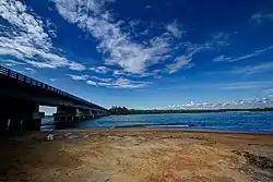
.jpg.webp)
Malappuram is well connected by roads. There are four KSRTC stations in district.[105] 2 National highways pass through district- NH 66 and NH 966. NH 66 reaches the district through Ramanattukara and connects the cities/towns including Tirurangadi, Kakkad, Kottakkal, Valanchery, Kuttippuram, and Ponnani and goes out from district through Chavakkad. Major cities/towns those are connected through NH 966 include Kondotty (Karipur Airport), Malappuram, and Perinthalmanna. The State Highways passing through district are SH 23 (Shornur-Perinthalmanna), SH 28 (Malappuram-Vazhikadavu), SH 34 (Quilandy-Edavanna), SH 39 (Perumbilavu-Nilambur), SH 53 (Mundur-Perinthalmanna), Hill Highway, SH 60 (Angadipuram-Cherukara), SH 62 (Guruvayur-Ponnani), SH 65 (Parappanangadi-Areekode), SH 69 (Thrissur-Kuttipuram), SH 70 (Karuvarakundu - Melattur), SH 71 (Tirur-Manjeri), SH 72 (Malappuram - Tirurangadi), and SH 73 (Valanchery-Nilambur). The length of road maintained by Kerala PWD in district is 2,680 km. Out of this, 2,305 km constitute district roads. The remaining 375 km consists of State Highways.[106]
The first modern kind of road in the district was laid in eighteenth century by Tipu Sultan.[42] The road from Tirur to Chaliyam via Tanur, Parappanangadi, and Vallikkunnu was projected by him.[42] Tipu had also projected the roads from Malappuram to Thamarassery, from Malappuram to Western Ghats, from Feroke to Kottakkal via Tirurangadi, and from Kottakkal to Angadipuram.[38]
Railways
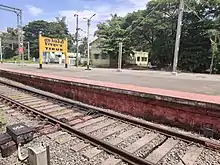
Total length of railway line that passes through the district is 142 km.[107] The railway in the district comes under the Palakkad Railway Division, which is one of the six divisions under the Southern Railway. The history of railways in Kerala traces back to the district. The oldest railway station in the state is at Tirur.[42] The stations at Tanur, Parappanangadi, and Vallikkunnu also form parts of the oldest railway line in the state laid from Tirur to Beypore.[42] The line was inaugaurated on 12 March 1861.[41] In the same year, it was extended from Tirur to Kuttippuram via Tirunavaya.[42] Later, it was further extended from Kuttippuram to Pattambi in 1862, and was again extended from Pattambi to Podanur in the same year.[42] The current Chennai-Mangalore railway line was later formed as an extension of the Beypore - Podanur line thus constructed.[42]
The Nilambur–Shoranur line is among the shortest as well as picturesque broad gauge railway lines in India.[108] It was laid by the British in colonial era for the transportation of Nilambur Teak logs into United Kingdom through Kozhikode. The Nilambur–Nanjangud line is a proposed railway line, which connects Nilambur with the districts of Wayanad, Nilgiris, and Mysore.[109][110] The Ministry of Railways has included the railway line connecting Kozhikode-Malappuram-Angadipuram in its Vision 2020 as a socially desirable railway line. Multiple surveys have been done on the line already. Indian Railway computerized reservation counter is available at Friends Janasevana Kendram, Down Hill. Reservation for any train can be done from here. Malappuram city is served by the railway stations at Angadipuram (17 km away), Tirur, and Parappanangadi (both 26 km, 40-minute drive away).
The railway stations in the district are:
- Angadipuram railway station
- Cherukara railway station
- Kuttippuram railway station
- Melattur railway station
- Nilambur Road railway station
- Parappanangadi Railway Station
- Pattikkad railway station
- Perassannur railway station
- Tanur railway station
- Thodikapulam railway station
- Tirunavaya railway station
- Tirur Railway Station
- Tuvvur railway station
- Vallikkunnu railway station
- Vaniyambalam railway station
Airport

Malappuram is served by Calicut International Airport (IATA: CCJ, ICAO: VOCL) located at Karipur, about 25 kilometre away from Malappuram City. The airport started operation in April 1988. It has two terminals, one for domestic flights and second for international flights.[111] The airport serves as an operating base for Air India Express and operates Hajj Pilgrimage services to Medina and Jeddah from Kerala. Domestic flight services are available to major cities including Bangalore, Chennai, Mumbai, Hyderabad, Goa, Kochi, Thiruvananthapuram, Mangalore and Coimbatore while International flight services connects Malappuram with Dubai, Jeddah, Riyadh, Sharjah, Abu Dhabi, Al Ain, Bahrain, Dammam, Doha, Muscat, Salalah and Kuwait. There are direct buses to the airport for transportation. Other than buses, Taxis, Auto Rickshaws available for transportation.
According to the statistics provided by the Airports Authority of India in 2019-20, it is the 17th busiest airport in the country and the third-busiest in the state.
Demography
Population
| Year | Pop. | ±% p.a. |
|---|---|---|
| 1901 | 682,151 | — |
| 1911 | 747,929 | +0.92% |
| 1921 | 764,138 | +0.21% |
| 1931 | 874,504 | +1.36% |
| 1941 | 977,085 | +1.12% |
| 1951 | 1,149,718 | +1.64% |
| 1961 | 1,387,370 | +1.90% |
| 1971 | 1,856,357 | +2.95% |
| 1981 | 2,402,701 | +2.61% |
| 1991 | 3,096,330 | +2.57% |
| 2001 | 3,625,471 | +1.59% |
| 2011 | 4,112,920 | +1.27% |
| 2018 | 4,494,998 | +1.28% |
| source:[112][8] | ||
According to the 2018 Statistics Report, the district had a population of 4,494,998,[8] which is roughly equal to the population of Mauritania or the US state of Kentucky. 12.98% of the total population of Kerala resides in Malappuram.[8] It is the most populous district in Kerala and also the 50th most populous of India's 640 districts, with a population density of 1,265 inhabitants per square kilometre (3,280/sq mi). Its population-growth rate from 2001 to 2011 was 13.39 per cent. According to the 2011 Census of India, Malappuram has a sex ratio of 1098 women to 1000 men, and its literacy rate is 93.57 per cent, which is almost equal to the average literacy rate of the state (93.91%). Out of the total Malappuram population for 2011 census, 44.18 percent lives in the urban regions of district. In 2011, children under 0-6 formed 13.96 percent of the total population, compared to the 15.21 percent in 2001. Child Sex Ratio as per census 2011 was 965 compared to 960 of census 2001. According to the census 2011, only 0.02% of the total population of the district is houseless.[9]
The Malappuram metropolitan area has a population of 1.7 million.[18] According to a report published by The Economist in January 2020, Malappuram is the fastest growing metropolitan area in the world.[113][114][115]
Religions
Religion in Malappuram (2011)[12]
The areas that come under the Malappuram district have been multi-ethnic and multi-religious since the early medieval period. The centuries of trade across the Arabian Sea has given Malappuram a cosmopolitan population.[116] The religions practised in district include Islam, Hinduism, Christianity, and other minor religions.[117] Malappuram is one of the two districts with a Muslim majority in South India, the other being Lakshadweep district. Most of the Christians in the district are descendants of Syrian Christians who migrated from Northern Travancore to Malabar in the 20th century (Malabar Migration).[118]
Languages
The principal language used in the district is Malayalam. Mappila dialect of Malayalam is common. Arabi Malayalam script, also known as Ponnani Script, was used widely in the district in the past centuries. Minority Dravidian languages are Allar (around 350 speakers)[119] and Aranadan, (around 200 speakers).[120] Tamil is spoken by a small fraction of the people. According to the census 2011, the percents of the mother tongue of the total population is as follows:
Healthcare
Modern medicine, Ayurveda, and Homeopathy are available in the district. A general hospital, 3 district hospitals, and 6 Taluk hospitals are functioning under the Government of Kerala for Allopathy. The Government Medical College, Manjeri, established in 2013, is the apex medical college in the district.[121] A network of local health centers function under the public sector. It includes 66 Primary Health Centres, 20 All-time functioning primary health centers, 20 Community health centers, and 2 TBC's. 5 Major public health centers, 77 mini public health centers, and 565 sub-centers are there. 3 Leprosy control units, 2 Filaria control units, etc. also function under the public sector. The total bed strength of government hospitals is 1500. Many private hospitals with super-specialty units are also there in the district under Allopathy.[122][123]
The Govt Ayurveda Research Institute for Mental Disease at Pottippara near Kottakkal is the only government Ayurvedic mental hospital in Kerala. It is also the first of its type under the public sector in the country. Kottakkal is also home to the Arya Vaidya Sala, the renowned Ayurvedic health center. Under the government sector, a district Ayurvedic hospital functions at Edarikode. Government Ayurvedic hospitals also function in Manjeri, Velimukku, Perinthalmanna, Malappuram, Vengara, Kalpakanchery, Thiruvali, and Chelembra. Homeopathic hospitals under public sector function at Malappuram, Manjeri, Wandoor, and Kuttippuram.[123][124] Many hospitals function under the private sector.
Education
The district has the highest number of schools in Kerala as per the school statistics of 2019–20. There are 898 Lower primary schools,[125] 363 Upper primary schools,[126] 355 High schools,[127] 248 Higher secondary schools,[128] and 27 Vocational Higher secondary schools[129] in the district. Hence there are 1620 schools in the district.[130] Besides these, there are 120 CBSE schools and 3 ICSE schools.
554 government schools, 810 Aided schools, and 1 unaided school, recognised by the Government of Kerala have been digitalised.[131] In the academic year 2019–20, the total number of students studying in the schools recognised by Government of Kerala is 739,966 - 407,690 in the aided schools, 245,445 in the government schools, and 86,831 in the recognised unaided schools.[132]
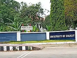
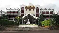
The district plays a significant role in the higher education sector of the state. It is home to two of the main universities in the state- the University of Calicut centered at Tenhipalam which was established in 1968 as the second university in Kerala,[133] and the Thunchath Ezhuthachan Malayalam University centered at Tirur which was established in the year 2012.[134] AMU Malappuram Campus, one of the three off-campus centres of Aligarh Muslim University (AMU) is situated in Cherukara, which was established by the AMU in 2010.[135][136] An off-campus of the English and Foreign Languages University functions at Panakkad.[137] INKEL Greens at Malappuram provides an educational zone with the industrial zone.[138] Eranad Knowledge City at Manjeri is a first of its kind project in the state.[139]
Culture
Moyinkutty Vaidyar, the most renowned Mappila paattu poet was born at Kondotty. He is considered as one of the Mahakavis (a title for 'great poet') of Mappila songs. The currently adopted Malayalam alphabet was first accepted by Thunchath Ezhuthachan, who was born at Tirur and is known as the father of the modern Malayalam language. Tirur is the headquarters of the Malayalam Research Centre.
Besides Moyinkutty Vaidyar and Thunchath Ezhuthachan, it is also the birthplace of many renowned writers of Malayalam including Achyutha Pisharadi, Edasseri Govindan Nair, K. P. Ramanunni, Kuttikrishna Marar, Melpathur Narayana Bhattathiri, Nandanar, Poonthanam Nambudiri, Pulikkottil Hyder, Uroob, V. C. Balakrishna Panicker, and Vallathol Narayana Menon. The district has also given its own deposits to Kathakali, the classical art form of Kerala, and Ayurveda. Kottakkal Chandrasekharan, Kottakkal Sivaraman, and Kottakkal Madhu were famous Kathakali artists hailed from Kottakkal Natya Sangam established by Vaidyaratnam P. S. Warrier in Kottakkal. Zainuddin Makhdoom II, the first known Keralite historian, also hails from the district.
During the medieval period, the district was a centre of Vedic as well as Islamic studies. It is believed that Malik Dinar had visited the port town of Ponnani.[140] Parameshvara, Nilakantha Somayaji, Jyeṣṭhadeva, Achyutha Pisharadi, and Melpathur Narayana Bhattathiri, who were the main members of the Kerala School of Astronomy and Mathematics hailed from Tirur region. The Arabi Malayalam script, otherwise known as the Ponnani script, took its birth during the late 16th century and early 17th century. The script was widely used in the district during the last centuries.
Cuisine
The centuries of maritime trade has given the Malappuram a cosmopolitan cuisine. The cuisine is a blend of traditional Kerala items with some of the Arab food items. One of the main elements of this cuisine is Pathiri, a pancake made of rice flour. Variants of Pathiri include Neypathiri (made with ghee), Poricha Pathiri (fried rather than baked), Meen Pathiri (stuffed with fish), and Irachi Pathiri (stuffed with beef). Spices like Black pepper, Cardamom, and Clove are widely used in the cuisine of Malappuram. The main item used in the festivals is the Malabar style of Biryani. Sadhya is also seen in marriage and festival occasions. Ponnani region of the district has a wide variety of indigenous dishes. Snacks such as Arikadukka, Chattipathiri, Muttamala, Pazham Nirachathu, and Unnakkaya have their own style in Ponnani. Besides these, other common food items of Kerala are also seen in the cuisine of Malappuram.[141]
Media
Malayala Manorama, Mathrubhumi, Madhyamam, Chandrika, Deshabhimani, Suprabhaatham, and Siraj dailies have their printing centres in and around the Malappuram city. The Hindu has an edition and printing press at Malappuram. A few periodicals-monthlies, fortnightlies and weeklies-mostly devoted to religion and culture are also published. Almost all Malayalam channels and newspapers have their bureau at Up Hill. There are so many local cable visions and their regional media. Malappuram Press Club is also situated at Uphill adjacent to Municipal Town Hall. Doordarshan has its major relay station in the district at Malappuram. The government of India's Prasar Bharati National Public Service Broadcaster has an FM station in the district (AIR Manjeri FM), broadcasting on 102.7 Mhtz. Even without any private FM stations, Malappuram, Ponnani, and Tirur find their own places in the top ten towns with the highest Radio listenership in India.[142]
Sports
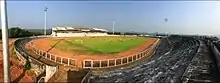
Malappuram is often known as The Mecca of Kerala Football.[1][2] Malappuram District Sports Complex & Football Academy is situated at Payyanad in Manjeri. Kottappadi Football Stadium is a historic football stadium. Other major stadiums include the Rajiv Gandhi Municipal Stadium at Tirur, and the Perinthalmanna Cricket Stadium at Perinthalmanna. A synthetic track is there along with the Tirur Municipal Stadium. Malabar Premier League was initiated in 2015 to strengthen football in the district.[143] The Calicut University Synthetic Track at Thenhipalam is the apex synthetic track in the district. It is associated with the C. H. Muhammad Koya Stadium at Thenhipalam.[144] The other major stadiums of district are at Areekode, Kottakkal, and Ponnani. A football hub to internationalise the eight major football stadiums of district is proposed.[145] The construction works of two new stadium complexes are being processed in Tanur and Nilambur.[146]
Places of Interest
According to the statistics of 2017–18, Malappuram ranks sixth in Kerala on the number of foreign tourist arrival and eighth in the number of domestic tourist arrival.[147]
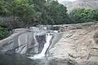


- Adyanpara Falls- a waterfall at Kurumbalangode.[148]
- Arimbra Hills, also known as 'Mini-Ooty'. At a height of 1050 feet above the sea level.[149]
- Arya Vaidya Sala - known for its heritage and expertise in the Indian traditional medicine system of Ayurveda.
- Bharathappuzha - The second-longest river in Kerala. Also known in the names River Ponnani, Nila and Perar.[150]
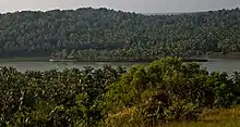
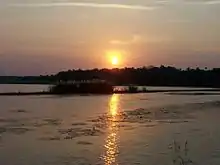
- Biyyam Kayal- A backwater lake at Ponnani[151]
- Chekkunnu Mala - A misty green hill near to Chaliyar at Edavanna.[152]
- Cherumb eco-tourist village - An eco-village at Karuvarakundu[153]
- Kadalundi Bird Sanctuary - a dwelling of more than a hundred species of native birds and over 60 species of migratory birds[154]
- Kadalundi-Vallikkunnu community reserve - The first community reserve in Kerala and an eco-tourism spot.[65]
- Kakkadampoyil - A hilly village on the bank of Cherupuzha.
- Keralamkundu waterfalls - Located 1500 ft above the sea level in Karuvarakundu.[155]
- Kodikuthimala - At Amminikadan hills, Perinthalmanna. Also known as Mini-Ooty.[156]
- Kollam Kolli Waterfalls - A waterfall near Areekode.
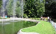
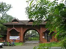
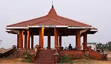
- Kottakkunnu - At the middle of Malappuram city. Also known as The Marine Drive of Malappuram. An old fort, a water-park, and ancient murals are seen here.[157]
- Nedumkayam Rainforest - A part of the Nilgiri Biosphere Reserve. Known for its greenery.[158]
- New Amarambalam Reserved Forest - A wildlife sanctuary near to Nilambur.[159]
- Nilambur Kovilakam - The headquarter of the Nilambur royal family.[160]
- Oorakam Hill - A mount near Malappuram.
- Padinjarekara beach - Two rivers (The Tirur River and the Bharathappuzha) joins with the Arabian sea at here.[161]
- Paloor Kotta Falls - A waterfall adjacent to the Paloor fort built by Tipu Sultan near Perinthalmanna.[162]
- Parappanangadi beach - A beach in the coastal town of Parappanangadi.
- Ponnani beach - A beach in Ponnani.
- Tanur beach - A beach at Tanur.
- Teak Museum - The world's first teak plantation in Nilambur.[163]
- Thunchan Parambu - It is the birthplace of Thunchaththu Ezhuthachan, who is known as the father of modern Malayalam language.
- Unity hill viewpoint - A viewpoint at Manjeri.
- Vakkad beach - It is at between Tirur and Ponnani.[164]
- Vallikunnu beach - A coconut-fringed beach in the northwestern coast of district.[165]
Notable people
- A. P. Anil Kumar - Former minister of Kerala.
- Abdul Nediyodath - Footballer.
- Abdurahiman Randathani - Politician.
- Achyutha Pisharadi - a Sanskrit grammarian, astronomer and mathematician.
- Ahmad Kutty - North American Islamic scholar.
- Ajijesh Pachat - Malayalam novelist, short story writer and columnist.
- Ali Musliyar - Freedom fighter.
- Anas Edathodika - Indian professional footballer.
- Aneesh G. Menon - Actor.[166][167]
- Aparna Nair - Actress.
- Arjun Jayaraj - Professional footballer.
- Artist Namboothiri - painter.
- Aryadan Muhammed - Former minister of Kerala.
- Aryadan Shoukath - Indian film producer.
- Ashique Kuruniyan - Indian professional footballer.
- Asif Saheer - Indian soccer player.
- Azad Moopen - Doctor and Philanthropist.[168][169][170]
- B. M. Kutty - Journalist and Activist.
- C. Karunakara Menon - Journalist and Politician.
- C. Radhakrishnan - Writer and film director of Malayalam language.
- C. N. Ahmad Moulavi - Indian writer of Malayalam literature.
- Chakkeeri Ahemed Kutty - Former minister of Kerala and former speaker of Kerala Legislative Assembly.
- Chalilakath Kunahmed Haji - Social reformer.[171]
- Cherukad - Malayalam playwright, Novelist, Poet, and Political activist.
- Damodara - Astronomer-mathematician.
- Deepu Pradeep - Scriptwriter.
- Devdutt Padikkal - Indian cricketer.
- Dhanish Karthik - Actor.
- Dileep K. Nair - Educationist, skill development campaigner, social activist, and publisher.
- E. Harikumar - Malayalam novelist and short story writer.
- E. Moidu Moulavi - Indian freedom fighter, and an Islamic scholar.[172]
- E. K. Imbichi Bava - Politician.
- E. M. S. Namboodiripad - The first Chief Minister of Kerala.[173]
- E. T. Mohammed Basheer - Former minister of Kerala and Member of Lok Sabha.
- Edasseri Govindan Nair - Poet.
- Elamaram Kareem - Former minister of Kerala and Member of Rajya Sabha.
- Faisal Kutty - Lawyer, academic, writer, public speaker, and human rights activist.[174]
- Gopinath Muthukad - magician, and motivational speaker.[175][176]
- Govinda Bhattathiri - Indian astrologer and astronomer.
- Hari Nair - Cinematographer.
- Hemanth Menon - Actor.
- Iqbal Kuttippuram - Screenwriter and homoeopathic physician.[177]
- Jayasree Kalathil - Writer, translator, mental health researcher, and activist.
- Jishnu Balakrishnan - Professional footballer.
- K. Abdurahman - Founder of Chaliyar movement.[178]
- K. Avukader Kutty Naha - Former deputy chief minister of Kerala.
- K. C. Manavedan Raja - Indian aristocrat.
- K. M. Asif - Cricketer.
- K. M. Maulavi - Indian freedom fighter, social reformer and the founding vice-president of IUML Malabar district committee.[179][180]
- K. P. A. Majeed - Former Chief Whip of the Government of Kerala.
- K. P. Ramanunni - Novelist and Short-story writer.[181][182]
- K. T. Irfan - Athlete.[183][184][185]
- K. T. Jaleel - Minister of Kerala.
- K. T. Muhammed- Malayalam playwright and screenwriter.
- K. V. Rabiya - Social worker.
- K. V. Ramakrishnan - Malayalam–language poet and journalist.
- Kadavanad Kuttikrishnan - Malayalam poet and journalist.
- Kalamandalam Kalyanikutty Amma - Resurrector of Mohiniyattam.
- Krishnachandran - Actor, Dubbing artist, and Playback singer.
- Kuttikrishna Marar - Essayist and literary critic of Malayalam literature.
- M. Govindan - Writer of Malayalam literature.
- M. Swaraj - Politician.
- M. G. S. Narayanan - Historian, and academic and political commentator.
- M. K. Vellodi - Former Indian diplomat.
- M. M. Akbar - Islamic scholar, and an expert in comparative religion.[186]
- M. P. Abdussamad Samadani - Former member of Rajya Sabha.
- M. P. M. Ahammed Kurikkal - Former minister of Kerala.
- M. P. M. Menon - Indian diplomat, ambassador to several countries.[187]
- Mahmood Kooria - Indian historian and academic.
- Malayath Appunni - Malayalam language poet and children's writer.
- Manjalamkuzhi Ali - Former minister of Kerala.
- Mankada Ravi Varma - Cinematographer and Director.[188][189][190]
- Mashoor Shereef - Professional footballer.
- Melattur Sahadevan - Carnatic music vocalist.
- Melpathur Narayana Bhattathiri - Mathematical linguist.
- Mohammed Irshad - Professional footballer.
- Mohamed Salah - Footballer.
- Mohanakrishnan Kaladi - Malayalam poet.
- Moyinkutty Vaidyar - Mappila pattu poet.[191]
- Muhammad Musthafa - Actor and Director.
- Muhsin Parari - Director, Writer, and Lyricist.
- Nalakath Soopy - Former minister of Kerala.
- Nandanar - Writer of Malayalam literature.
- Nilambur Ayisha - Actress in the Malayalam film industry and drama.
- Nilambur Balan - Malayalam actor.
- Nirupama Rao - Former foreign secretary of India.[192][193]
- P. Sreeramakrishnan - current speaker of Kerala Legislative Assembly.
- P. Surendran - Writer, Columnist, art critic, and a philanthropist.[194]
- P. K. Abdu Rabb - Former minister of Kerala.
- P. K. Kunhalikutty - Former minister of Kerala.
- P. K. Warrier - Ayurvedic physician and a Padma Bhushan winner.
- P. P. Ramachandran - Malayalam poet.
- P. V. Abdul Wahab - Businessman, and a member of Rajya Sabha.
- Paloli Mohammed Kutty - Former minister of Kerala.
- Parameshvara - Indian mathematician and astronomer.
- Parvathy Jayadevan - Playback singer.
- Poonthanam Nambudiri - Malayalam poet.[195]
- Premji - Social reformer, Cultural leader, and Actor.
- Pulapre Balakrishnan - Economist and Educationalist.
- Pulikkottil Hyder - Mappila pattu poet.[196]
- Rajeev Nair - Writer, Lyricist, and Producer.
- Ranjith Padinhateeri - Biological physicist and a professor.
- Rashin Rahman - Actor.
- Ravi Vallathol - Actor.
- Rinshad Reera - Student Activist.
- Salam Bappu - Film director.
- Salman Kalliyath - Indian professional footballer.
- Sangita Madhavan Nair - Actress.
- Sankaran Embranthiri - Kathakali musician.
- Savithri Rajeevan - Indian poet, short story writer, and painter.
- Sayyid Sanaullah Makti Tangal - Social reformer.[197][198]
- Shahabaz Aman - Playback singer and Composer.[199][200]
- Shanavas K Bavakutty - Film director.
- Shweta Menon - Model, Actress, and Television anchor.
- Sithara - Playback singer, Composer, and an occasional actor.[201]
- Sukumaran - Film actor and producer.
- Syed Muhammedali Shihab Thangal - Religious leader and politician.[202]
- T. A. Razzaq - Screenwriter.
- T. K. Hamza - Former minister of Kerala.
- T. K. Padmini - Indian painter.
- T. M. Nair - Political activist of Dravidian movement.
- Thunchaththu Ezhuthachan- Father of Malayalam language.[203][204]
- Tirur Nambissan - Kathakali singer.
- U. A. Beeran - Former minister of Kerala.
- U.Jimshad - Professional footballer.
- U. Sharaf Ali - Former Indian International football player.[205][206]
- Unni Menon - Playback singer.
- Uroob - Writer of Malayalam literature.
- V. C. Balakrishna Panicker - Indian poet and writer.
- Vaidyaratnam P. S. Warrier - Ayurvedic physician.[207]
- Vaidyaratnam Triprangode Moossad - Ayurvedic physician.
- Vallathol Narayana Menon - Malayalam poet.[208]
- Variyan Kunnathu Kunjahammed Haji - Indian Freedom Fighter.[209]
- Vazhenkada Kunchu Nair - Kathakali master and a Padma Shri winner.
- Vinay Govind - Indian film director.
- Zainuddin Makhdoom II - The author of Tuhfat Ul Mujahideen.
- Zakariya Mohammed - Film director, screenwriter, and actor.[210][211]
- Zakeer Mundampara - Footballer.
Demand of bifurcation
For a few years, the demand to create a new coastal district called Tirur district, centered at Tirur is being strengthened.[212] They argue that it is imperative from the development perspective to split the district, with double the population and size of the Alappuzha district, into two. No other district in Kerala has seven subdistricts, 94 Village Panchayats, and 12 municipalities together. As for its extent, if one travels from Perumbadappu which borders Thrissur district to Vazhikkadavu bordering Tamil Nadu, normally it takes more than three hours to cover that distance of 115 km. They also point out that the problems in the health and educational sectors that require solutions are not trivial. The issue was raised again by the IUML MLA K. N. A. Khader in 2019.[212] The demand is to bifurcate the existing Malappuram district into two districts by carving out a new one called Tirur district from it.[212] Kerala Congress (M) campaigns for a new district centred at Edappal.[213] Some people including Veteran Congress leader Aryadan Muhammad, and IUML district secretary UA Latheef oppose the bifurcation of Malappuram.[214][215]
However, the demand was rejected by the two successive governments who ruled Kerala in 2013 and in 2019.[214][215] But the studies regarding the bifurcation of the district are still in the consideration of the Government of Kerala.
References
- "Malabar Premier League to be launched in Malappuram". The Hindu. 3 March 2015. Retrieved 28 November 2019.
- "Football hub proposed in Malappuram". Deccan Chronicle. 18 July 2016. Retrieved 28 November 2019.
- "Kerala kids who sacrificed chocolates to buy football flooded with footballs after video goes viral". m.dailyhunt.in. 8 November 2019. Retrieved 28 November 2019.
- Manoj. "Malappuram, the hill top town". nativeplanet.com. Native Planet. Retrieved 17 July 2020.
- "Jaffer Malik,IAS steps down as Malappuram collector; N.Gopalakrishnan,IAS is the new collector". Keralakaumudi dialy. Retrieved 27 May 2020.
- "Malappuram Police". Malappuram police. Retrieved 30 September 2020.
- "Malappuram Jilla Panchayath". Retrieved 2 January 2021.
- Annual Vital Statistics Report - 2018 (PDF). Thiruvananthapuram: Department of Economics and Statistics, Government of Kerala. 2020. p. 55.
- "Census 2011, Malappuram" (PDF). censusindia.gov.in. Retrieved 17 April 2020.
- "Malappuram's first book stall bids adieu". The Hindu. 19 December 2018. Retrieved 4 July 2020.
- "Language – Kerala, Districts and Sub-districts". Census of India 2011. Office of the Registrar General.
- "Religion – Kerala, Districts and Sub-districts". Census of India 2011. Office of the Registrar General.
- "Population profile of Kerala". spb.kerala.gov.in. Retrieved 28 November 2019.
- "Economy of Malappuram". ecostat.kerala.gov.in.
- Radhakrishnan, S. Anil (14 December 2019). "Engaging Kerala's non-resident diaspora". The Hindu. ISSN 0971-751X. Retrieved 9 September 2020.
- "The first E-literate district of India". The Times of India. 18 August 2004. Retrieved 3 July 2020.
- "The first cyber literate district of India". The Hindu. 6 July 2018. Retrieved 3 July 2020.
- "The Malappuram Urban Agglomeration" (PDF). censusindia.gov.in. Retrieved 25 June 2020.
- 1951 census handbook - Malabar district (PDF). Chennai: Government of Madras. 1953. p. 1.
- Charles Alexander Innes (1908). Madras District Gazetteers Malabar (Volume-I). Chennai: Madras Government Press.
- "Malappuram, The Hill Top Town". nativeplanet.com. 30 June 2014.
- "Cultural counterpoint". The Financial Express. 24 March 2013.
- Akash Singh (7 May 2018). "Hilly areas of Malappuram". Native Planet. Retrieved 11 October 2020.
- "History of Malappuram" (PDF). censusindia.gov.in. Retrieved 17 April 2020.
- Nair, K. K. (2013). By Sweat and Sword: Trade, Diplomacy and War in Kerala Through the Ages. KK Nair. ISBN 978-81-7304-973-6.
- Ramachandran, C. M. Problems of Higher Education in India: A Case Study. Mittal Publications.
- K. V. Krishna Iyer Zamorins of Calicut: From the Earliest Times to AD 1806. Calicut: Norman Printing Bureau, 1938
- Logan, William. MALABAR MANUAL: With Commentary by VED from VICTORIA INSTITUTIONS (Volume 2 ed.). VICTORIA INSTITUTIONS, Aaradhana, DEVERKOVIL 673508. Retrieved 12 July 2020.
- Narayanan, M. G. S. (1996). Perumals of Kerala: Political and Social Conditions of Kerala Under the Cēra Perumals of Makotai (c. 800 A.D.-1124 A.D.). Xavier Press.
- Scammell, p. 13
- "Maritime Heritage - Join Indian Navy | Government of India". www.joinindiannavy.gov.in. Retrieved 10 March 2020.
- Singh, Arun Kumar (11 February 2017). "Give Indian Navy its due". The Asian Age. Retrieved 6 March 2020.
- AG Noorani "Archived copy". Archived from the original on 21 December 2012. Retrieved 5 January 2013.CS1 maint: archived copy as title (link)
- A. Sreedhara Menon. Kerala History and its Makers. D C Books (2011)
- A G Noorani. Islam in Kerala. Books
- Roland E. Miller. Mappila Muslim Culture SUNY Press, 2015
- Sanjay Subrahmanyam (29 October 1998). The Career and Legend of Vasco Da Gama. Cambridge University Press. pp. 293–294. ISBN 978-0-521-64629-1. Retrieved 26 July 2012.
- Devassy, M. K. (1965). District Census Handbook (2) - Kozhikode (1961) (PDF). Ernakulam: Government of Kerala.
- Naravane, M.S. (2014). Battles of the Honorable East India Company. A.P.H. Publishing Corporation. p. 176. ISBN 9788131300343.
- "Oldest teak plantation, Conolly's Plot, to reopen after maintenance". Mathrubhumi. 16 May 2017. Retrieved 12 October 2020.
- "'Lifeline' of Malabar turns 125". www.thehindu.com. 29 December 2012. Retrieved 19 December 2020.
- "ആ ചൂളംവിളി പിന്നെയും പിന്നെയും..." Mathrubhumi. 17 June 2019. Retrieved 19 December 2020.
- K. Madhavan Nair, 'Malayalathile Mappila Lahala,' Mathrubhumi, 24 March 1923.
- Malappuram British History
- "The 1920 political conference at Manjeri". Deccan Chronicle. 29 June 2016. Retrieved 18 July 2020.
- Sreedhara Menon, A. (2007). A Survey of Kerala History (2007 ed.). Kottayam: DC Books. ISBN 9788126415786.
- Tottenham GRF (ed), The Mappila Rebellion 1921-22, Govt Press Madras 1922 P 71
- Karim KK Muhammed Abdul, Variam Kunnath Kunjahammed Haji, Kalima Books, Kozhikkode 1992 (Malayalam)
- Malabar Desiyathayude Idapedalukal. Dr. M. T. Ansari. DC Books
- Panikkar, K. N., Against Lord and State: Religion and Peasant Uprisings in Malabar 1836-1921
- K. Narayanan (1972). District Census Handbook - Malappuram (Part-C) - 1971 (PDF). Thiruvananthapuram: Directorate of Census Operations, Kerala. p. 3.
- "Summer Journey 2011". Time. 21 July 2011.
- "Physical divisions of Malappuram" (PDF). censusindia.gov.in. pp. 21–22. Retrieved 18 April 2020.
- "The coastal area of Malappuram". kerenvis.nic.in. Retrieved 30 November 2019.
- "Ponnani, the Mecca of Malabar". nativeplanet.com. Retrieved 19 April 2020.
- "Rivers in Malappuram district". malappuram.nic.in. Retrieved 23 November 2019.
- "MSN Weather". Archived from the original on 9 October 2009. Retrieved 29 November 2019.
- "Climate of Malappuram". en.climate-data.org. Retrieved 30 November 2019.
- "Forest area of Malappuram" (PDF). industry.kerala.gov.in. Retrieved 21 April 2020.
- "The Karimpuzha Wildlife Sanctuary". The Hindu. 3 July 2020. Retrieved 5 July 2020.
- "The largest wildlife sanctuary of Kerala". touristinindia.com. Retrieved 5 July 2020.
- T Ramavarman (1 January 2018). "First for forest produce, GI tag for Nilambur teak". The Times of India. Retrieved 30 October 2020.
- "Tirur Vettila gets GI tag". The Hindu. Retrieved 19 April 2020.
- "Flora and fauna of Malappuram". malappuram.nic.in. Retrieved 24 November 2019.
- "Kadalundi-Vallikkunnu community reserve". www.onmanorama.com. 4 April 2018. Retrieved 25 July 2020.
- Anupama Mili (4 September 2018). "Lotus fields of Tirunavaya". Malayala Manorama. Retrieved 26 July 2020.
- "Municipalities in Malappuram". malappuram.nic.in. Retrieved 1 December 2019.
- "No. of wards in Malappuram". lsgkerala.gov.in.
- "Collectorate Malappuram". Official website of Malappuram district. Retrieved 3 October 2020.
- "Administrative divisions of Malappuram district". malappuram.nic.in. Retrieved 23 November 2019.
- "Niyamasabha constituencies of Malappuram". ceo.kerala.gov.in. Retrieved 25 November 2019.
- "Talukas in Malappuram district". malappuram.nic.in. Retrieved 23 November 2019.
- "Taluk-wise demography of Malappuram" (PDF). censusindia.gov.in. Directorate of Census Operations, Kerala. pp. 161–193. Retrieved 19 April 2020.
- "Villages in Malappuram". malappuram.nic.in. Retrieved 25 November 2019.
- "Rural administration in Malappuram district". Official website of Malappuram district. Retrieved 2 August 2020.
- "Malappuram District Panchayat election 2015". lbtrend. Retrieved 12 December 2020.
- "Gram Panchayats and wards in Malappuram". Local self government department, Government of Kerala. Retrieved 3 August 2020.
- "Draft notifications for new local bodies in Malappuram". Delimitation Commission, Kerala. Government of Kerala. Retrieved 10 October 2020.
- "Malappuram - municipalities and wards". lsgkerala. Retrieved 3 October 2020.
- "No. of wards in Malappuram". lsgkerala.gov.in.
- "Population of urban bodies" (PDF). Urban Affairs Kerala. Retrieved 14 August 2020.
- "Chairpersons of Kerala municipalities". Urban Affairs Kerala. Government of Kerala. Retrieved 10 October 2020.
- "District Planning Committee, Malappuram". SEC Kerala. Retrieved 7 November 2020.
- "Constituencies for Kerala Legislative Assembly - Districtwise" (PDF). CEO Kerala. Retrieved 7 November 2020.
- "Judicial administration of Malappuram". districts.ecourts.gov.in.
- "Thrissur Range Police districts". Kerala Police. Retrieved 2 November 2020.
- "Malappuram police". malappuram.keralapolice.gov.in.
- "Malappuram ranks first in the number of emigrants from Kerala". spb.kerala.gov.in. Retrieved 3 December 2019.
- "KGB to expand operations in all Panchayats". The New Indian Express. 15 July 2013. Retrieved 25 June 2020.
- national geo-heritage of India, INTACH
- "Minerals of Malappuram" (PDF). industry.kerala.gov.in. p. 35. Retrieved 21 April 2020.
- "Proceedings of the Indian History Congress". Indian History Congress. 60: 1204. 2000. OCLC 1752882.
- "KINFRA Techno Industrial Park, Malappuram". kinfra.org.
- "Kerala's INKEL to bring an invest of Rs 1000 crore". The Economic Times. 4 June 2015. Retrieved 6 October 2020.
- "KELCERA". keltronelcera. Retrieved 30 January 2021.
- "MALCOTEX". malcotex. Retrieved 30 January 2021.
- "KELTEX Athavanad". keltex. Retrieved 30 January 2021.
- "Brief Industrial Profile of Malappuram District 2017-18" (PDF). msmedithrissur.gov.in.
- "Kerala State Detergents and Chemicals Limited". The Economic Times. Retrieved 29 July 2020.
- "Kerala State Wood Industries Ltd". The Economic Times. Retrieved 29 July 2020.
- TNN (6 April 2020). "Popees baby care". Times of India. Retrieved 16 August 2020.
- "Agriculture in Malappuram". ecostat.kerala.gov.in.
- "Important farms in Malappuram". Farm Information Bureau, Kerala. Retrieved 28 August 2020.
- "Kelappaji College of Agricultural Engineering & Technology, Tavanur | Kerala Agricultural University". kau.in.
- "KSRTC stations of Malappuram". keralartc.com.
- "Length of PWD Roads in Malappuram". kerenvis.nic.in. Retrieved 19 April 2020.
- "Railway in Malappuram" (PDF). industry.kerala.gov.in. p. 45. Retrieved 21 April 2020.
- "The Nilambur news". Kerala Tourism. Archived from the original on 20 September 2016. Retrieved 13 November 2020.
- "Nilambur-Nanjandgud way to be realised". The Times of India. 2 September 2016. Retrieved 26 June 2020.
- Muringatheri, Mini (10 February 2017). "Nilambur teak set to enter elite club of products with GI tag". The Hindu. Retrieved 24 January 2021.
- "Silver jubilee does not bring cheer to Karipur airport users". The Times of India.
- "Census of India Website : Office of the Registrar General & Census Commissioner, India". censusindia.gov.in.
- "Malappuram, the fastest growing city". cnbctv18.com. 9 January 2020. Retrieved 28 June 2020.
- "Malappuram, the fastest growing city of world". scroll.in.
- "Malappuram is world's fastest-growing city; Kozhikode, Kollam also in top 10". The New Indian Express.
- Nainar, S. Muhammad Hussain (1942). Tuhfat-al-Mujahidin: An Historical Work in The Arabic Language. University of Madras.
- pp. 396, Malayala Manorama Yearbook 2006, Kottayam, 2006 ISSN 0970-9096
- Joseph, Mithosh (7 January 2020). "Malabar migration: is the dream coming to an end?". The Hindu. Retrieved 31 October 2020.
- M. Paul Lewis, ed. (2009). "Allar: A language of India". Ethnologue: Languages of the World (16th ed.). Dallas, Texas: SIL International. Retrieved 28 September 2011.
- M. Paul Lewis, ed. (2009). "Aranadan: A language of India". Ethnologue: Languages of the World (16th ed.). Dallas, Texas: SIL International. Retrieved 28 September 2011.
- "A new government medical college in Kerala after 31 years". The Hindu. 2 September 2013.
- "Healthcare in Malappuram". ecostat.kerala.gov.in.
- "Healthcare in Malappuram". malappuram.nic.in.
- ["Homeopathy in Malappuram". homoeopathy.kerala.gov.in.
- "LP schools in Malappuram". sametham.kite.kerala.gov.in. Retrieved 17 April 2020.
- "UP schools in Malappuram". sametham.kite.kerala.gov.in. Retrieved 17 April 2020.
- "High schools in Malappuram". sametham.kite.kerala.gov.in. Retrieved 17 April 2020.
- "HSE schools in Malappuram". sametham.kite.kerala.gov.in. Retrieved 17 April 2020.
- "VHSE schools in Malappuram". sametham.kite.kerala.gov.in. Retrieved 17 April 2020.
- "Schools in Malappuram". sametham.kite.kerala.gov.in. Retrieved 17 April 2020.
- "Hi-tech schools in Malappuram". sametham.kite.kerala.gov.in. Retrieved 17 April 2020.
- "Strength of schools in Malappuram". sametham.kite.kerala.gov.in. Retrieved 17 April 2020.
- "The University of Calicut". uoc.ac.in.
- "Malayalam University". malayalamuniversity.edu.in.
- "Aligarh Muslim University Malappuram Off-centre". amu.ac.in.
- "Universities in Malappuram district". malappuramtourism.org.
- "Eflu to start courses in Malappuram campus on January-31". The Times of India. 17 January 2014. Retrieved 24 June 2020.
- "Inkel Greens beckons firms to Malappuram". The Hindu Businessline. 28 June 2016. Retrieved 6 October 2020.
- "Eranad knowledge city". eku.edu.in. Retrieved 4 November 2020.
- "History of Ponnani". Kerala Tourism. Retrieved 12 October 2020.
- "Cuisine of Malappuram". malappuramtourism.org. Retrieved 18 April 2020.
- "Top Ten Towns with Highest Radio Listenership". Retrieved 28 July 2015.
- "Malabar Premier League". The Hindu. 3 March 2015. Retrieved 24 June 2020.
- "Tenhipalam Synthetic Track". Deccan Chronicle. 2 April 2016. Retrieved 24 June 2020.
- "Football hub proposed in Malappuram". Deccan Chronicle. 18 July 2016. Retrieved 24 June 2020.
- "Stadium complexes at Tanur and Nilambur". newsexperts.in. 14 February 2019. Retrieved 24 June 2020.
- "Tourism in Malappuram" (PDF). keralatourism.org. Retrieved 5 July 2020.
- "Adyanpara Waterfalls". keralatourism.org.
- "Arimbra Hills Aka Mini Ooty of Kerala". Art of Legend India. Archived from the original on 30 May 2015. Retrieved 30 May 2015.
- "Infobox facts". All Kerala River Protection Council. Retrieved 30 January 2006.
- "The Biyyam backwaters in Ponnani". nativeplanet.com.
- "Chekkunnu Malappuram". Onmanorama. Retrieved 11 August 2020.
- "Cherumb". tripadvisor.in.
- "Birds of Kadalundi))". keralatourism.org.
- "Keralamkundu waterfalls". keralatourism.org.
- "Kodikuthimala". keralatourism.org.
- "Kottakkunnu". keralatourism.org.
- "Nedumkayam Rainforest". keralatourism.org.
- "BirdLife International (2016) Important Bird and Biodiversity Area factsheet: Amarambalam Wildlife Sanctuary - Nilambur". BirdLife International. Retrieved 27 June 2020.
- "Nilambur Kovilakam". keralatourism.org.
- "Padinjarekara Beach". keralatourism.org.
- Rajesh R. (18 August 2019). "A trip to Paloor Kotta". Mathrubhumi. english.mathrubhumi.com. Retrieved 10 August 2020.
- "Teak Museum". keralatourism.org.
- "Vakkad beach". keralatourism.org.
- "Vallikunnu beach". keralatourism.org.
- "Being the usual and unusual actor: Aneesh G Menon". Deccan Chronicle. 19 September 2017.
- "Length of the character matters to me: Aneesh". The Times of India.
- Jagwani, Lohit (12 February 2014). "We are looking at a turnover of $1B by 2017: Azad Moopen, chairman of Aster DM Healthcare". VC Circle. Retrieved 5 May 2014.
- Padma Awards Announced Ministry of Home Affairs, 25 January 2011
- "Top 100 Indian Leaders in UAE". Forbes. Archived from the original on 5 May 2014. Retrieved 5 May 2014.
- H. Abdul Rahman. Vakkom Moulavi and the Renaissance Movement among the Muslims. Conclusion: University of Kerala-Shodhganga. p. 257. Retrieved 21 March 2020.
- "Nationalism now linked to mob psychology". The Hindu. 8 June 2017. Retrieved 12 March 2020.
- Singh, Kuldip (1 April 1998). "Obituary: E. M. S. Namboodiripad". The Independent. Retrieved 20 May 2018.
- "VU law professor among world's most influential Muslims". nwitimes.com. 31 December 2012. Retrieved 18 February 2013.
- "Indian magician performs Houdini-like escape". Rediff.com. 14 February 1997. Retrieved 3 May 2017.
- "2011 Yearbook". International Magicians Society. Archived from the original on 20 August 2016. Retrieved 20 August 2016.
- "Archived copy". Archived from the original on 25 July 2011. Retrieved 23 March 2020.CS1 maint: archived copy as title (link)
- "Honouring a legend of the Chaliyar". The Hindu. 10 January 2009. Retrieved 25 January 2021.
- "Article". Samakalika Malayalam Weekly. 19 (48): 47. 22 April 2016. Retrieved 27 May 2020.
- Muhammed Rafeeq. Development of Islamic movement in Kerala in modern times (PDF). Islahi Movement. p. 115. Retrieved 24 October 2019.
- "Vayalar award for K.P. Ramanunni". The Hindu. 8 October 2011. Retrieved 12 October 2011.
- "manorama online-english". Archived from the original on 3 April 2012. Retrieved 12 October 2011.
- "Irfan qualifies for Olympics in 20 km walk.He completed the walk by touching the finish line at 10th position". dailysports.co. Archived from the original on 29 March 2014. Retrieved 2 July 2012.
- "Khushbir fails after Irfan qualifies for Olympics in 20 km walk". The Times of India. Retrieved 2 July 2012.
- "Irfan Thodi". The Times of India. Retrieved 19 July 2013.
- "Arab News". Arab News.
- "Indian community in UAE mourns death of diplomat", Gulf News, Abu Dhabi, 14 February 2013. Retrieved 14 February 2013.
- S Nanda Kumar. "Directpr's Cut". Deccan Herald. Retrieved 23 November 2010.
- "Painting with light". The Hindu. Chennai, India. 7 September 2007.
- Dore, Shalini (24 November 2010). "Indian cinematographer Varma dies: He worked on Adoor Gopalakrishnan's films". Variety.
- "Mappila songs cultural fountains of a bygone age, says MT". The Hindu. Chennai, India. 31 March 2007. Retrieved 15 August 2009.
- Nirupama Rao takes over as Foreign Secy Press Trust of India / New Delhi, Business Standard, 1 August 2009.
- Nirupama Rao is India's new foreign secretary The Times of India, 1 August 2009."Chokila Iyer was first woman, Indian Foreign Secretary in 2001."
- "Award for Short Stories". keralasahityaakademi.org. Archived from the original on 5 July 2017. Retrieved 27 October 2015.
- I K K Menon. FOLK TALES OF KERALA. Publications Division Ministry of Information & Broadcasting Government of India. pp. 194–. ISBN 978-81-230-2188-1.
- "Archived copy". Archived from the original on 29 June 2010. Retrieved 25 November 2010.CS1 maint: archived copy as title (link)
- Journal of Kerala Studies Volume 9. (1982): 84.
- Mohammed, U. Educational Empowerment of Kerala Muslims. Calicut (Kerala): Other Books, 2017. 33.
- ""Shaam-e-Ehsas" Ghazal Nite by Shahabaz Aman". Hello Bahrain. 29 March 2012. Archived from the original on 13 December 2013. Retrieved 9 December 2013.
- "Shahabaz Aman: When I die, I'd rather have people say that Malabar's renowned romantic passed away than just a singer". The Times of India. Retrieved 14 June 2019.
- "Sithara goes to Kollywood". Times of India. 2 March 2012.
- "President, PM, Sonia pay homage to IUML leader Thangal". The Times of India. 2 August 2009.
- Lewis, M. Paul, Gary F. Simons, and Charles D. Fennig (eds. "Malayalam" Ethnologue: Languages of the World. 2014: (Dallas, Texas) Web. 29 September 2014.
- K. SANTHOSH. "When Malayalam found its feet" THRISSUR, 17 July 2014 The Hindu
- "Minister convenes high-level meet". The Hindu. 4 July 2009. Retrieved 10 October 2009.
- "Department of Physical Education". Calicut University. Archived from the original on 25 July 2008. Retrieved 10 October 2009.
- mail at aryavaidyasala dot com. "ARYA VAIDYA SALA - Kottakkal". aryavaidyasala.com. Retrieved 22 March 2015.
- Zarrilli, Phillip (2004). Kathakali Dance-Drama: Where Gods and Demons Come to Play. Routledge. pp. 30–31. ISBN 9780203197660.
- EncyclopaediaDictionaryIslamMuslimWorld Volume 6. 1988. p. 460.
Contemporary evaluation within India tends to the view that the Malabar Rebellion was a war of liberation, and in 1971 the Kerala Government granted the remaining active participants in the revolt the accolade of Ayagi, "freedom fighter"
- "Aravindan Puraskaram awarded to Zakariya Mohammed - Times of India". The Times of India.
- "Sudani from Nigeria wins audience choice award at Russian film festival". The New Indian Express.
- "The demand for bifurcation of Malappuram". thenewsminute.com. 28 August 2019. Retrieved 25 November 2019.
- "KC(M) to raise new Edappal district". The Times of India. 17 November 2019. Retrieved 15 June 2020.
- "Pinarayi govt rejects demand for partition of Malappuram". Manoramaonline. Retrieved 25 December 2019.
- "No move to bifurcate of Malappuram district: Oommen Chandy". The Economic Times. 26 June 2013. Retrieved 25 December 2019.
Further reading
- Manorama Yearbook 1995 (Malayalam Edition) ISSN 0970-9096.
- Manorama Yearbook 2003 (English Edition) ISBN 81-900461-8-7.
- S. Muhammad Hussain Nainar (1942), Tuhfat-al-Mujahidin: An Historical Work in The Arabic Language, University of Madras
- Government of Madras (1953), 1951 Census Handbook- Malabar District (PDF), Madras Government Press
- Government of India (2014–15), District Census Handbook - Malappuram (Part-A) 2011 (PDF), Directorate of Census Operations, Kerala
- Government of India (2014–15), District Census Handbook - Malappuram (Part-B) 2011 (PDF), Directorate of Census Operations, Kerala
External links
| Wikimedia Commons has media related to Malappuram district. |
| Wikivoyage has a travel guide for Malappuram District. |
Places adjacent to Malappuram district | |
|---|---|
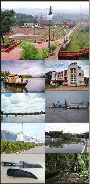
| Authority control |
|
|---|
- "dchb malappuram" (PDF). censusindia.gov.in.