Manjeri
Manjeri is a major town and the largest municipality in Malappuram district, Kerala, India. It is the fourth-most populous municipality in the state and the largest in the district.[3] It is situated 23 kilometres (14 mi) southeast to Karipur International Airport and 13 kilometres (8.1 mi) northeast to the district headquarters, and forms a part of Malappuram metropolitan area. It is one of the major commercial towns under the Malappuram urban agglomeration and serves as the headquarters of Eranad Taluk. Manjeri Municipality is a Local Self Government Institution with a jurisdiction of three villages namely Manjeri, Payyanad, and Narukara.
Manjeri | |
|---|---|
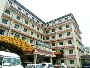
 A view of Manjeri town | |
 Manjeri  Manjeri  Manjeri .svg.png.webp) Manjeri | |
| Coordinates: 11.12°N 76.12°E | |
| Country | |
| State | Kerala |
| District | Malappuram |
| Government | |
| • Type | Municipality |
| • Body | Manjeri Municipality |
| • Chairperson | V. M. Subaida (IUML)[1] |
| • Vice chairman | V. P. Firoz (INC)[1] |
| Area | |
| • Total | 53.10 km2 (20.50 sq mi) |
| Elevation | 38 m (125 ft) |
| Population (2011)[2] | |
| • Total | 97,102 |
| • Density | 1,829/km2 (4,740/sq mi) |
| Languages | |
| • Official | Malayalam, English |
| Human Development | |
| • Sex ratio (2011) | 1059 ♀/1000♂[2] |
| • Literacy (2011) | 95.76%[2] |
| Time zone | UTC+5:30 (IST) |
| PIN | 676121, 676122, 676123 |
| Telephone code | 0483 |
| Vehicle registration | KL-10 |
| Metropolitan area | Malappuram metropolitan area |
| Website | www |


History
The remains of pre-historic symbols including Dolmens, Menhirs, and Rock-cut caves that have been found from various parts of Manjeri indicates human life at the region in the Stone Age itself.[4] The region was under the control of Zamorins in medieval period. There was a set pattern of succession, indicated by Sthanams (ranks) in the royal line in the Kingdom of Zamorins.[5] Five Sthanams were defined in the kingdom of Zamorin, each with its own separate property enjoyed in succession by the senior members of the three Kovilakams (palaces) of the family[6] . One of these five Sthanams came to be known as Edattaranadu Nambiyathiri Thirumulpadu (the Etatralpadu), which is mentioned in the Manjeri Pulapatta inscription as the overlord of the "Three Hundred" Nairs. The Etatralpadu used to reside in a palace at Edathara near Manjeri.[7]
Manjeri was once the headquarters and the military centre of the Kingdom of Mysore under Tipu Sultan.[8] Under British rule, Manjeri served as the administrative headquarters of Eranad subdistrict, which was the largest subdistrict within the Malabar District. In 1896, the landlords of Manjeri Kovilakam started to evacuate the tenants from their lands. The landless tenants started to revolt under the leadership of Variyan Kunnathu Kunjahammed Haji. They seized the land and properties of the landlords. British army came to help the landlords. The conflict caused the British to risk 94 out of 100 soldiers.[9]
The Malabar district political conference of Indian National Congress held at Manjeri on 28 April 1920, fueled Indian independence movement and national movement in British Malabar.[10] That conference declared that the Montagu–Chelmsford Reforms were not able to satisfy the needs of British India. It also argued for a land reform to seek solutions for the problems caused by tenancy that existed in Malabar. However, the decision widened the drift between extremists and moderates within the Congress. The conference resulted in dissatisfaction of landlords with the Indian National Congress. It caused the leadership of the Malabar district Congress Committee to come under the control of the extremists who stood for labourers and the middle class.[11]
The region has been part of movements such as Khilafat Movement and Malabar rebellion following the Manjeri conference. It was one of the strongholds of the Malabar Rebellion in 1921. Manjeri police station was destructed by the rebels on 21 August 1921. The protestors won in removing the colonial rule from the region and establish self-rule for about six months.[8] After Indian independence in 1947, the region continued in Malabar District. In 1969, it became a part of the newly formed Malappuram district. Now it forms a part of the Malappuram metropolitan area.
Demographics
Total population under municipality limits is 97,102 according to the 2011 census. Males form 48.6% and females 51.4%.[2] Malayalam is the widely spoken language in the town. Manjeri has been a multi-ethnic and multi-religious town since the early medieval period. The Muslims form the largest religious group, followed by Hindus and Christians.[12] The municipality of Manjeri has an average literacy rate of 95.8%.[2]
Geography
Manjeri is located at 11.12°N 76.12°E.[13] It has an average elevation of 38 metres (124 feet) from sea level.
Civic administration
The town is administered by the Manjeri Municipality, headed by a chairperson. For administrative purposes, the town is divided into 50 wards,[1] from which the members of the municipal council are elected for five years. The municipality comes under the jurisdiction of Manjeri police station, which was formed on 14 April 1879.[14] The apex district court of Malappuram district is at Manjeri and the judicial district is known as Manjeri judicial district.[15]
Manjeri Municipality Election 2015[16]
| S.No. | Party Name | Party symbol | Number of Councillors |
|---|---|---|---|
| 01 | UDF | 34 | |
| 02 | LDF | 11 | |
| 03 | Independents |  | 04 |
 BJP | 00 | |
See also
References
- "Manjeri municipality". lsgkerala. Retrieved 18 August 2020.
- Directorate of Census Operations, Kerala. District Census Handbook, Malappuram (PDF). Thiruvananthapuram: Directorate of Census Operations, Kerala. pp. 154–155. Retrieved 18 August 2020.
- "Alphabetical list of towns and their population (Kerala)" (PDF). censusindia.gov.in. Government of India. Retrieved 21 December 2020.
- "History of Malappuram" (PDF). censusindia.gov.in. Retrieved 17 April 2020.
- V. V., Haridas. "King court and culture in medieval Kerala – The Zamorins of Calicut (AD 1200 to AD 1767)". Unpublished Ph.D. Thesis. Mangalore University
- K. V. Krishna Iyer, Zamorins of Calicut: From the earliest times to AD 1806. Calicut: Norman Printing Bureau, 1938.
- Narayanan, M. G. S. (1996). Perumals of Kerala: Political and Social Conditions of Kerala Under the Cēra Perumals of Makotai (c. 800 A.D.-1124 A.D.). Xavier Press.
- "History of Manjeri". Incredible India. Retrieved 18 August 2020.
- Menon, MPS (1992). Malabar Samaram MP Narayanamenonum Sahapravarthakarum. Kozhikkode: Islamic Publishing House. p. 77. ISBN 81-8271-100-2.
- "The 1920 political conference at Manjeri". Deccan Chronicle. 29 June 2016. Retrieved 18 July 2020.
- Sreedhara Menon, A. (December 2019). A Survey of Kerala History (2019 ed.). Kottayam: DC Books. ISBN 9788126415786.
- "Religion – Kerala, Districts and Sub-districts". Census of India 2011. Office of the Registrar General.
- Falling Rain Genomics, Inc - Manjeri
- "Manjeri PS". Kerala police. Retrieved 18 August 2020.
- "Manjeri judicial district". ecourt. Retrieved 18 August 2020.
- "Manjeri Municipality election 2015". lbtrend. Retrieved 11 December 2020.
External links
| Wikimedia Commons has media related to Manjeri. |
| Wikivoyage has a travel guide for Manjeri. |