Quebec Route 279
Route 279 is a 48 km two-lane north-south highway in Quebec, Canada, which starts in Beaumont at the junction of Route 132 and ends in Notre-Dame-Auxiliatrice-de-Buckland at the junction of Route 216. The road goes through the Grande Plée Bleue between Beaumont and Saint-Charles-de-Bellechasse, crosses the Boyer River in St-Charles, and slowly goes up the Appalachian Mountains.
| ||||
|---|---|---|---|---|
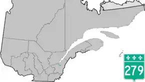 | ||||
| Route information | ||||
| Length | 48.0 km[1] (29.8 mi) | |||
| Major junctions | ||||
| North end | ||||
| South end | ||||
| Location | ||||
| Major cities | Saint-Charles-de-Bellechasse | |||
| Highway system | ||||
| ||||

Towns along Route 279
- Beaumont
- Saint-Charles-de-Bellechasse
- Saint-Gervais
- Saint-Lazare-de-Bellechasse
- Saint-Damien-de-Buckland
- Buckland
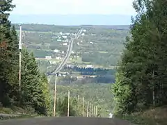 Route 279 climbs appalachian hills near Notre-Dame-Auxiliatrice-de-Buckland.
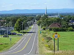 Quebec Route 279 at Saint-Gervais.
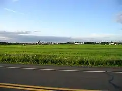 Route 279 in Saint-Charles,
See also
References
- Ministère des transports, "Distances routières", page (?), Les Publications du Québec, 2005
External links
- Provincial Route Map (Courtesy of the Quebec Ministry of Transportation) (in French)
- Route 279 on Google Maps
This article is issued from Wikipedia. The text is licensed under Creative Commons - Attribution - Sharealike. Additional terms may apply for the media files.