Quiçama
Quiçama (Portuguese spelling), Kissama or Kisama (Bantu spelling) is one of the seven municípios (city council[2][3] or municipality) that make up the province of Luanda, as per the new administrative division of the province (the others being, Luanda, Belas, Cazenga, Cacuaco, Viana and Icolo e Bengo).[2] It covers an area of 13,900 square kilometres (5,400 sq mi) and its population as of 2014 is 26,546.[1] The municipal seat is the village of Muxima.
Quiçama | |
|---|---|
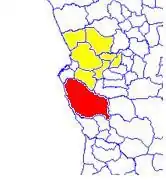 Quiçama (red) in Bengo province (yellow) | |
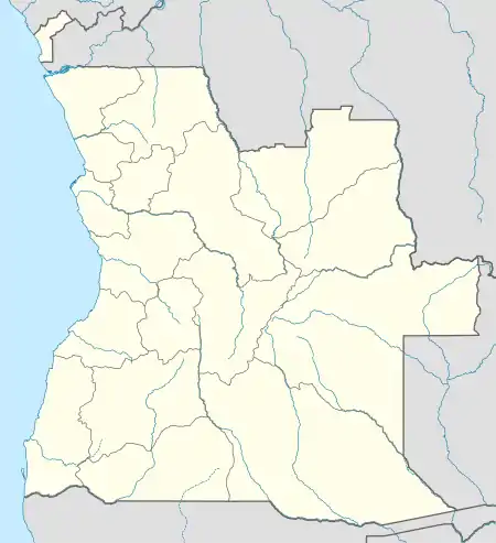 Quiçama Location in Angola | |
| Coordinates: 09°31′S 013°58′E | |
| Country | |
| Province | Luanda Province |
| Area | |
| • Total | 13,900 km2 (5,400 sq mi) |
| Population (2014 census)[1] | |
| • Total | 26,546 |
| • Density | 3.37/km2 (8.7/sq mi) |
| Time zone | UTC+1 (WAT) |
Quiçama is bordered to the north by the municipalities of Viana and Icolo e Bengo, to the east by the municipalities of Cambambe, Libolo and Quibala, to the south by the municipalities of Quilenda and Porto Amboim, and to the west by the Atlantic Ocean.
Part of the municipality is occupied by the Quiçama National Park (Portuguese: Parque Nacional da Quiçama).
Administrative division
The municipality of Quiçama is made up of five comunas (communes), as follows:
References
- "Resultados Definitivos Recenseamento Geral da População e da Habitação – 2014 Província de Luanda" (PDF). Instituto Nacional de Estatística, República de Angola. Retrieved 3 May 2020.
- "Reference Center: Provinces". Angolan Embassy in the United States. Archived from the original on 11 February 2006.
- "City councils of Angola". Statoids. Retrieved 6 Apr 2009.