Quingey
Quingey is a commune and former canton seat in the Doubs department in the Bourgogne-Franche-Comté region in eastern France.
Quingey | |
|---|---|
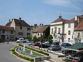
 Town hall | |
 Coat of arms | |
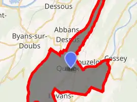
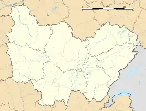
Location of Quingey 
| |
 Quingey  Quingey | |
| Coordinates: 47°06′15″N 5°53′01″E | |
| Country | France |
| Region | Bourgogne-Franche-Comté |
| Department | Doubs |
| Arrondissement | Besançon |
| Canton | Saint-Vit |
| Intercommunality | Loue-Lison |
| Government | |
| • Mayor (2014–2020) | Sarah Faivre |
| Area 1 | 8.55 km2 (3.30 sq mi) |
| Population (2017-01-01)[1] | 1,430 |
| • Density | 170/km2 (430/sq mi) |
| Time zone | UTC+01:00 (CET) |
| • Summer (DST) | UTC+02:00 (CEST) |
| INSEE/Postal code | 25475 /25440 |
| Elevation | 259–522 m (850–1,713 ft) |
| 1 French Land Register data, which excludes lakes, ponds, glaciers > 1 km2 (0.386 sq mi or 247 acres) and river estuaries. | |
Geography
Quingey lies 20 km (12 mi) southwest of Besançon and 30 km (19 mi) east of Dole in the department of Jura.
The commune is at the western extremity of the department of Doubs, a dozen km from the department of Jura. The river Loue runs through it. On the north is the valley of the Doubs River, the vast forests of Chaux and the Val d'Amour lie on the west, the mountains of Salins on the south, and the valley of the Lison on the east.
As the Loue traverses this alluvial plain, it is barred by numerous natural dams. The plain is surrounded by peaks between 470 m and 850 (the Mont Poupet).
History
Situated on the Roman road between Lyon and Strasbourg, its history goes back to the third century.
The last vestiges of its fortifications were destroyed in 1823, but the bridge over the Loue dates from 1590. It was slightly rebuilt in 1844.
Pope Calistus II was born in Quingey in c. 1065.
Population
| Year | Pop. | ±% |
|---|---|---|
| 1962 | 836 | — |
| 1968 | 854 | +2.2% |
| 1975 | 936 | +9.6% |
| 1982 | 920 | −1.7% |
| 1990 | 980 | +6.5% |
| 1999 | 1,049 | +7.0% |
| 2008 | 1,274 | +21.4% |
| 2012 | 1,366 | +7.2% |
See also
References
- "Populations légales 2017". INSEE. Retrieved 6 January 2020.
