Jougne
Jougne is a commune in the Doubs department in the Bourgogne-Franche-Comté region in eastern France.
Jougne | |
|---|---|
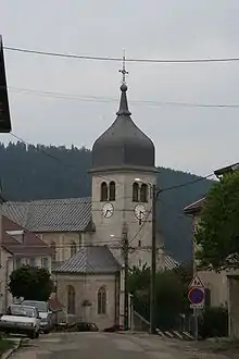
 Town hall | |
 Coat of arms | |
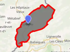
Location of Jougne 
| |
 Jougne  Jougne | |
| Coordinates: 46°45′51″N 6°23′19″E | |
| Country | France |
| Region | Bourgogne-Franche-Comté |
| Department | Doubs |
| Arrondissement | Pontarlier |
| Canton | Frasne |
| Government | |
| • Mayor (2008–2014) | Michel Morel |
| Area 1 | 29.03 km2 (11.21 sq mi) |
| Population (2017-01-01)[1] | 1,858 |
| • Density | 64/km2 (170/sq mi) |
| Time zone | UTC+01:00 (CET) |
| • Summer (DST) | UTC+02:00 (CEST) |
| INSEE/Postal code | 25318 /25370 |
| Elevation | 809–1,463 m (2,654–4,800 ft) |
| 1 French Land Register data, which excludes lakes, ponds, glaciers > 1 km2 (0.386 sq mi or 247 acres) and river estuaries. | |
Geography
The commune is situated 19 km (12 mi) from Pontarlier and 4.5 km (2.8 mi) from the Swiss border. It lies in the Jura Mountains, which form the border between France and Switzerland.
It dominates the valley of the Jougnena. From Piquemiette, there are views of the Alps.
History

In the Middle Ages, Jougne was an important toll station on the road to Italy. Of the ancient fortifications, a gate and ramparts, as well as ruins of the fort, remain.
The chapel of Saint Maurice dates from the twelfth century and has a Carolingian crypt.
Population
| Year | Pop. | ±% |
|---|---|---|
| 1962 | 744 | — |
| 1968 | 815 | +9.5% |
| 1975 | 858 | +5.3% |
| 1982 | 866 | +0.9% |
| 1990 | 1,162 | +34.2% |
| 1999 | 1,198 | +3.1% |
| 2008 | 1,376 | +14.9% |
| 2012 | 1,470 | +6.8% |
Tourism
Jougne is a tourist town noted for winter sports. The ski resort of Piquemiette caters to alpine skiers, but there are also hiking and cross-country ski trails in the forest of la Joux.
There is also an animal museum and numerous hotels and restaurants.
See also
References
- "Populations légales 2017". INSEE. Retrieved 6 January 2020.