Río de los Remedios metro station
Río de los Remedios is a station on Line B of the Mexico City Metro system.[2][3] It is located on the Anillo Periférico and Boulevard Río de los Remedios in the Colonia Valle de Aragón 2a. Sección neighborhood of the Nezahualcóyotl municipio in Mexico State.[2]
| STC rapid transit | |||||||||||
 Rio de los Remedios entrance, 24 July 2012 | |||||||||||
| Location | Nezahualcóyotl, State of Mexico Mexico | ||||||||||
| Coordinates | 19°29′27″N 99°02′48″W | ||||||||||
| Platforms | 1 island platform | ||||||||||
| Tracks | 2 | ||||||||||
| Construction | |||||||||||
| Structure type | Surface | ||||||||||
| History | |||||||||||
| Opened | 30 November 2000 | ||||||||||
| Passengers | |||||||||||
| 2018 | 7,787,996[1] | ||||||||||
| Rank | 83/195[1] | ||||||||||
| Services | |||||||||||
| |||||||||||
| Location | |||||||||||
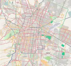
 Río de los Remedios Location within Greater Mexico City | |||||||||||
The station was opened on 30 November 2000.[4]
References
- "Afluencia de estación por línea 2018" (in Spanish). Sistema Transporte Colectivo Metro. 2019. Archived from the original on 6 June 2019. Retrieved 8 April 2020.
- "Río de los Remedios" (in Spanish). Archived from the original on 25 August 2012. Retrieved 6 August 2011.
- Archambault, Richard. "Río de los Remedios » Mexico City Metro System". Retrieved 6 August 2011.
- Monroy, Marco. Schwandl, Robert (ed.). "Opening Dates for Mexico City's Subway". Retrieved 5 August 2011.
External links
- Monzón, Jorge Arturo. "world.nycsubway.org/ Photos 1-12 of 12: Río de los Remedios". Retrieved 28 August 2011.
This article is issued from Wikipedia. The text is licensed under Creative Commons - Attribution - Sharealike. Additional terms may apply for the media files.