Racovița, Sibiu
Racovița (Racovița-Olt until 1931; German: Rakowitza or Rakevets; Hungarian: Oltrákovica or colloquially Rákovica) is a commune in Sibiu County, Transylvania, Romania. It has a population of 2,884 inhabitants (2002 census) and is composed of two villages, Racovița and Sebeșu de Sus (Oltfelsősebes).
Racovița | |
|---|---|
 Location in Sibiu County | |
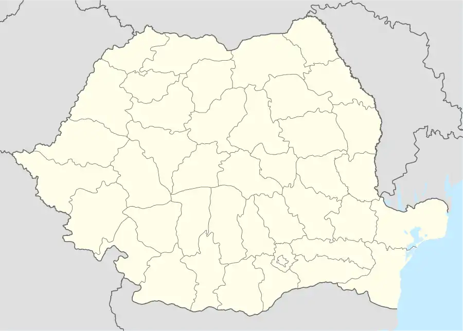 Racovița Location in Romania | |
| Coordinates: 45°40′45″N 24°20′38″E | |
| Country | |
| County | Sibiu |
| Established | 1443 (first mentioned) |
| Subdivisions | Racovița, Sebeșu de Sus |
| Government | |
| • Mayor | Olariu Simion (since 2008) (PNL) |
| Area | 34.5 km2 (13.3 sq mi) |
| Population (2011)[1] | 2,760 |
| • Density | 80/km2 (210/sq mi) |
| Time zone | EET/EEST (UTC+2/+3) |
| Postal code | 557195 |
| Vehicle reg. | SB |
| Website | racovita-sb |
The first official mention of the then-village was in a May 22, 1443 "gift" act of John Hunyadi. Church documents first mention the village on July 8, 1647, when George I Rákóczi names Ion din Ţichindeal as archpriest over 17 villages around Sibiu, including Racovița. The rich history of the village is linked to the military border with Transylvania established by empress Maria Theresa of Austria in 1765. At the time, Racovița was part of the 7th Company of the First Border Regiment in Orlat.
Starting in 1698, before the village was completely militarized, the village and its area were confronted with severe religious conflicts due to the decision made by the Alba-Iulia Orthodox Church to unite with the Catholic Church.
Soldiers and villagers participated enthusiastically in the Hungarian Revolution of 1848. Once the military border was abolished in 1851, important village members took initiative to manage the Regiment School Funds and became actively involved in the Transylvanian Association for Romanian Literature and the Culture of Romanian People.
During World War I soldiers from Racovița were involved from 1916 to 1918 and received distinctions for fighting against "Russian Poland", Galicia, Albania, Italy, Serbia and even France.
Geography
Racovița Commune, is situated at the base of Suru Peak (2,281 m or 7,484 ft) on the contact between the foothills of the Făgăraș Mountains and the low terrace of the floodplain, on the left bank of the Olt River, at an altitude of 385 meters.[2] The commune is borders to the north and northeast with the town Avrig, border which extends from the confluence of the Mârșa Valley with the Olt River to the Sorliţei Peak, border established after the year 1200 [3] and marked with border signs called 'morminți'.
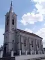 Holy Trinity Church, dedicated in 1887
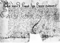 The first document mentioning the locality, May 22, 1443
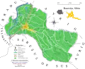 Toponymic map of Racovița village
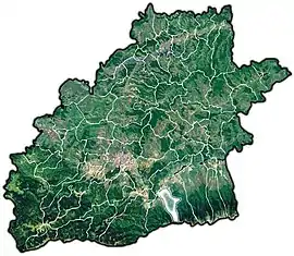
References
- "Populaţia stabilă pe judeţe, municipii, oraşe şi localităti componenete la RPL_2011" (in Romanian). National Institute of Statistics. Retrieved 4 February 2014.
- Altitudes are taken from the "Touristenkarte der Section "Hermannstadt" de S.K.V, Blatt II (Fogarascher Gebirge), Hermannstadt, 1921
- S. Lupşa, Satul lui Gheorghe Lazăr, in "Mitropolia Ardealului", VII, nr.7-8/1962, p.483, n.5.