Rahata taluka
Rahata taluka, is a taluka in Shrirampur subdivision of Ahmednagar district in Maharashtra State of India.[1]
Rahata taluka | |
|---|---|
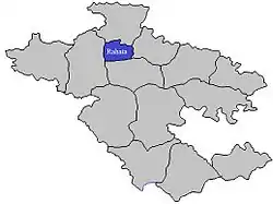 Location of Rahata in Ahmednagar district in Maharashtra | |
| Country | |
| State | Maharashtra |
| District | Ahmednagar district |
| Headquarters | Shrirampur |
| Area | |
| • Total | 759.19 km2 (293.12 sq mi) |
| Population (2001) | |
| • Total | 288,003 |
| • Density | 380/km2 (980/sq mi) |
| Demographics | |
| • Sex ratio | 68.16 |
Area
The table below shows area of the taluka by land type.[2]
| Type of Land | Area (km2) | % of Total Area |
|---|---|---|
| Agriculture | 689.39 | 90.81 |
| Forest | 16.13 | 2.12 |
| Other | 53.67 | 7.07 |
| Total | 759.19 | 100 |
Villages
There are around 60 villages in Rahata taluka. For list of villages see Villages in Rahata taluka.
Population
The table below shows population of the taluka by sex. The data is as per 2001 census.[3]
| Population | % of Total Population | Number of Literate | Literacy (% of Population) | |
|---|---|---|---|---|
| Male | 148642 | 51.61 | 112294 | 75.55 |
| Female | 139361 | 48.39 | 84002 | 60.28 |
| Total | 288003 | 100 | 196296 | 68.16 |
Rain Fall
The Table below details of rainfall from year 1981 to 2004.[4]
| Year | Rainfall (mm) |
|---|---|
| 2000 | 525 |
| 2001 | 413 |
| 2002 | 385 |
| 2003 | 249 |
| 2004 | 491 |
References
Ahmednagar district topics | ||
|---|---|---|
| History | 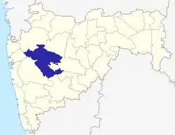 | |
| Geography | ||
| Talukas | ||
| Cities and towns | ||
| Monuments | ||
| Education | ||
| Lok Sabha constituencies | ||
| Vidhan Sabha constituencies | ||
| Dams in District | ||
This article is issued from Wikipedia. The text is licensed under Creative Commons - Attribution - Sharealike. Additional terms may apply for the media files.