Ahmednagar
Ahmednagar (![]() pronunciation ) is a city in Ahmednagar district in the state of Maharashtra, India, about 120 km northeast of Pune and 114 km from Aurangabad. Ahmednagar takes its name from Ahmad Nizam Shah I, who founded the town in 1494 on the site of a battlefield where he won a battle against superior Bahamani forces.[2] It was close to the site of the village of Bhingar.[2] With the breakup of the Bahmani Sultanate, Ahmad established a new sultanate in Ahmednagar, also known as Nizam Shahi dynasty.[3]
pronunciation ) is a city in Ahmednagar district in the state of Maharashtra, India, about 120 km northeast of Pune and 114 km from Aurangabad. Ahmednagar takes its name from Ahmad Nizam Shah I, who founded the town in 1494 on the site of a battlefield where he won a battle against superior Bahamani forces.[2] It was close to the site of the village of Bhingar.[2] With the breakup of the Bahmani Sultanate, Ahmad established a new sultanate in Ahmednagar, also known as Nizam Shahi dynasty.[3]
Ahmednagar | |
|---|---|
City | |
 Ahmednagar Station | |
 Ahmednagar  Ahmednagar 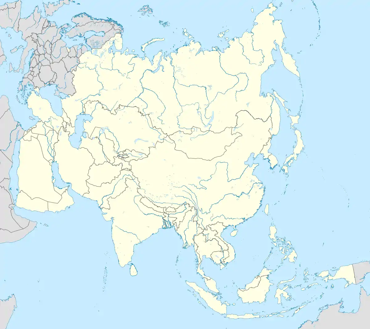 Ahmednagar | |
| Coordinates: 19.08°N 74.73°E | |
| Country | |
| State | Maharashtra |
| District | Ahmednagar |
| Founded by | Ahmad Nizam Shah I in 1490. |
| Government | |
| • Type | Mayor–Council |
| • Mayor | Baba Wakale (BJP) |
| Area | |
| • Total | 39.30 km2 (15.17 sq mi) |
| Elevation | 649 m (2,129 ft) |
| Population (2011)[1] | |
| • Total | 350,905 |
| • Rank | 124th |
| • Density | 8,900/km2 (23,000/sq mi) |
| Demonym(s) | Nagarkar / Nagari (Marathi) |
| Languages | |
| • Official | Marathi |
| Time zone | UTC+5:30 (IST) |
| PIN | 414001, 414003 |
| Telephone code | 0241 |
| Vehicle registration | MH 16,17 |
| Website | ahmednagar |
Ahmednagar has several dozen buildings and sites from the Nizam Shahi period.[4] Ahmednagar Fort, once considered almost impregnable, was used by the British to house Jawaharlal Nehru (the first prime minister of India) and other Indian Nationalists before Indian independence. A few rooms there have been converted to a museum. During his confinement by the British at Ahmednagar Fort in 1944, Nehru wrote the famous book The Discovery of India.[5] Ahmednagar is home to the Indian Armoured Corps Centre & School (ACC&S), the Mechanised Infantry Regimental Centre (MIRC), the Vehicle Research and Development Establishment (VRDE) and the Controllerate of Quality Assurance Vehicles (CQAV). Training and recruitment for the Indian Army Armoured Corps takes place at the ACC&S.[6]
Ahmednagar is a relatively small town and shows less development than the nearby western Maharashtra cities of Mumbai and Pune. Ahmednagar is home to 19 sugar factories and is also the birthplace of the cooperative movement. Due to scarce rainfall, Ahmednagar often suffers from drought. Marathi is the primary language for daily-life communication. Ahmednagar has recently published a plan of developing the city by year 2031.[7]
History
The town Ahmednagar was founded in 1490 by Ahmad Nizam Shah I on the site of a more ancient city, Bhingar. With the breakup of the Bahmani Sultanate, Ahmad established a new sultanate in Ahmednagar, also known as Nizam Shahi dynasty.[8]
It was one of the Deccan sultanates, which lasted until its conquest by Mughal emperor Shah Jahan in 1636. Aurangzeb, the last Mughal emperor, who spent the latter years of his reign, 1681–1707, in the Deccan, died in Ahmednagar and is buried at Khuldabad, near Aurangabad in 1707, with a small monument marking the site.
In 1759, the Peshwa of the Marathas obtained possession of the place from Nizam of Hyderabad and in 1795 it was ceded by the Peshwa to the Maratha chief Daulat Rao Sindhia. Ahmednagar was besieged by a British force under Richard Wellesley and captured. It was afterward restored to the Marathas, but again came into the possession of the British in 1817, according to the terms of the Treaty of Poona, and was known as Ahmednuggur.
Military base
Ahmednagar is home to the Indian Armoured Corps Centre & School (ACC&S), the Mechanised Infantry Regimental Centre (MIRC), the Vehicle Research and Development Establishment (VRDE) and the Controllerate of Quality Assurance Vehicles (CQAV). Training and recruitment for the Indian Army Armoured Corps take place at the ACC&S. Formerly, the city was the Indian base of the British Army's Royal Tank Corps / Indian Armoured Corps, amongst other units. The town-houses the second-largest display of military tanks in the world and largest in Asia.[9]
Geography
Climate
Situated in the rain-shadow region of the Western Ghats, Ahmednagar experiences primarily hot and dry climate through November to mid-June.
| Climate data for Ahmednagar (1981–2010, extremes 1901–2012) | |||||||||||||
|---|---|---|---|---|---|---|---|---|---|---|---|---|---|
| Month | Jan | Feb | Mar | Apr | May | Jun | Jul | Aug | Sep | Oct | Nov | Dec | Year |
| Record high °C (°F) | 36.1 (97.0) |
38.9 (102.0) |
43.2 (109.8) |
43.5 (110.3) |
44.0 (111.2) |
43.3 (109.9) |
37.7 (99.9) |
39.5 (103.1) |
38.2 (100.8) |
39.7 (103.5) |
35.6 (96.1) |
35.6 (96.1) |
44.0 (111.2) |
| Average high °C (°F) | 30.1 (86.2) |
32.3 (90.1) |
35.7 (96.3) |
38.6 (101.5) |
38.6 (101.5) |
33.1 (91.6) |
29.7 (85.5) |
29.2 (84.6) |
29.9 (85.8) |
31.8 (89.2) |
30.3 (86.5) |
29.5 (85.1) |
32.4 (90.3) |
| Average low °C (°F) | 11.7 (53.1) |
13.3 (55.9) |
16.8 (62.2) |
20.4 (68.7) |
22.5 (72.5) |
22.1 (71.8) |
21.4 (70.5) |
20.9 (69.6) |
20.4 (68.7) |
18.3 (64.9) |
15.0 (59.0) |
11.6 (52.9) |
17.9 (64.2) |
| Record low °C (°F) | 1.8 (35.2) |
2.8 (37.0) |
7.5 (45.5) |
9.5 (49.1) |
15.2 (59.4) |
17.0 (62.6) |
16.5 (61.7) |
12.2 (54.0) |
10.7 (51.3) |
10.6 (51.1) |
5.6 (42.1) |
3.3 (37.9) |
1.8 (35.2) |
| Average rainfall mm (inches) | 0.3 (0.01) |
0.8 (0.03) |
1.9 (0.07) |
4.1 (0.16) |
22.7 (0.89) |
124.5 (4.90) |
90.9 (3.58) |
99.6 (3.92) |
186.9 (7.36) |
72.0 (2.83) |
24.8 (0.98) |
6.8 (0.27) |
635.4 (25.02) |
| Average rainy days | 0.0 | 0.3 | 0.3 | 0.5 | 1.3 | 6.4 | 6.0 | 5.0 | 8.8 | 4.2 | 1.0 | 0.4 | 34.3 |
| Average relative humidity (%) (at 17:30 IST) | 37 | 32 | 26 | 23 | 30 | 58 | 68 | 70 | 68 | 57 | 52 | 43 | 48 |
| Source: India Meteorological Department[10][11] | |||||||||||||
Demographics
As of 2011 Indian census,[12] Ahmednagar had a population of 347,549. Males constitute 53% of the population and females 47%. Ahmednagar has an average literacy rate of 84%, higher than the national urban average of 79.9%.[13] 10% of the population is under 6 years of age.
Notable people
- Sant Dnyaneshwar, Marathi sant, wrote Dnyaneshwari, a discourse on the Bhagavad Gita.
- Bahirji Naik, Head of Intelligence Agency of Shivaji's army.
- Sai Baba of Shirdi, spiritual master
- Anand Rishiji, Jain saint
- Meher Baba, spiritual leader
- Chand Bibi, Nizamshahi princess, defended Ahmednagar Fort against the Mughal forces of Emperor Akbar
- Malik Ambar, Siddi military leader who lead a successful guerrilla war to defend Ahmednagar against the Mughal Empire
- Anna Hazare, Gandhian and social activist
- Shahu Modak, film actor
- Sadashiv Amrapurkar, noted film and theater actor
- Michael J. S. Dewar, theoretical chemist
- Anna Leonowens, educator, feminist, author of The English Governess at the Siamese Court (1870)
- Pramod Kamble, painter and sculptor
- Zaheer Khan, cricketer
- Ajinkya Rahane, cricketer
- Spike Milligan, 1918–2002, comedian and author
- Cynthia Farrar, American missionary
- Narayan Waman Tilak, Christian Writer, Poet, Pastor
- Popatrao Baguji Pawar, Padmashri, Sarpanch Hiware Bazar
- Rajanikant Arole, Doctor, Magsaysay Winner, Padmabhushan
Tourist places
- Tomb of Salabat Khan II - also called the Chand Bibi Palace,[15] this is a solid three-storey stone structure situated on the crest of a hill 13 km from Ahmednagar city.
- Meherabad, where the samadhi (tomb) of the spiritual master Meher Baba is a place of pilgrimage, particularly on the anniversary of his death, Amartithi. His later residence was at Meherazad (near Pimpalgaon village), approximately nine miles north of Ahmednagar.
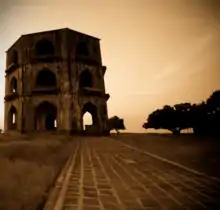
- Ahmednagar Fort (Bhuekot Killa) - Built by Ahmed Nizam Shah in 1490, this is one of the best-designed and most impregnable forts in India. As of 2013, it is under the control of the military command of India.[16]
- Cavalry Tank Museum - The Armoured Corps Centre and School has created a museum with an extensive collection of 20th-century armoured fighting vehicles.[17]
- Ralegan Siddhi - a village which is a model for environmental conservation. Social activist Anna Hazare is from Ralegan Siddhi.
- Pimpri Gawali- is a village in Parner taluka, about 25 km away from Ahmednagar and known for the watershed development and agribusiness activities.
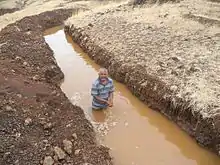 Deep Continuous Contour Trenches (CCT)
 - Avhane, Shevgaon - Temple of Ganesh (Nidrista/Sleeping).
- Shri Munjaba Tample, Ukkadgaon- In Shrigonda Taluka about 60 km from Ahmednagar main city it is very beautiful Temple with four big statue of ganapati, mahadev (shankar), vishnu and hanuman on Temple and thousands of devotees visit this place.
- Jamgaon- Place in Parner taluka with a historic 18th-century palace built by Mahadaji Shinde.
- Shree Kshetra Korthan Khandoba Devastan Temple of Lord Khandoba.
- Mahatma Phule Krishi Vidyapeeth, Rahuri Mahatma Phule Krishi Vidyapeeth is an agricultural university at Rahuri, named after an activist and social reformer of 19th century—one of four agricultural universities in the state.[18]
- Mula Dam: It is 52 KMS from the Ahmednagar City
Transport
Air
Ahmednagar city has air connectivity by Seaplane service. The port for Seaplane is located at the Mula Dam water reservoir, 30 min away from Ahmednagar City. The service offered by Maritime Energy Heli Air Services Pvt. Ltd. (MEHAIR) from 22 September 2014. Ongoing Flight is available from Juhu, Mumbai to Mula Dam. The service will now enable the large number of pilgrims traveling to the holy sites of Meherabad, Shirdi and Shani Shingnapur to travel quickly and conveniently to their destinations. Now the new airport has started at Shirdi which is 80 km from Ahmednagar and the only airport in the district. Regular flights from Mumbai, Delhi, and Hyderabad fly to Shirdi. Currently, it is served by Air India and SpiceJet.
Rail
Ahmednagar railway station (station code:ANG) belongs to Solapur Division of Central Railway zone of the Indian Railways. Ahmednagar has rail connectivity with Pune, Manmad, Kopargaon, Shirdi, Daund, Goa, Nasik and other metro-cities like New Delhi, Mumbai, Chennai, Kolkata, Bangalore, Ahmedabad. 41 express trains stop at this station. There is still a demand for direct rail connectivity to other major cities of India.
Road
Ahmednagar is well connected by roads with major cities of Maharashtra and other states. Ahmednagar has 4 lane road connectivity to Aurangabad, Parbhani, Pune, Nashik, Beed, Solapur, Osmanabad.National Highway 222 from Kalyan to Nirmal near Adilabad in Telangana passes through the city. The Maharashtra State Road Transport Corporation (MSRTC) and different private transport operators provide bus service connecting the city to all parts of the state.
Ahmednagar has 3 main bus stands:
Intra city transport
Several ways to have a commute in the city. Autorickshaws, which can be trusted as a private commute in the city. Sharing rikshaws also been part of the daily life of the citizen. Newly bus service has been established by Municipal corporation in the month of July 2019 which can turn a safer and cheaper commute to the citizens in the future. Main routes in the city are:
- Maliwada Bus stand to Nirmalnagar via Delhi gate, Patrakar chowk, Premdan chowk, Professor colony, and Pipeline road.
- Maliwada Bus stand to Dr.Vikhe Patil College, Vilad ghat. via Delhi gate, Patrakar chowk, Premdan chowk, Savedi naka, Nagapur MIDC, and New Nagapur.
- Maliwada Bus stand to Kedgaon via Sakkar chowk, Kinetic Chowk, Railway flyover and Ambikanagar.
- Maliwada Bus stand to Bhingar via Market Yard chowk, Nagar college, GPO Chowk, Ahmednagar fort, Shukrawar Bazaar, and Bhingar wes.
- Maliwada Bus stand to Nimbalak via Delhigate, Patrakar chowk, Premdan chowk, Savedi naka and Nagapur MIDC
Politics
Ahmednagar Municipal Council was upgraded to Municipal Corporation status in 2003. As of Dec 2018, Babasaheb Wakale of BJP was the incumbent mayor. Ahmednagar city is represented in the central and state legislatures by the Ahmednagar Lok Sabha and Ahmednagar City Vidhan Sabha seats respectively. The Sitting MP is Dr.Sujay Vikhe Patil and while seating MLA is Sangram Jagtap.
Media and communication
- Newspapers: Lokmat, Sakaal, Sarvamat, Deshdoot, Punyanagri, Samana, Loksatta, Nava Maratha, Nagar Times, Divya Marathi, Maharashtra Times, Samachar, Savedi Mitra
- TV Channel: CMN Channel
- Radio: 104 MY FM, AIR Nagar FM, Radio City, Dhamaal 24, Radio Nagar FM
- Internet: Internet facilities are provided by several suppliers
References
- "Cities having population 1 lakh and above" (PDF). censusindia. The Registrar General & Census Commissioner, India. Retrieved 29 December 2012.
- The Kingdom of Ahmadnagar. Motilal Banarsidass. 1966. p. 38. ISBN 978-81-208-2651-9.
- Sen, Sailendra (2013). A Textbook of Medieval Indian History. Primus Books. pp. 118–119. ISBN 978-9-38060-734-4.
- Sohoni, Pushkar (2015). Aurangabad with Daulatabad, Khuldabad, and Ahmadnagar. London; Mumbai: Deccan Heritage Foundation; Jaico. ISBN 9788184957020.
- Moraes, Frank (1 January 2007). Jawaharlal Nehru. Jaico Publishing House. p. 319. ISBN 978-81-7992-695-6.
- Sainik Samachar: The Pictorial Weekly of the Armed Forces. 1988. p. 14.
- Nagarick (6 June 2007). "Ahmednagar by year 2031". Nagarick.blogspot.com. Retrieved 23 November 2011.
- Sohoni, Pushkar (2018). The Architecture of a Deccan Sultanate: Courtly Practice and Royal Authority in Late Medieval India. London: I.B. Tauris. ISBN 9781784537944.
- "The History of Ahmednagar". Ahmednagar.nic.in. 15 August 1947. Archived from the original on 7 October 2011. Retrieved 23 November 2011.
- "Station: Ahmednagar Climatological Table 1981–2010" (PDF). Climatological Normals 1981–2010. India Meteorological Department. January 2015. pp. 15–16. Archived from the original (PDF) on 5 February 2020. Retrieved 30 March 2020.
- "Extremes of Temperature & Rainfall for Indian Stations (Up to 2012)" (PDF). India Meteorological Department. December 2016. p. M135. Archived from the original (PDF) on 5 February 2020. Retrieved 30 March 2020.
- "Census of India 2001: Data from the 2001 Census, including cities, villages and towns (Provisional)". Census Commission of India. Archived from the original on 16 June 2004. Retrieved 1 November 2008.
- Ministry of Home Affairs, Government of India, "2001 Literacy Rates", Census of India 2001, Ministry of Home Affairs, India
- Archived 6 September 2013 at the Wayback Machine Official website
- Ahmednagar City at ahmednagar.nic.in
- Rajendra Rajan Fort that held Nehru The Tribune, 12 July 2009
- Tank Museum at ahmednagar.nic.in
- Maharashtra Krishi Vidyapeeth, Rahuri
- "ahmednagar bus stand - Google Search". www.google.co.in. Retrieved 26 October 2017.
- "Bus Stands & Traffic Control Centers Ahmednagar".
External links
| Wikimedia Commons has media related to Ahmednagar. |
- Ahmednagar: Places to Visit
- Ahmednagar sultane
- Talukas of Ahmednagar district
- Ahmednagar (Lok Sabha constituency)
- Ahmednagar
 Ahmednagar travel guide from Wikivoyage
 - Ahmednagar Bus Stands Center Contact list
| Topics | |||||||||||||
|---|---|---|---|---|---|---|---|---|---|---|---|---|---|
| Regions | |||||||||||||
| Divisions and Districts |
| ||||||||||||
| Million-plus cities in Maharashtra | |||||||||||||
| Other cities with municipal corporations | |||||||||||||
Portal:India | |||||||||||||