Railroad, Pennsylvania
Railroad is a borough in York County, Pennsylvania, United States. The population was 278 at the 2010 census.[3]
Railroad | |
|---|---|
Borough | |
.jpg.webp) | |
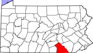
 Location in York County and the U.S. state of Pennsylvania. | |
 Railroad Location of Railroad in Pennsylvania  Railroad Railroad (the United States) | |
| Coordinates: 39°45′24″N 76°41′58″W | |
| Country | United States |
| State | Pennsylvania |
| County | York |
| Settled | 1792 |
| Incorporated | 1871 |
| Government | |
| • Type | Borough Council |
| Area | |
| • Total | 0.64 sq mi (1.65 km2) |
| • Land | 0.64 sq mi (1.65 km2) |
| • Water | 0.00 sq mi (0.00 km2) |
| Elevation | 804 ft (245 m) |
| Population (2010) | |
| • Total | 278 |
| • Estimate (2019)[2] | 280 |
| • Density | 438.87/sq mi (169.37/km2) |
| Time zone | UTC-5 (Eastern (EST)) |
| • Summer (DST) | UTC-4 (EDT) |
| Zip code | 17355 |
| Area code(s) | 717 |
| FIPS code | 42-63288 |
History
The borough owes its existence, and its name, to what became the Northern Central Railway, which was built connecting Baltimore, Maryland, and Harrisburg, Pennsylvania. The Railroad Borough Historic District was listed on the National Register of Historic Places in 1984.[4]
Laura Randall described Railroad as a "tiny town of three hundred people near the Maryland border... home to the Jackson House B&B, a popular crab shack, and not much else."[5]
Geography
Railroad is located at 39°45′24″N 76°41′58″W (39.756761, -76.699396).[6]
According to the United States Census Bureau, the borough has a total area of 0.6 square miles (1.6 km2), all of it land.
Demographics
| Historical population | |||
|---|---|---|---|
| Census | Pop. | %± | |
| 1880 | 220 | — | |
| 1890 | 201 | −8.6% | |
| 1900 | 213 | 6.0% | |
| 1910 | 308 | 44.6% | |
| 1920 | 310 | 0.6% | |
| 1930 | 268 | −13.5% | |
| 1940 | 279 | 4.1% | |
| 1950 | 300 | 7.5% | |
| 1960 | 273 | −9.0% | |
| 1970 | 308 | 12.8% | |
| 1980 | 272 | −11.7% | |
| 1990 | 317 | 16.5% | |
| 2000 | 300 | −5.4% | |
| 2010 | 278 | −7.3% | |
| 2019 (est.) | 280 | [2] | 0.7% |
| Sources:[7][8][9] | |||
At the 2000 census,[8] there were 300 people, 112 households and 79 families living in the borough. The population density was 478.7 per square mile (183.9/km2). There were 116 housing units at an average density of 185.1 per square mile (71.1/km2). The racial makeup of the borough was 96.33% White, 1.67% African American and 2.00% Native American. Hispanic or Latino of any race were 0.67% of the population.
There were 112 households, of which 41.1% had children under the age of 18 living with them, 57.1% were married couples living together, 12.5% had a female householder with no husband present, and 28.6% were non-families. 24.1% of all households were made up of individuals, and 7.1% had someone living alone who was 65 years of age or older. The average household size was 2.68 and the average family size was 3.16.
29.0% of the population were under the age of 18, 8.3% from 18 to 24, 33.7% from 25 to 44, 20.7% from 45 to 64, and 8.3% who were 65 years of age or older. The median age was 36 years. For every 100 females there were 98.7 males. For every 100 females age 18 and over, there were 86.8 males.
The median household income was $37,917 and the median family income was $47,813. Males had a median income of $29,286 compared with $25,417 for females. The per capita income was $16,709. About 1.3% of families and 4.7% of the population were below the poverty line, including none of those under the age of eighteen and 16.7% of those 65 or over.
References
| Wikimedia Commons has media related to Railroad, Pennsylvania. |
- "2019 U.S. Gazetteer Files". United States Census Bureau. Retrieved July 28, 2020.
- "Population and Housing Unit Estimates". United States Census Bureau. May 24, 2020. Retrieved May 27, 2020.
- "Race, Hispanic or Latino, Age, and Housing Occupancy: 2010 Census Redistricting Data (Public Law 94-171) Summary File (QT-PL), Railroad borough, Pennsylvania". United States Census Bureau. Retrieved October 6, 2011.
- "National Register Information System". National Register of Historic Places. National Park Service. July 9, 2010.
- Randall, Laura (2008). Eastern Pennsylvania: An Explorer's Guide. Woodstock, Vermont: The Countrymen Press. p. 201. ISBN 9780881507478.
- "US Gazetteer files: 2010, 2000, and 1990". United States Census Bureau. 2011-02-12. Retrieved 2011-04-23.
- "Census of Population and Housing". U.S. Census Bureau. Retrieved 11 December 2013.
- "U.S. Census website". United States Census Bureau. Retrieved 2008-01-31.
- "Incorporated Places and Minor Civil Divisions Datasets: Subcounty Resident Population Estimates: April 1, 2010 to July 1, 2012". Population Estimates. U.S. Census Bureau. Archived from the original on 11 June 2013. Retrieved 11 December 2013.
| Authority control |
|---|