Rajura
Rajura is a city and municipal council in the Chandrapur district of the Indian state of Maharashtra.
Rajura | |
|---|---|
Town | |
 Rajura Location in Maharashtra, India | |
| Coordinates (19.7775° N, 79.3663° E): | |
| Country | |
| State | Maharashtra |
| District | Chandrapur |
| Elevation | 181 m (594 ft) |
| Population | |
| • Total | 28,881 |
| Languages | |
| • Official | Marathi |
| Time zone | UTC+5:30 (IST) |
| PIN | 442905 |
| Vehicle registration | MH 34 |
Geography
Rajura is at 19.7775°N 79.3663°E[1] in Maharashtra, on the banks of the Wardha River in central India's coal belt.[2] The city has an average elevation of 189 metres (624 feet).[3]
Demographics
According to the 2001 Indian census,[4] Rajura had a population of 28,881 (52 percent male, 48 percent female). Children under age six constitute about 15 percent of the population. Rajura's average literacy rate of 72 percent (77 percent of males, 67 percent of females) exceeds the national average of 59.5 percent.[5] Nearby towns include Ballarpur, Gadchandur, Nanda and Korpana.
Industries
Rajura is in the heart of Maharashtra's coal and cement-producing areas. Due to the availability of raw materials, there are a number of cement factories near the city.
Places of interest
A number of temples are in and near Rajura. They include the Hanuman temple near the lake in Jogapur, about 10 km (6.2 mi) from Rajura, and the Shri Saibaba temple (Chota Shirdi) on the Wardha River. The Somnath Mandir temple is in Somanathapur region.
References
- Falling Rain Genomics, Inc - Rajura
- Prabha Shastri Ranade. Population Dynamics in India. South Asia Books, 1990, p. 37.
- DistancesTo.com - Rajura]
- "Census of India 2001: Data from the 2001 Census, including cities, villages and towns (Provisional)". Census Commission of India. Archived from the original on 16 June 2004. Retrieved 1 November 2008.
- Census of India 2001, Table - 3 : Population, population in the age group 0-6 and literates by sex - Cities/Towns (in alphabetic order): 2001 and Census of India 2001, Table - 1: Population, population in the age group 0-6 and literates by sex - India and States/Union Territories: 2001
Places adjacent to Rajura | ||||||||||
|---|---|---|---|---|---|---|---|---|---|---|
| ||||||||||
Chandrapur district topics | ||
|---|---|---|
| History | 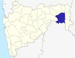 | |
| Geography | ||
| Cities and towns | ||
| Lok Sabha constituencies | ||
| Vidhan Sabha constituencies | ||