Wainganga River
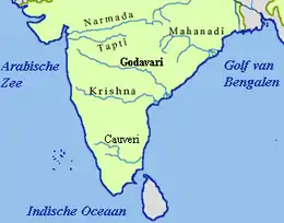
The Wainganga[lower-alpha 1] is a river in India originating in the Mahadeo Hills in Mundara near the village Gopalganj in Seoni, Madhya Pradesh. It is a key tributary of the Godavari. The river flows south in a winding course through the states of Madhya Pradesh and Maharashtra, roughly 579 km (360 mi). After joining the Wardha River, the united stream, which is known as the Pranahita River, empties into the Godavari River at Kaleshwaram, Telangana.
| Wainganga River वैनगंगा नदी | |
|---|---|
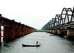
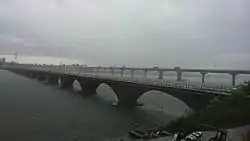 Wainganga River in Bhandara City | |
| Location | |
| Country | India |
| State | Madhya Pradesh, Maharashtra |
| Cities | Seoni, Balaghat, Bhandara |
| Physical characteristics | |
| Source | Mundara |
| • location | MUNDARA, Seoni District, Madhya Pradesh |
| • coordinates | 21°57′N 79°34′E |
| • elevation | 1,048 m (3,438 ft) |
| Mouth | Pranahita River |
• location | Adilabad district, Gadchiroli District, border of the 2 districts |
• coordinates | 19°35′24″N 79°47′59″E |
• elevation | 146 m (479 ft) |
| Length | 569 km (354 mi) |
| Basin size | 43,658 km2 (16,856 sq mi) |
| Basin features | |
| Tributaries | |
| • left | Thanwar River, Nahara River, Sonbiri River, Bagh River, Chulband River, Gadhavi River, Triveni River, Kathani River |
| • right | Hirri River, Sarrati River, Chandan River, Bawanthari River, Sur River, Kanhan River, Andhari River |
Course
The main stream of the Wainganga originates at Mahadev hills near Gopalganj, Seoni District,[1] on the southern slopes of the Satpura Range of Madhya Pradesh.
The river has developed extensive floodplains characterized by sweeping graceful meanders, low alluvial flats, and slip-off slopes. The river has high banks, which measure from 10 m (33 ft) to 15 m (49 ft) on either side. The northern part is surrounded by the Mahadeo hills and Satpura Range, with an average elevation of 625 m (2,051 ft) above sea level. The valley of the Wainganga River is forested and sparsely populated.
Balaghat and Bhandara are the major cities located on the bank of the Wainganga River, while Pauni and Desaiganj are smaller urban centers on the smallest of the river banks. The Wainganga River is the water lifeline of these cities and their primary source of water. The Government of Maharashtra is developing a protection wall for Bhandara to protect it from heavy flooding. This flood protection wall encircles Bhandara from east to south.[2]
Tributaries
The Wainganga river receives numerous tributaries on both sides and drains the western, central, and eastern regions of the Balaghat district of Madhya Pradesh, Chandrapur, Gadchiroli, Bhandara, Gondia, and Nagpur Districts of Maharashtra. The main tributaries of the Wainganga River are the Thel, Thanwar, Bagh, Chulband, Garhavi, Khobragadi, and Kathani, which meet on the left bank; and the Hirri, Chandan, Bawanthari, Kanhan, and Mul joining on the right bank.[2]
Thanwar
The Thanwar River joins the Wainganga at the Nainpur Forest Range, at the border of the Seoni District and Mandla District, before the Dhuty Dam on the Wainganga. It originates from the forest of Chiraidongri in the Mandla District. There is a medium-sized dam at the village of Bejegaon on the bank of this river, which opened in 1980. River water stored in the dam is used to irrigate the farmland of 50 villages. The Halon River[3] and the Chakor River (catchment from Nainpur Forest Range) are some of the well-known tributaries to this small, fully utilized river. Geographically, this river misses a few miles due to a Satpura foothill to become the Narmada's first major tributary. The main towns on this tributary are Nainpur and Pindrai. The river has been in recreational use since ancient times, as it was on the route of pilgrimage from South to North India. The village Jhulpur,[4] on the bank of this river, was a stoppage and temple town. The major bridge over the river is at the town Pindrai by Indian Railway (Jabalpur-Gondia rail track).
Kathani
The Kathani River originates in the Pendhri Hills at Dhanora and joins Wainganga near Gadchiroli city.
Hirri
The Hirri River originates in Moondapar, Seoni District and flows through Jeonara. It joins Wainganga near the Dhuty Dam.
Chandan
The Chandan River is an important river of the Balaghat District. It flows through Waraseoni. The Nahalesara dam is built upon the Chandan River. One of the major features along the river is the Rampayali's temple.his meet in vainganga river in Maharashtra mahalgaon (Murdara) village
Bawanthadi
The Bawanthadi River is an important river which originates in the Kurai plateau of Seoni District in Madhya Pradesh.[5] It divides Madhya Pradesh and Maharashtra near Mowad and Bonkatta. The Bawanthadi River joins Wainganga after flowing 48 km[5] south, near Mowad, Madhya Pradesh.There is a middle size dam over this river which irrigate farm lands of M.P. and Maharastra.
Kanhan
The Kanhan River is Wainganga's longest tributary, at 275 km (171 mi). It rises in the hills at the southern edge of the Satpura Range in the north-western region of Chhindwara District.[1]
River modifications
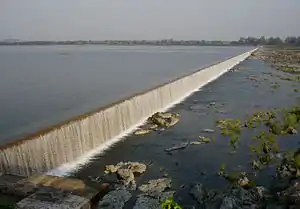
By 2012, there were about 149 dams built in the Wainganga basin.[6] Gose Khurd Dam on Wainganga River is being built by the Water Resources Department (WRD) of the Government of Maharashtra. One of the major features along the river is the Bheemgarh Dam (the biggest mud dam in Asia), which is located in the Seoni District.[2]
Economy
The river is used for shipping both goods and passengers under the National Waterways Project (NAWAD). The first river port is likely to have been established in Bhandara City.[7]

Literature
Wainganga River was used in The Jungle Book and The Second Jungle Book (1894–1895) by Rudyard Kipling, featuring in the "Mowgli stories." In the books, it is the primary source of water for all the people of the jungle, the location of the "Peace Rock," and the place where Shere Khan vows to place Mowgli's bones once he has killed him. The forests of the Kanha National Park, which grew around the Wainganga, have tiger, leopard, and bear populations, as featured in Kipling's stories. Some believe that Mowgli was found at Amodagadh in the Seoni District.[8][9]
The Disney interpretation of Kipling's novel as an animated film showed Mowgli and the other jungle characters moving around in lush tropical rain forests. In reality, the area around the Wainganga is not actually a rainforest.
Notes and References
- Notes
- IAST: Wainganga
- Citations
- GoPract.com. "Geography: Rivers of Maharashtra". Retrieved 6 August 2018.
- Vikalp, Ganvir (6 August 2016). "Wainganga river in balaghat". www.youtube.com. Retrieved 8 October 2018.
- "Web page of Govt. Of India Website:india-wris.nrsc.gov.in"
- "Govt. Museum at Mandla District"
- "Bawanthadi River in India". Retrieved 6 August 2018.
- "Wainganga River: Threatened lifeline of Vidarbha's Forests". SANDRP. 14 April 2017. Retrieved 6 August 2018.
- "Vainganga to get the firstever inland water transport project: Gadkari- Times of india". Times Of India. Retrieved 29 January 2016.
- "Tourist Place". Seoni.
- "Did Seoni have a real Mowgli? - Times of India". The Times of India. Retrieved 13 August 2018.
External links
 Media related to Wainganga River at Wikimedia Commons