Redavalle
Redavalle is a comune (municipality) in the Province of Pavia in the Italian region Lombardy, located about 50 km south of Milan and about 15 km south of Pavia.
Redavalle | |
|---|---|
| Comune di Redavalle | |
 Coat of arms | |
Location of Redavalle 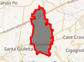
| |
 Redavalle Location of Redavalle in Italy 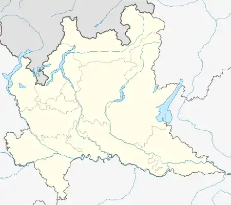 Redavalle Redavalle (Lombardy) | |
| Coordinates: 45°2′N 9°11′E | |
| Country | Italy |
| Region | Lombardy |
| Province | Pavia (PV) |
| Frazioni | Calcababbio, Casa Ramati |
| Area | |
| • Total | 5.47 km2 (2.11 sq mi) |
| Elevation | 85 m (279 ft) |
| Population (Dec. 2004)[2] | |
| • Total | 1,028 |
| • Density | 190/km2 (490/sq mi) |
| Time zone | UTC+1 (CET) |
| • Summer (DST) | UTC+2 (CEST) |
| Postal code | 27050 |
| Dialing code | 0385 |
Redavalle borders the following municipalities: Barbianello, Broni, Pietra de' Giorgi, Santa Giuletta.
History
A Roman centre called Cameliomagus, Comillomagus or Camillomagus existed in the area. In the Middle Ages a settlement known as San Martino di Strada (St. Martin on the Road) replaced it, which was acquired by the commune of Pavia in 1164. It had a castle which was set on fire during the war against Frederick Barbarossa. San Martino's population gradually moved to Ridavalle, part of the fief of Broni.
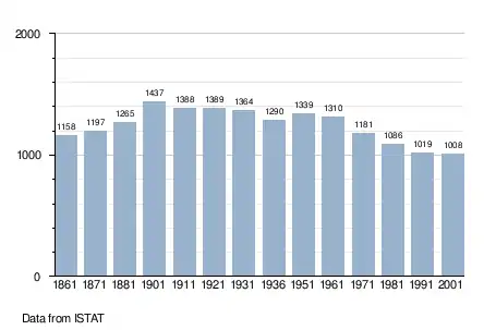
Demographic evolution
Twin towns
References
- "Superficie di Comuni Province e Regioni italiane al 9 ottobre 2011". Istat. Retrieved 16 March 2019.
- All demographics and other statistics: Italian statistical institute Istat.
| Authority control |
|
|---|
This article is issued from Wikipedia. The text is licensed under Creative Commons - Attribution - Sharealike. Additional terms may apply for the media files.
