Santa Giuletta
Santa Giuletta is a comune (municipality) in the Province of Pavia in the Italian region Lombardy, located about 50 km south of Milan and about 15 km south of Pavia. As of 31 December 2004, it had a population of 1,605 and an area of 11.7 km².[3]
Santa Giuletta | |
|---|---|
| Comune di Santa Giuletta | |
Location of Santa Giuletta 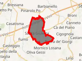
| |
 Santa Giuletta Location of Santa Giuletta in Italy 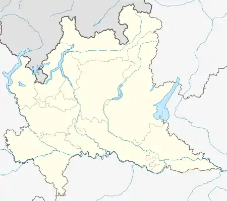 Santa Giuletta Santa Giuletta (Lombardy) | |
| Coordinates: 45°2′N 9°11′E | |
| Country | Italy |
| Region | Lombardy |
| Province | Province of Pavia (PV) |
| Area | |
| • Total | 11.7 km2 (4.5 sq mi) |
| Population (Dec. 2004)[2] | |
| • Total | 1,605 |
| • Density | 140/km2 (360/sq mi) |
| Time zone | UTC+1 (CET) |
| • Summer (DST) | UTC+2 (CEST) |
| Postal code | 27046 |
| Dialing code | 0383 |
Santa Giuletta borders the following municipalities: Barbianello, Mornico Losana, Pietra de' Giorgi, Pinarolo Po, Redavalle, Robecco Pavese, Torricella Verzate. Santa Giuletta is situated at the end of the Apennines chain. The village has a railway station on the line Alessandria-Voghera-piacenza. It is crossed by the SS10 "Padana inferiore". The area in which Santa Giuletta is located is known as "Oltrepo Pavese".
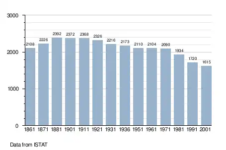
Demographic evolution
References
- "Superficie di Comuni Province e Regioni italiane al 9 ottobre 2011". Istat. Retrieved 16 March 2019.
- "Popolazione Residente al 1° Gennaio 2018". Istat. Retrieved 16 March 2019.
- All demographics and other statistics: Italian statistical institute Istat.
This article is issued from Wikipedia. The text is licensed under Creative Commons - Attribution - Sharealike. Additional terms may apply for the media files.
