Redbank Creek (Pennsylvania)
Redbank Creek is a tributary of the Allegheny River in Clarion, Armstrong, and Jefferson counties, Pennsylvania in the United States.[1][2]
| Redbank Creek | |
|---|---|
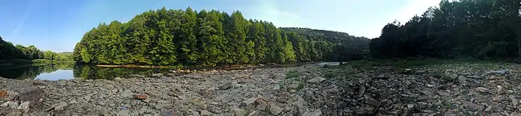
 Creekside scene in Summerville | |
| Location | |
| Country | United States |
| State | Pennsylvania |
| Physical characteristics | |
| Source | |
| • location | Brookville, Pennsylvania |
| • coordinates | 41°09′30″N 79°04′36″W |
| • elevation | 1,194 feet (364 m) |
| Mouth | |
• location | Allegheny River near East Brady |
• coordinates | 40°58′55″N 79°33′00″W |
• elevation | 823 feet (251 m) |
| Basin features | |
| River system | Allegheny River |
| Tributaries | |
| • left | Sandy Lick Creek, Rattlesnake Run, Carrier Run, Beaver Run, Tarkiln Run, Red Run, Little Sandy Creek |
| • right | North Fork Creek, Clement Run, Thompson Run, Simpson Run, Welch Run, Runaway Run, Patton Run, Miller Run, Pine Creek, Town Run, Middle Run, Leisure Run, Long Run, Leatherwood Run, Middle Run, Rock Run, Wildcat Run |
Redbank Creek is born at the confluence of Sandy Lick Creek and the North Fork Creek in the borough of Brookville, then flows west to form the border between Clarion County on the north bank and Armstrong County on the south bank. The tributary Little Sandy Creek joins just upstream of the community of Mayport.[2]
The stream flows 50.3 miles (81 km) to join the Allegheny River and about 64 miles upstream from its confluence, just downstream of the borough of East Brady.[2]
Political subdivisions
The political subdivisions Redbank Creek traverses, given in the order they are encountered traveling downstream, are as follows:
- Brookville[3]
- Rose Township[4]
- Clover Township[5]
- Summerville[6]
- Clover Township[5]
- Beaver Township[7]
- Redbank Township (Armstrong)[8]
- Redbank Township (Clarion)[9]
- Hawthorn[10]
- Redbank Township (Clarion)[9]
- Mahoning Township[11]
- New Bethlehem[12]
- South Bethlehem[13]
- Mahoning Township[11]
- Porter Township[14]
- Madison Township (Clarion)[15]
- Madison Township (Armstrong)[16]
Tributaries
The named tributaries of Redbank Creek, given in the order they are encountered traveling downstream, are as follows:
- Sandy Lick Creek[17]
- North Fork Creek[18]
- Clement Run[19]
- Rattlesnake Run[20]
- Thompson Run[21]
- Simpson Run[22]
- Welch Run[23]
- Runaway Run[24]
- Carrier Run[25]
- Beaver Run[26]
- Tarkiln Run[27]
- Red Run[28]
- Patton Run[29]
- Little Sandy Creek[30]
- Miller Run[31]
- Pine Creek[32]
- Town Run[33]
- Middle Run[34]
- Leisure Run[35]
- Citizens Water Company Dam[36]
- Long Run[37]
- Leatherwood Creek[38]
- Middle Run[39]
- Rock Run[40]
- Wildcat Run[41]
See also
References
- U.S. Geological Survey Geographic Names Information System: Redbank Creek (Pennsylvania)
- Gertler, Edward. Keystone Canoeing, Seneca Press, 2004. ISBN 0-9749692-0-6
- "Brookville". Geographic Names Information System. United States Geological Survey.
- "Rose Township, Jefferson County". Geographic Names Information System. United States Geological Survey.
- "Clover Township, Jefferson County". Geographic Names Information System. United States Geological Survey.
- "Summerville". Geographic Names Information System. United States Geological Survey.
- "Beaver Township, Jefferson County". Geographic Names Information System. United States Geological Survey.
- "Redbank Township, Armstrong County". Geographic Names Information System. United States Geological Survey.
- "Redbank Township, Clarion County". Geographic Names Information System. United States Geological Survey.
- "Hawthorn". Geographic Names Information System. United States Geological Survey.
- "Mahoning Township, Armstrong County". Geographic Names Information System. United States Geological Survey.
- "New Bethlehem". Geographic Names Information System. United States Geological Survey.
- "South Bethlehem". Geographic Names Information System. United States Geological Survey.
- "Porter Township, Clarion County". Geographic Names Information System. United States Geological Survey.
- "Madison Township, Clarion County". Geographic Names Information System. United States Geological Survey.
- "Madison Township, Armstrong County". Geographic Names Information System. United States Geological Survey.
- "Sandy Lick Creek". Geographic Names Information System. United States Geological Survey.
- "North Fork Redbank Creek". Geographic Names Information System. United States Geological Survey.
- "Clement Run". Geographic Names Information System. United States Geological Survey.
- "Rattlesnake Run". Geographic Names Information System. United States Geological Survey.
- "Thompson Run". Geographic Names Information System. United States Geological Survey.
- "Simpson Run". Geographic Names Information System. United States Geological Survey.
- "Welch Run". Geographic Names Information System. United States Geological Survey.
- "Runaway Run". Geographic Names Information System. United States Geological Survey.
- "Carrier Run". Geographic Names Information System. United States Geological Survey.
- "Beaver Run". Geographic Names Information System. United States Geological Survey.
- "Tarkiln Run". Geographic Names Information System. United States Geological Survey.
- "Red Run". Geographic Names Information System. United States Geological Survey.
- "Patton Run". Geographic Names Information System. United States Geological Survey.
- "Little Sandy Creek". Geographic Names Information System. United States Geological Survey.
- "Miller Run". Geographic Names Information System. United States Geological Survey.
- "Pine Creek". Geographic Names Information System. United States Geological Survey.
- "Town Run". Geographic Names Information System. United States Geological Survey.
- "Middle Run". Geographic Names Information System. United States Geological Survey.
- "Leisure Run". Geographic Names Information System. United States Geological Survey.
- "Citizens Water Company Dam". Geographic Names Information System. United States Geological Survey.
- "Long Run". Geographic Names Information System. United States Geological Survey.
- "Leatherwood Creek". Geographic Names Information System. United States Geological Survey.
- "Middle Run". Geographic Names Information System. United States Geological Survey.
- "Rock Run". Geographic Names Information System. United States Geological Survey.
- "Wildcat Run". Geographic Names Information System. United States Geological Survey.