Redfield, Arkansas
Redfield is a small city in the Pine Bluff metropolitan area of northwestern Jefferson county in the U.S. state of Arkansas. The city is situated on the Union Pacific Railway and is approximately 24 miles (39 km) south of Little Rock, the state capital.[4] As of the 2010 census, Redfield has a population of 1,297.[5]
Redfield, Arkansas | |
|---|---|
City | |
| City of Redfield | |
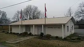 Main façade of the Redfield City Hall | |
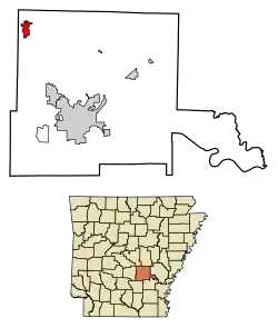 | |
 Redfield Location in the United States | |
| Coordinates: 34°26′42.3″N 92°10′59.5″W | |
| Country | |
| State | |
| County | Jefferson |
| Township | Barraque |
| Founded | December 20, 1880 |
| Incorporated | October 18, 1898 |
| Founded by | James Kirkwood Brodie |
| Named for | Jared Edgar Redfield |
| Government | |
| • Type | Mayor–Council |
| • Mayor | Roben Brooks (I) |
| • Council | |
| Area | |
| • Total | 3.15 sq mi (8.15 km2) |
| • Land | 3.09 sq mi (8.01 km2) |
| • Water | 0.05 sq mi (0.14 km2) |
| Elevation | 302 ft (92 m) |
| Population (2010) | |
| • Total | 1,297 |
| • Estimate (2019)[3] | 1,514 |
| • Density | 489.33/sq mi (188.96/km2) |
| Time zone | UTC−06:00 (CST) |
| • Summer (DST) | UTC−05:00 (CDT) |
| ZIP code | 72132 |
| Area code | 501 |
| FIPS code | 05-58580 |
| GNIS feature ID | 58477, 2404603 |
| Highways |
|
| Major airport | Clinton Airport (LIT) |
| Website | Official website |
History
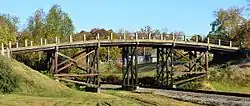
Following the arrival of the Little Rock, Mississippi River and Texas Railway (L. R., M. R. & T. Ry.),[6][7][8] a settlement grew up around the new station (present-day Redfield Church of Christ) named for company president Jared Edgar Redfield of Essex, Connecticut.[9][10][11] The municipality was incorporated by the Jefferson county court on October 18, 1898.[12] Four properties have been added to the National Register of Historic Places (NRHP): Dollarway Road (1974), West James Street Overpass (1995), Lone Star Baptist Church (2005), and Redfield School Historic District (2014).
To the area now known as Redfield came Auguste le Noir de Serville, after serving with the French in the American Revolutionary War and being wounded at Yorktown. Killed by a falling tree in 1828, De Serville was buried with honors, and his funeral was attended by political and military notables.[13] The location of De Serville's grave is unknown.[14][15]
Government
The Redfield City Council comprises the mayor of Redfield and six aldermen.[1] The council determines the strategic direction and policies for the municipality and the mayor in turn appoints staff to implement those policies and administer and manage the municipal services. Private citizens are welcome to attend the council meetings which are held in the Council Chamber in the City Hall at 212 North Brodie Street, Redfield, on the first Tuesday of the month at 7:00 p.m.
Demographics
| Historical population | |||
|---|---|---|---|
| Census | Pop. | %± | |
| 1890 | 400 | — | |
| 1900 | 333 | −16.7% | |
| 1910 | 278 | −16.5% | |
| 1920 | 296 | 6.5% | |
| 1930 | 350 | 18.2% | |
| 1940 | 339 | −3.1% | |
| 1950 | 291 | −14.2% | |
| 1960 | 242 | −16.8% | |
| 1970 | 277 | 14.5% | |
| 1980 | 745 | 169.0% | |
| 1990 | 1,082 | 45.2% | |
| 2000 | 1,157 | 6.9% | |
| 2010 | 1,297 | 12.1% | |
| 2019 (est.) | 1,514 | [3] | 16.7% |
| U.S. Decennial Census[16] | |||
As of the census of 2010, there were 1,297 people, 525 households and 369 families residing in the city. There were 581 housing units. The racial makeup of the city was 91.7% White, 4.8% Black or African American, 0.1% Native American, 0.5% Asian, 0% Pacific Islander, 0.6% from other races and 2.3% from two or more races. 1.8% of the population were Hispanic or Latino of any race. There were 525 households, out of which 29.9% had children under the age of 18 living with them, 52.2% were married couples living together, 13.3% had a female householder with no husband present, and 29.7% were non-families. 26.1% of all households were made up of individuals, and 22.9% had someone living alone who was 65 years of age or older. The average household size was 2.47 and the average family size was 2.95. The median age was 38.5 years.[4]
Education
Public education in northwest Jefferson county is administered by the White Hall School District.[17] The public school district manages two secondary schools (White Hall High School and White Hall Middle School) and four elementary schools.[18] The M. A. Hardin Elementary School is located in Redfield.[19] The Pine Bluff/Jefferson County Library System operates Redfield's public library, an about 3,500-square-foot (330 m2) library building, which opened in August 1999.[20]
Highways
Redfield is on Highway 365 linking Pine Bluff and Little Rock, as well as Highway 46, linking it to Sheridan. It is also on Interstate 530 (via Highway 46).[21]
See also
- CenturyTel of Redfield
- List of cities and towns in Arkansas
- List of places named after people in the United States
- National Register of Historic Places listings in Jefferson County, Arkansas
References
- "Redfield". Arkansas Municipal League. Retrieved January 16, 2019.
- "2019 U.S. Gazetteer Files". United States Census Bureau. Retrieved June 30, 2020.
- "Population and Housing Unit Estimates". United States Census Bureau. May 24, 2020. Retrieved May 27, 2020.
- "U.S. Census website". United States Census Bureau. U.S. Department of Commerce. Retrieved May 8, 2016.
- "Geographic Identifiers: 2010 Census Summary File 1 (G001): Redfield city, Arkansas". American Factfinder. U.S. Census Bureau. Archived from the original on February 13, 2020. Retrieved April 17, 2018.
- Pine Bluff and Jefferson County, Arkansas: Full Description (World's Fair ed.). Jefferson County Bureau of Agriculture, Manufactures and Immigration. May 1893. p. 13. LCCN 25000261 – via Internet Archive.
- Taylor, Clarence (August 3, 1962). "Redfield—Made by a Railroad". The Pine Bluff Commercial. Pine Bluff, Arkansas.
- "Happy Birthday, City of Redfield!". The Redfield Update. Redfield, Arkansas. October 1, 1998.
- Biographical and Historical Memoirs of Pulaski, Jefferson, Lonoke, Faulkner, Grant, Saline, Perry, Garland and Hot Spring Counties, Arkansas. Chicago, Nashville and St. Louis: Goodspeed Publishing Co. 1889. pp. 134, 137. LCCN 01001243. OL 24190554M – via Internet Archive.
- "Obituary Notes" (PDF). The New York Times. October 22, 1889. Retrieved May 8, 2017.
- Redfield, John Howard (1860). Genealogical History of the Redfield Family in the United States. Albany and New York: Munsell & Rowland; C. B. Richardson. p. 141. LCCN 09013244. OCLC 423619906 – via Internet Archive.
- Teske, Steven (2017). "Redfield (Jefferson County)". Encyclopedia of Arkansas. Central Arkansas Library System. Retrieved May 8, 2017.
- "Communicated". The Arkansas Gazette. Little Rock: William E. Woodruff. February 10, 1829.
- Shinn, Josiah H. (1908). Pioneers and Makers of Arkansas. Genealogical and Historical Publishing Company. pp. 78–79. LCCN 67017587. OCLC 1061981. OL 5540009M – via Internet Archive.
- Arkansas: A Guide to the State. American Guide Series. New York: Hastings House. 1941. p. 276. LCCN 41052931. OCLC 882129.
- "Census of Population and Housing". Census.gov. Retrieved June 4, 2015.
- "SCHOOL DISTRICT REFERENCE MAP (2010 CENSUS): Jefferson County, AR." U.S. Census Bureau. Retrieved on July 31, 2017.
- "Schools". White Hall School District. SchoolWorld. n.d. Retrieved August 10, 2017.
- "Hardin Elementary". White Hall School District. SchoolWorld. n.d. Retrieved August 10, 2017.
- "Redfield Public Library." Pine Bluff-Jefferson County Library System. Retrieved on August 2, 2017.
- Arkansas State Highway and Transportation Department (March 2016). Map of Redfield, Jefferson County, Arkansas (PDF) (Map). Retrieved May 7, 2016.
Further reading
- Leslie, James W. (1981). Pine Bluff and Jefferson County: A Pictorial History. Norfolk, Va.: Donning Co. ISBN 978-0898651485. LCCN 81005481. OCLC 7462693.
- Moneyhon, Carl H. (1997). West, Elliott (ed.). Arkansas and the New South 1874-1929. Histories of Arkansas. Fayetteville: University of Arkansas Press. ISBN 1-55728-490-3. LCCN 97026932. OCLC 37269309. OL 680393M.
- Rand, McNally & Co.'s New Business Atlas Map of Arkansas (Map). 1:900,000. Rand, McNally & Co. 1898. LCCN 98688447. Retrieved December 24, 2016 – via Library of Congress.
External links
- Government
- General information
 Geographic data related to Redfield, Arkansas at OpenStreetMap
- Post 343 at The American Legion Centennial Celebration
- Redfield Athletic Association
- Redfield Chamber of Commerce
- Redfield Missionary Baptist Church
- Redfield Public Library at Pine Bluff/Jefferson County Library System
Places adjacent to Redfield, Arkansas | |
|---|---|
Municipalities and communities of Jefferson County, Arkansas, United States | ||
|---|---|---|
| Cities | 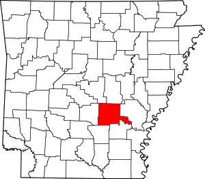 Map of Arkansas highlighting Jefferson County | |
| Towns | ||
| CDP | ||
| Unincorporated communities | ||
| Footnotes | ‡This populated place also has portions in an adjacent county or counties | |
| ||
| Authority control |
|---|