National Register of Historic Places listings in Jefferson County, Arkansas
This is a list of the National Register of Historic Places listings in Jefferson County, Arkansas.
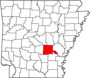
Location of Jefferson County in Arkansas
This is intended to be a complete list of the properties and districts on the National Register of Historic Places in Jefferson County, Arkansas, United States. The locations of National Register properties and districts for which the latitude and longitude coordinates are included below, may be seen in a map.[1]
There are 72 properties and districts listed on the National Register in the county. Another 9 properties were once listed but have been removed.
- This National Park Service list is complete through NPS recent listings posted February 5, 2021.[2]
Current listings
| [3] | Name on the Register[4] | Image | Date listed[5] | Location | City or town | Description |
|---|---|---|---|---|---|---|
| 1 | Antioch Missionary Baptist Church Cemetery | Antioch Missionary Baptist Church Cemetery |
July 8, 2010 (#10000437) |
500 N. McKinney Rd. 34°23′37″N 91°59′01″W |
Sherrill | |
| 2 | Arkansas Louisiana Gas Company Building | 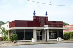 Arkansas Louisiana Gas Company Building |
May 10, 2001 (#01000480) |
116 W. 6th 34°13′25″N 92°00′14″W |
Pine Bluff | |
| 3 | Jewel Bain House Number 2 | 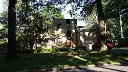 Jewel Bain House Number 2 |
January 29, 2013 (#12001228) |
3601 S. Cherry St. 34°11′34″N 92°00′47″W |
Pine Bluff | |
| 4 | Jewel Bain House No. 4 | September 21, 2017 (#100001649) |
27 Longmeadow 34°11′38″N 92°01′14″W |
Pine Bluff | ||
| 5 | Bellingrath House | 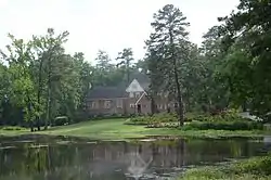 Bellingrath House |
December 1, 1994 (#94001410) |
7520 Dollarway Rd. 34°24′09″N 92°10′28″W |
White Hall | |
| 6 | Boone-Murphy House | 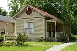 Boone-Murphy House |
February 18, 1979 (#79000442) |
714 W. 4th Ave. 34°13′32″N 92°00′39″W |
Pine Bluff | |
| 7 | Caldwell Hall | 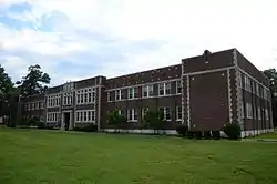 Caldwell Hall |
December 22, 1982 (#82000843) |
University Drive 34°14′32″N 92°01′10″W |
Pine Bluff | |
| 8 | Camp White Sulphur Springs Confederate Cemetery | 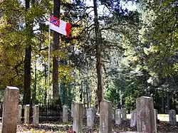 Camp White Sulphur Springs Confederate Cemetery |
January 19, 2005 (#04001512) |
Luckwood Rd. one half block north of Highway 54 34°10′52″N 92°07′11″W |
Sulphur Springs | |
| 9 | Carnahan House | 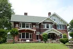 Carnahan House |
September 30, 2014 (#14000790) |
1200 S. Laurel St. 34°13′03″N 92°00′30″W |
Pine Bluff | |
| 10 | Central Texas Gravel Locomotive #210 | 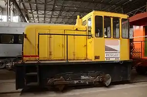 Central Texas Gravel Locomotive #210 |
May 24, 2007 (#07000442) |
Arkansas Railroad Museum 34°13′46″N 91°59′06″W |
Pine Bluff | |
| 11 | Community Theatre | 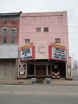 Community Theatre |
May 26, 2004 (#04000507) |
207 W. 2nd Ave. 34°13′49″N 92°00′17″W |
Pine Bluff | |
| 12 | DODX Guard Car #G-56 | 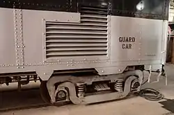 DODX Guard Car #G-56 |
June 28, 2007 (#07000441) |
Arkansas Railroad Museum 34°13′47″N 91°59′06″W |
Pine Bluff | |
| 13 | Dollarway Road | Dollarway Road |
May 17, 1974 (#74000480) |
South of Redfield off U.S. Highway 65; also Highway 365 34°26′17″N 92°10′49″W |
Redfield | Highway 365 represents a boundary increase of July 15, 1999 |
| 14 | Du Bocage | 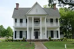 Du Bocage |
June 24, 1974 (#74000478) |
1115 W. 4th St. 34°13′34″N 92°00′42″W |
Pine Bluff | |
| 15 | The Elms | July 7, 1978 (#78000596) |
South of Altheimer 34°18′15″N 91°50′33″W |
Altheimer | ||
| 16 | Federal Building-U.S. Post Office and Courthouse | February 7, 2017 (#100000626) |
100 E. 8th St. 34°13′17″N 92°00′11″W |
Pine Bluff | ||
| 17 | Ferguson House |  Ferguson House |
January 18, 1978 (#78000598) |
902 E. 4th Ave. 34°13′33″N 92°00′42″W |
Pine Bluff | |
| 18 | Fox House | 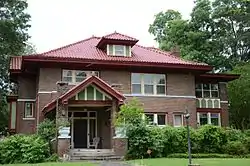 Fox House |
December 22, 1982 (#82000845) |
1303 S. Olive St. 34°12′58″N 92°00′25″W |
Pine Bluff | |
| 19 | Gibson-Burnham House |  Gibson-Burnham House |
June 5, 1991 (#91000694) |
1326 Cherry St. 34°12′56″N 92°00′49″W |
Pine Bluff | |
| 20 | Hotel Pines |  Hotel Pines |
August 10, 1979 (#79000443) |
Main St. and W. 5th Ave. 34°13′30″N 92°00′13″W |
Pine Bluff | |
| 21 | Howson House |  Howson House |
December 22, 1982 (#82000847) |
1700 S. Olive St. 34°12′41″N 92°00′25″W |
Pine Bluff | |
| 22 | Hudson House |  Hudson House |
December 22, 1982 (#82000848) |
304 W. 5th St. 34°12′51″N 92°00′20″W |
Pine Bluff | |
| 23 | Hudson-Grace-Borreson House |  Hudson-Grace-Borreson House |
June 24, 1971 (#71000126) |
716 W. Barraque 34°13′44″N 92°00′30″W |
Pine Bluff | |
| 24 | Johnson House | 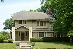 Johnson House |
December 22, 1982 (#82000849) |
315 Martin St. 34°13′06″N 92°00′21″W |
Pine Bluff | |
| 25 | Katzenstein House |  Katzenstein House |
December 22, 1982 (#82000850) |
902 W. 5th St. 34°13′30″N 92°00′46″W |
Pine Bluff | |
| 26 | R.M. Knox House | _before_1905_via_HS_Goodman's_Knox_Family.jpg.webp) R.M. Knox House |
June 5, 1975 (#75000395) |
1504 W. 6th St. 34°13′24″N 92°01′04″W |
Pine Bluff | A two-story frame house exemplifying Eastlake Victorian architecture. Features include a three-story tower, a gabled bay, and a two-story porch along the east end. It was built in 1885 by R. M. Knox, a wealthy Pine Bluff businessman.[6] |
| 27 | Lake Dick | 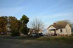 Lake Dick |
July 3, 1975 (#75000394) |
4 miles (6.4 km) south of Altheimer off Highway 88 34°15′13″N 91°50′30″W |
Altheimer | |
| 28 | R.E. Lee House |  R.E. Lee House |
June 8, 1982 (#82002118) |
1302 W. 2nd Ave. 34°13′41″N 92°00′59″W |
Pine Bluff | |
| 29 | Lone Star Baptist Church | 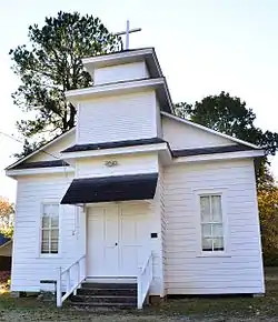 Lone Star Baptist Church |
September 28, 2005 (#05001076) |
620 Sheridan Rd. 34°26′32″N 92°11′17″W |
Redfield | |
| 30 | MacMillan-Dilley House |  MacMillan-Dilley House |
December 12, 1976 (#76000422) |
407 Martin Ave. 34°13′05″N 92°00′22″W |
Pine Bluff | |
| 31 | Masonic Temple | 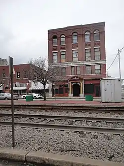 Masonic Temple |
November 30, 1978 (#78000599) |
4th and State St. 34°13′35″N 92°00′09″W |
Pine Bluff | |
| 32 | McDonald's Store #433 Sign | 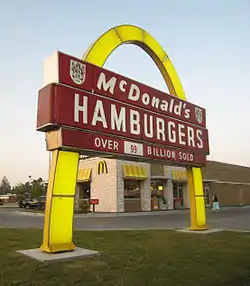 McDonald's Store #433 Sign |
August 21, 2006 (#06000411) |
2801 S. Olive St. 34°12′00″N 92°00′24″W |
Pine Bluff | |
| 33 | Merchants and Planters Bank Building |  Merchants and Planters Bank Building |
August 1, 1978 (#78000600) |
100 Main St. 34°13′45″N 92°00′13″W |
Pine Bluff | |
| 34 | Mills House | 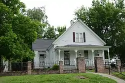 Mills House |
May 29, 1998 (#98000584) |
715 W. Barraque 34°13′15″N 92°00′36″W |
Pine Bluff | |
| 35 | National Guard Armory-Pine Bluff |  National Guard Armory-Pine Bluff |
February 16, 2001 (#01000112) |
623 W. 2nd Ave. 34°13′44″N 92°00′32″W |
Pine Bluff | |
| 36 | Nichol House |  Nichol House |
November 12, 1993 (#93001201) |
205 Park Pl. 34°12′39″N 92°00′02″W |
Pine Bluff | |
| 37 | W.E. O'Bryant Bell Tower | 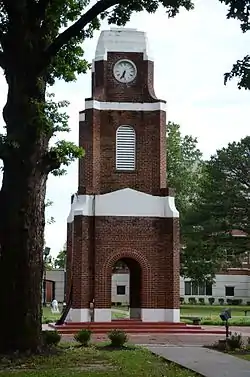 W.E. O'Bryant Bell Tower |
June 3, 1998 (#98000622) |
1200 N. University Dr. on the campus of the University of Pine Bluff 34°14′35″N 92°01′08″W |
Pine Bluff | |
| 38 | Parkview Apartments |  Parkview Apartments |
May 1, 1989 (#89000335) |
300 W. 13th Ave. 34°12′58″N 92°00′20″W |
Pine Bluff | |
| 39 | Pine Bluff Arsenal Access Road Bridge No. 2280 | January 24, 2019 (#100003330) |
AR 256 over Caney Cr. 34°17′45″N 92°05′46″W |
White Hall | ||
| 40 | Pine Bluff Civic Center |  Pine Bluff Civic Center |
June 1, 2005 (#05000496) |
200 E. 8th Ave. 34°13′19″N 92°00′04″W |
Pine Bluff | |
| 41 | Pine Bluff Commercial Historic District | 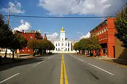 Pine Bluff Commercial Historic District |
May 20, 2008 (#08000438) |
Roughly bounded by U.S. Highway 65B, Walnut St., 10th Ave., and S. Alabama St. 34°13′18″N 92°00′11″W |
Pine Bluff | |
| 42 | Pine Bluff Confederate Monument | 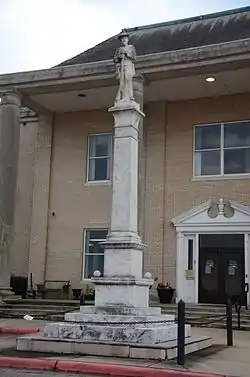 Pine Bluff Confederate Monument |
April 26, 1996 (#96000464) |
Northern side of the Jefferson County Courthouse at the junction of Barraque and Main Sts. 34°13′49″N 92°00′11″W |
Pine Bluff | |
| 43 | Pine Bluff Fifth Avenue Historic District | 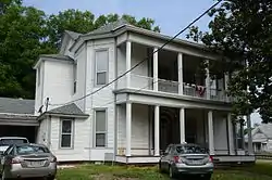 Pine Bluff Fifth Avenue Historic District |
October 29, 1980 (#80000777) |
5th Ave. 34°13′30″N 92°00′27″W |
Pine Bluff | |
| 44 | Plum Bayou Homesteads |  Plum Bayou Homesteads |
June 5, 1975 (#75000396) |
North of Pine Bluff, east of the Arkansas River, includes the community of Wright and its environs 34°25′52″N 92°03′21″W |
Pine Bluff | |
| 45 | Prigmore House | 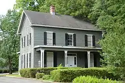 Prigmore House |
April 10, 1986 (#86000720) |
1104 W. 5th Ave. 34°13′29″N 92°00′38″W |
Pine Bluff | |
| 46 | Puddephatt House | 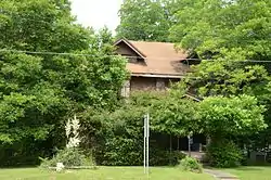 Puddephatt House |
December 22, 1982 (#82000851) |
1820 S. Olive St. 34°12′37″N 92°00′26″W |
Pine Bluff | |
| 47 | Redfield School Historic District | 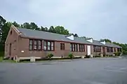 Redfield School Historic District |
October 1, 2014 (#14000791) |
101 School St. 34°26′54″N 92°11′06″W |
Redfield | |
| 48 | Roselawn |  Roselawn |
May 23, 1978 (#78000597) |
Southwest of Altheimer off Highway 88 34°18′26″N 91°51′34″W |
Altheimer | |
| 49 | Roth-Rosenzweig House |  Roth-Rosenzweig House |
December 12, 1976 (#76000423) |
717 W. 2nd Ave. 34°13′43″N 92°00′34″W |
Pine Bluff | |
| 50 | Saenger Theater |  Saenger Theater |
March 23, 1995 (#95000348) |
Southeastern corner of the junction of W. 2nd Ave. and Pine St. 34°13′41″N 92°00′14″W |
Pine Bluff | |
| 51 | St. Louis San Francisco (Frisco) Railway Coach #661 | May 19, 2006 (#06000413) |
2815 Dixie Woods Dr. 34°16′04″N 92°03′35″W |
Pine Bluff | ||
| 52 | St. Louis Southwestern Railway (Cotton Belt Route) Caboose #2325 | March 2, 2006 (#06000074) |
2815 Dixie Woods Dr. 34°16′04″N 92°03′34″W |
Pine Bluff | ||
| 53 | St. Louis Southwestern Railway (Cotton Belt Route) Relief Train | _Relief_Train.jpg.webp) St. Louis Southwestern Railway (Cotton Belt Route) Relief Train |
May 25, 2007 (#07000471) |
Arkansas Railroad Museum 34°13′45″N 91°59′09″W |
Pine Bluff | |
| 54 | St. Louis Southwestern Railway (Cotton Belt Route) Steam Locomotive #336 | _Steam_Locomotive_336.jpg.webp) St. Louis Southwestern Railway (Cotton Belt Route) Steam Locomotive #336 |
January 24, 2007 (#06001276) |
Arkansas Railroad Museum 34°13′37″N 91°59′04″W |
Pine Bluff | |
| 55 | St. Louis Southwestern Railway Steam Locomotive #819 | 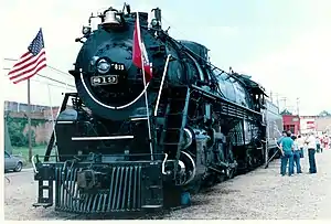 St. Louis Southwestern Railway Steam Locomotive #819 |
May 18, 2003 (#03000401) |
Arkansas Railroad Museum 34°13′37″N 91°59′05″W |
Pine Bluff | |
| 56 | St. Peter's Cemetery |  St. Peter's Cemetery |
June 4, 1998 (#98000617) |
Morgan Rd., south of New Gascony 34°13′17″N 91°46′42″W |
Pine Bluff | |
| 57 | Sherrill Methodist Episcopal Church, South | 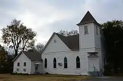 Sherrill Methodist Episcopal Church, South |
May 16, 2002 (#02000487) |
301 Main St. 34°23′15″N 91°57′08″W |
Sherrill | |
| 58 | Walter B. Sorrells Cottage | 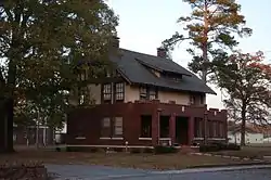 Walter B. Sorrells Cottage |
August 4, 1986 (#86002276) |
Off Highway 104 34°13′03″N 92°05′16″W |
Pine Bluff | |
| 59 | Strengthen the Arm of Liberty Monument-Pine Bluff |  Strengthen the Arm of Liberty Monument-Pine Bluff |
November 1, 2000 (#00001265) |
10th Ave. between Georgia and State Sts. 34°13′11″N 92°00′03″W |
Pine Bluff | |
| 60 | Taylor Field | 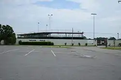 Taylor Field |
January 21, 2010 (#09001250) |
1201 E. 16th St. 34°12′50″N 91°59′29″W |
Pine Bluff | |
| 61 | Temple House | 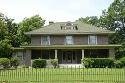 Temple House |
December 22, 1982 (#82000840) |
1702 S. Oak St. 34°12′41″N 92°00′38″W |
Pine Bluff | |
| 62 | Trinity Episcopal Church | 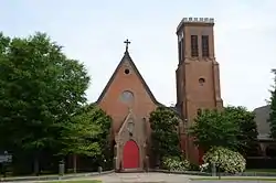 Trinity Episcopal Church |
July 30, 1974 (#74000479) |
3rd and Oak Sts. 34°13′40″N 92°00′36″W |
Pine Bluff | |
| 63 | Trulock-Cook House | 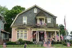 Trulock-Cook House |
February 21, 1979 (#79000444) |
703 W. 2nd Ave. 34°13′43″N 92°00′38″W |
Pine Bluff | |
| 64 | Trulock-Gould-Mullis House | 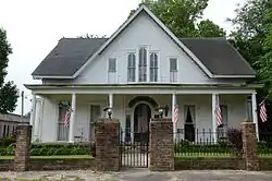 Trulock-Gould-Mullis House |
January 3, 1978 (#78003199) |
704 W. Barraque St. 34°13′46″N 92°00′35″W |
Pine Bluff | |
| 65 | Tucker School | 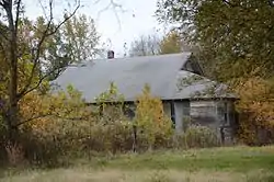 Tucker School |
June 10, 2005 (#05000538) |
Vandalsen Dr. 34°26′08″N 91°57′21″W |
Tucker | |
| 66 | Union Station | 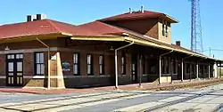 Union Station |
December 14, 1978 (#78000601) |
E. 4th Ave. and State St. 34°13′34″N 92°00′06″W |
Pine Bluff | |
| 67 | United States Army Snow Plow #SN-87 |  United States Army Snow Plow #SN-87 |
January 24, 2007 (#06001273) |
Arkansas Railroad Museum 34°13′47″N 91°59′07″W |
Pine Bluff | |
| 68 | Wabash Alloys Locomotive | 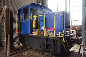 Wabash Alloys Locomotive |
May 22, 2007 (#07000444) |
Arkansas Railroad Museum 34°13′45″N 91°59′06″W |
Pine Bluff | |
| 69 | Wabbaseka Methodist Episcopal Church, South | 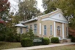 Wabbaseka Methodist Episcopal Church, South |
October 4, 2002 (#02001073) |
U.S. Highway 79 34°21′36″N 91°47′52″W |
Wabbaseka | |
| 70 | John Brown Watson Memorial Library Building | 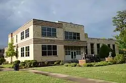 John Brown Watson Memorial Library Building |
January 13, 2006 (#05001073) |
1200 N. University Dr. 34°14′42″N 92°01′13″W |
Pine Bluff | |
| 71 | West James Street Overpass | West James Street Overpass |
May 18, 1995 (#95000609) |
W. James St. over Union Pacific railroad tracks 34°26′44″N 92°11′06″W |
Redfield | |
| 72 | Yauch-Ragar House |  Yauch-Ragar House |
January 20, 1978 (#78000602) |
625 State St. 34°13′28″N 92°00′07″W |
Pine Bluff |
Former listings
| [3] | Name on the Register | Image | Date listed | Date removed | Location | City or town | Summary |
|---|---|---|---|---|---|---|---|
| 1 | Austin House | December 22, 1982 (#82000842) | December 28, 2002 | 704 West 5th Avenue |
Pine Bluff | ||
| 2 | Floyd B. Brown House | January 19, 2006 (#04001493) | January 26, 2018 | 1401 S. Georgia St. 34°13′02″N 92°00′00″W |
Pine Bluff | ||
| 3 | Collier House | December 22, 1982 (#82000844) | January 23, 2008 | 1227 West 5th Street |
Pine Bluff | A Bungalow/Craftsman | |
| 4 | Dilley House | August 3, 1977 (#77000258) | January 26, 2018 | 656 Laurel St. 34°13′24″N 92°00′30″W |
Pine Bluff | ||
| 5 | Gracie House | December 22, 1982 (#82000846) | January 24, 2019 | Off Highway 88 34°13′36″N 91°46′33″W |
New Gascony | ||
| 6 | Hospital and Benevolent Association | December 22, 1982 (#82000841) | January 25, 2010 | 11th and Cherry 34°13′04″N 92°00′50″W |
Pine Bluff | ||
| 7 | Dr. John Walter Parker Sr. House | September 25, 2003 (#03000947) | January 26, 2018 | 1405 S. Alabama St. 34°12′54″N 92°00′03″W |
Pine Bluff | ||
| 8 | Russell House | December 22, 1982 (#82000852) | September 20, 2006 | 1617 South Olive Street 34°12′44″N 92°00′24″W |
Pine Bluff | A Bungalow/Craftsman | |
| 9 | Williams Building | November 16, 2010 (#10000833) | September 25, 2012 | 418-420 N. University 34°13′59″N 92°01′10″W |
Pine Bluff |
See also
| Wikimedia Commons has media related to National Register of Historic Places in Jefferson County, Arkansas. |
References
- The latitude and longitude information provided in this table was derived originally from the National Register Information System, which has been found to be fairly accurate for about 99% of listings. Some locations in this table may have been corrected to current GPS standards.
- "National Register of Historic Places: Weekly List Actions". National Park Service, United States Department of the Interior. Retrieved on February 5, 2021.
- Numbers represent an alphabetical ordering by significant words. Various colorings, defined here, differentiate National Historic Landmarks and historic districts from other NRHP buildings, structures, sites or objects.
- "National Register Information System". National Register of Historic Places. National Park Service. March 13, 2009.
- The eight-digit number below each date is the number assigned to each location in the National Register Information System database, which can be viewed by clicking the number.
- "R. M. Knox House, Pine Bluff, Jefferson County". Little Rock, Arkansas: Arkansas Historic Preservation Program. Archived from the original on 2013-11-10. Retrieved 2013-11-10.
| Topics | |
|---|---|
| Lists by state |
|
| Lists by insular areas | |
| Lists by associated state | |
| Other areas | |
| Related | |
| |
Municipalities and communities of Jefferson County, Arkansas, United States | ||
|---|---|---|
| Cities | Map of Arkansas highlighting Jefferson County | |
| Towns | ||
| CDP | ||
| Unincorporated communities | ||
| Footnotes | ‡This populated place also has portions in an adjacent county or counties | |
| ||
This article is issued from Wikipedia. The text is licensed under Creative Commons - Attribution - Sharealike. Additional terms may apply for the media files.