Regent's Park tube station
Regent's Park is a London Underground station 175 m south of Regent's Park. It is on a northern cusp of Fitzrovia[lower-alpha 1] and Marylebone on the Bakerloo line, between Baker Street and Oxford Circus. Its access is on Marylebone Road, within Park Crescent, in Travelcard Zone 1, in which zone it is the second-least used station (least-used is Lambeth North) – it saw 3.5 million entries or exits in 2015. It is 175 m west of Great Portland Street tube station on the same arterial road.
| Regent's Park | |
|---|---|
 | |
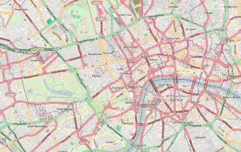 Regent's Park Location of Regent's Park in Central London | |
| Location | Marylebone |
| Local authority | City of Westminster |
| Managed by | London Underground |
| Number of platforms | 2 |
| Fare zone | 1 |
| London Underground annual entry and exit | |
| 2015 | |
| 2016 | |
| 2017 | |
| 2018 | |
| 2019 | |
| Railway companies | |
| Original company | Baker Street and Waterloo Railway |
| Key dates | |
| 10 March 1906 | Station opened |
| Other information | |
| External links | |
| WGS84 | 51.5235°N 0.1464°W |
History
The station was opened on 10 March 1906[4] by the Baker Street and Waterloo Railway (BS&WR); in the original parliamentary authority for the construction of the BS&WR no station was allowed at Regent's Park. Permission was granted to add it to the already partially constructed line in 1904.[5]
Station design
Construction of the station ticket hall involved digging a box like void underneath the garden above. This caused significant subsidence, this is why the large metal beams in the ticket hall are present.
Unlike most of the BS&WR's other stations, Regent's Park has no surface buildings and is accessed from a subway. The station is served by lifts, and between 10 July 2006 and 14 June 2007 it was closed to allow essential refurbishment work on these and other parts of the station. There is also a staircase which can be used which has 96 steps.
Nearby points of interest are Regent's Park itself, the Royal Academy of Music, the Royal College of Physicians, Holy Trinity Church, Portland Place and Harley Street.
Great Portland Street station is within walking distance to the east for interchanges to the Circle, Hammersmith & City, and Metropolitan lines.
Services
The typical service pattern in trains per hour (tph) operated during off-peak hours weekdays and all day Saturdays is:[6]
- 6tph to Harrow & Wealdstone via Queen's Park and Stonebridge Park (Northbound)
- 3tph to Stonebridge Park via Queen's Park (Northbound)
- 11tph to Queen's Park (Northbound)
- 20tph to Elephant & Castle (Southbound)
Weekday peak service operates with one or two additional Queen's Park-Elephant & Castle trains per hour, and Sunday service operates with two fewer Queen's Park-Elephant & Castle trains per hour during the core of the day.
Connections
The station is served by London Buses routes 18, 27, 30, 88, 205, 453 and C2, and also by night route N18.
Notes and references
- Footnotes
- Until the 1940s called East Marylebone
- Citations
- "Multi-year station entry-and-exit figures (2007–2017)" (XLSX). London Underground station passenger usage data. Transport for London. January 2018. Retrieved 22 July 2018.
- "Station Usage Data" (CSV). Usage Statistics for London Stations, 2018. Transport for London. 21 August 2019. Retrieved 27 April 2020.
- "Station Usage Data" (XLSX). Usage Statistics for London Stations, 2019. Transport for London. 23 September 2020. Retrieved 9 November 2020.
- Rose, Douglas (1999). The London Underground, A Diagrammatic History. Douglas Rose. ISBN 1-85414-219-4.
- Badsey-Ellis, Antony (2005). London's Lost Tube Schemes. Capital Transport. p. 232. ISBN 1-85414-293-3.
- "Bakerloo Line Working Timetable No. 42" (PDF). Transport for London. 21 May 2017. Retrieved 14 July 2017.
External links
| Wikimedia Commons has media related to Regent's Park tube station. |
| Preceding station | Following station | |||
|---|---|---|---|---|
towards Harrow & Wealdstone | Bakerloo line | towards Elephant & Castle |
| Stations |
| ||||||||||
|---|---|---|---|---|---|---|---|---|---|---|---|
| Non-revenue stations | |||||||||||
| Rolling stock | |||||||||||
| Depots | |||||||||||
| History |
| ||||||||||
| |||||||||||