Rivière-Nipissis, Quebec
Rivière-Nipissis is an unorganized territory in the Côte-Nord region of Quebec, Canada, part of the Sept-Rivières Regional County Municipality.
Rivière-Nipissis | |
|---|---|
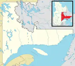 Rivière-Nipissis Location in Côte-Nord region of Quebec. | |
| Coordinates: 51°15′N 65°55′W[1] | |
| Country | |
| Province | |
| Region | Côte-Nord |
| RCM | Sept-Rivières |
| Constituted | January 1, 1986 |
| Government | |
| • Federal riding | Manicouagan |
| • Prov. riding | Duplessis |
| Area | |
| • Total | 10,429.70 km2 (4,026.93 sq mi) |
| • Land | 9,914.04 km2 (3,827.83 sq mi) |
| Population (2011)[3] | |
| • Total | 0 |
| • Density | 0.0/km2 (0/sq mi) |
| • Pop 2006-2011 | |
| • Dwellings | 1 |
| Time zone | UTC−5 (EST) |
| • Summer (DST) | UTC−4 (EDT) |
| Area code(s) | 418 and 581 |
| Highways | No major routes |
The eponymous Nipissis River is a left tributary of the Moisie River, with its source north of Lake Siamois. Nipissis, first identified as such in 1892 by surveyor Vincent, comes from the Innu language meaning "small body of water" or "small stream". In previous centuries, the river was also known as Little Saguenay and Moisie River East Branch.[4]
Demographics
As with neighboring communities Lac-Jerome and Petit-Mecatina, Rivière-Nipissis has been completely uninhabited since at least 1991.[5]
References
- Reference number 149759 of the Commission de toponymie du Québec (in French)
- "Rivière-Nipissis". Répertoire des municipalités (in French). Ministère des Affaires municipales, des Régions et de l'Occupation du territoire. Retrieved 2012-05-07.
- "Rivière-Nipissis census profile". 2011 Census of Population. Statistics Canada. Retrieved 2012-05-07.
- "Rivière Nipissis" (in French). Commission de toponymie du Québec. Retrieved 2009-08-03.
- Statistics Canada: 1996, 2001, 2006, 2011 census
Adjacent Municipal Subdivisions | ||||||||||
|---|---|---|---|---|---|---|---|---|---|---|
| ||||||||||
| Administrative units |
| ||||
|---|---|---|---|---|---|
| Protected areas |
| ||||
| Major river basins | |||||
| Significant lakes | |||||
| Transport infrastructure | |||||
| |||||
This article is issued from Wikipedia. The text is licensed under Creative Commons - Attribution - Sharealike. Additional terms may apply for the media files.