Minganie Regional County Municipality
Minganie is a regional county municipality in the Côte-Nord region of Quebec, Canada. It includes Anticosti Island. Its seat is Havre-Saint-Pierre.
Minganie | |
|---|---|
 | |
| Coordinates: 50°14′N 63°36′W[1] | |
| Country | |
| Province | |
| Region | Côte-Nord |
| Effective | January 1, 1982 |
| County seat | Havre-Saint-Pierre |
| Government | |
| • Type | Prefecture |
| • Prefect | Julien Boudreau |
| Area | |
| • Total | 73,725.10 km2 (28,465.42 sq mi) |
| • Land | 56,116.77 km2 (21,666.81 sq mi) |
| Population | |
| • Total | 6,582 |
| • Density | 0.1/km2 (0.3/sq mi) |
| • Pop 2006-2011 | |
| • Dwellings | 3,038 |
| Time zone | UTC−5 (EST) |
| • Summer (DST) | UTC−4 (EDT) |
| Area code(s) | 418 and 581 |
| Website | www |
It has an area of 73,725.10 square kilometres (28,465.42 sq mi) according to Quebec's Ministère des Affaires municipales, des Régions et de l'Occupation du territoire (which includes coastal, lake, and river water territory and also disputed land within Labrador), or a land area of 56,116.77 square kilometres (21,666.81 sq mi) according to Statistics Canada. The population from the Canada 2011 Census was 6,582[4] and in 2016 it was 11,323.[5] The majority live in Havre-Saint-Pierre.[2]
Minganie and the neighbouring Le Golfe-du-Saint-Laurent Regional County Municipality are grouped into the single census division of Minganie—Le Golfe-du-Saint-Laurent (known as Minganie–Basse-Côte-Nord before 2010). The combined population at the Canada 2011 Census was 11,708.[3]
Until 2002, Minganie RCM encompassed the entire lower north shore right up to Blanc-Sablon. In 2002, it lost all the coastal communities east of the Natashquan River when the Basse-Côte-Nord Territory was formed. In July 2010, the RCM lost another 44% of its territory when the (uninhabited) Petit-Mécatina unorganized territory was transferred to the newly created Le Golfe-du-Saint-Laurent Regional County Municipality, which superseded Basse-Côte-Nord.[6]
Subdivisions
There are 9 subdivisions and 2 native reserves within the RCM:[2]
|
|
|
|
Transportation
River basins
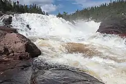
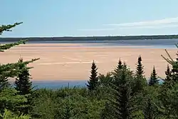
There are a number of large rivers that flow in a generally north-south direction through Minganie to enter the Gulf. Near the coast the river basins tend to narrow in towards the river mouth, and between their mouths are areas that drain into the Gulf through smaller streams. From west to east, the larger river basins, which may cover parts of Labrador, Sept-Rivières or Le Golfe-du-Saint-Laurent, are:[8]
References
- Reference number 141053 of the Commission de toponymie du Québec (in French)
- Geographic code 981 in the official Répertoire des municipalités (in French)
- "(Code 2498) Census Profile". 2011 census. Statistics Canada. 2012.
- Derived indirectly from Minganie—Le Golfe-du-Saint-Laurent census division Hierarchy data, by summing up data for Aguanish, Baie-Johan-Beetz, Havre-Saint-Pierre, L'Île-d'Anticosti, Lac-Jérôme, Longue-Pointe-de-Mingan, Mingan, Natashquan (reserve), Natashquan (township), Rivière-Saint-Jean and Rivière-au-Tonnerre census subdivisions.
- "Census Profile, 2016 Census: Minganie--Le Golfe-du-Saint-Laurent, Census division [Census division], Quebec". Statistics Canada. Retrieved November 30, 2019.
- Audrée Soucy (July 2010), "Municipalité régionale de comté (MRC)" (PDF), Modifications aux municipalités du Québec, Quebec: Institut de la statistique du Québec, ISSN 1715-6408, archived from the original (PDF) on 2011-06-12, retrieved 2010-09-17
- Official Transport Quebec Road Map
- Portrait préliminaire de la zone de gestion intégrée de l'eau par bassin versant Duplessis (PDF) (in French), OBV Duplessis, April 2015, p. 20, retrieved 2019-09-29
External links
- (in French) Municipalité régionale de comté de Minganie
| Administrative units |
| ||||
|---|---|---|---|---|---|
| Protected areas | |||||
| Major river basins | |||||
| Significant lakes | |||||
| Transport infrastructure | |||||
| |||||
Adjacent Counties & Equivalent Territories | |
|---|---|
| Regional county municipalities and equivalent territories | |
|---|---|
| Municipalities | |