Rossburg, Ohio
Rossburg is a village in Darke County, Ohio, United States. The population was 201 at the 2010 census.
Rossburg, Ohio | |
|---|---|
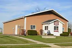 Village Hall | |
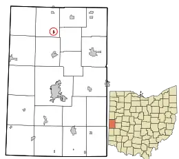 Location in Darke County and the state of Ohio | |
| Coordinates: 40°16′50″N 84°38′21″W | |
| Country | United States |
| State | Ohio |
| County | Darke |
| Township | Allen |
| Area | |
| • Total | 0.14 sq mi (0.36 km2) |
| • Land | 0.14 sq mi (0.36 km2) |
| • Water | 0.00 sq mi (0.00 km2) |
| Elevation | 1,030 ft (310 m) |
| Population | |
| • Total | 201 |
| • Estimate (2019)[4] | 185 |
| • Density | 1,321.43/sq mi (509.46/km2) |
| Time zone | UTC-5 (Eastern (EST)) |
| • Summer (DST) | UTC-4 (EDT) |
| ZIP codes | 45348, 45362 |
| Area code(s) | 937, 326 |
| FIPS code | 39-68672[5] |
| GNIS feature ID | 1057972[2] |
History
Rossburg was platted by John G. Ross in 1868.[6] In its early years, the community was also known as "Hagerman"; under this name a post office was established in the community on December 19, 1883, and it operated under this name until November 4, 1905.[7] The village was known as Rossville in 1881 to 1890.[8] The village was very small until a period of growth began circa 1883, when a predecessor of the Cincinnati, Jackson and Mackinaw Railroad built a railroad line through Rossburg.[6]
Geography
Rossburg is located at 40°16′50″N 84°38′21″W (40.280603, -84.639240).[9]
According to the United States Census Bureau, the village has a total area of 0.14 square miles (0.36 km2), all land.[10]
Demographics
| Historical population | |||
|---|---|---|---|
| Census | Pop. | %± | |
| 1890 | 254 | — | |
| 1900 | 251 | −1.2% | |
| 1910 | 261 | 4.0% | |
| 1920 | 246 | −5.7% | |
| 1930 | 176 | −28.5% | |
| 1940 | 204 | 15.9% | |
| 1950 | 203 | −0.5% | |
| 1960 | 295 | 45.3% | |
| 1970 | 275 | −6.8% | |
| 1980 | 260 | −5.5% | |
| 1990 | 250 | −3.8% | |
| 2000 | 224 | −10.4% | |
| 2010 | 201 | −10.3% | |
| 2019 (est.) | 185 | [4] | −8.0% |
| U.S. Decennial Census[11] | |||
2010 census
As of the census[3] of 2010, there were 201 people, 77 households, and 58 families living in the village. The population density was 1,435.7 inhabitants per square mile (554.3/km2). There were 81 housing units at an average density of 578.6 per square mile (223.4/km2). The racial makeup of the village was 100.0% White. Hispanic or Latino of any race were 0.5% of the population.
There were 77 households, of which 32.5% had children under the age of 18 living with them, 57.1% were married couples living together, 9.1% had a female householder with no husband present, 9.1% had a male householder with no wife present, and 24.7% were non-families. 22.1% of all households were made up of individuals, and 14.3% had someone living alone who was 65 years of age or older. The average household size was 2.61 and the average family size was 3.03.
The median age in the village was 39.8 years. 22.4% of residents were under the age of 18; 9.5% were between the ages of 18 and 24; 27.5% were from 25 to 44; 30.5% were from 45 to 64; and 10.4% were 65 years of age or older. The gender makeup of the village was 50.7% male and 49.3% female.
2000 census
As of the census[5] of 2000, there were 224 people, 86 households, and 62 families living in the village. The population density was 1,600.2 people per square mile (617.8/km2). There were 89 housing units at an average density of 635.8 per square mile (245.5/km2). The racial makeup of the village was 99.11% White, 0.45% Native American, 0.45% from other races. Hispanic or Latino of any race were 0.45% of the population.
There were 86 households, out of which 31.4% had children under the age of 18 living with them, 58.1% were married couples living together, 5.8% had a female householder with no husband present, and 27.9% were non-families. 26.7% of all households were made up of individuals, and 11.6% had someone living alone who was 65 years of age or older. The average household size was 2.60 and the average family size was 3.16.
In the village, the population was spread out, with 26.8% under the age of 18, 11.2% from 18 to 24, 28.1% from 25 to 44, 22.8% from 45 to 64, and 11.2% who were 65 years of age or older. The median age was 36 years. For every 100 females there were 89.8 males. For every 100 females age 18 and over, there were 100.0 males.
The median income for a household in the village was $30,583, and the median income for a family was $43,125. Males had a median income of $30,833 versus $18,906 for females. The per capita income for the village was $16,376. About 3.5% of families and 4.3% of the population were below the poverty line, including none of those under the age of eighteen and 5.6% of those 65 or over.
Entertainment
Rossburg is home to the Eldora Speedway, a half-mile clay oval race track, which hosts the Mudsummer Classic, the first NASCAR national race held on dirt since 1970.[12]
References
- "2019 U.S. Gazetteer Files". United States Census Bureau. Retrieved July 28, 2020.
- "US Board on Geographic Names". United States Geological Survey. 2007-10-25. Retrieved 2008-01-31.
- "U.S. Census website". United States Census Bureau. Retrieved 2013-01-06.
- "Population and Housing Unit Estimates". Retrieved May 21, 2020.
- "U.S. Census website". United States Census Bureau. Retrieved 2008-01-31.
- Wilson, Frazer Ells (1914). History of Darke County, Ohio, from its earliest settlement to the present time, Vol. 1. Milford, Ohio: Hobart Publishing Company. p. 565.
- U.S. Geological Survey Geographic Names Information System: Rossburg Post Office
- Transcripts of the Ansonia Mirror (newspaper), 1881-90
- "US Gazetteer files: 2010, 2000, and 1990". United States Census Bureau. 2011-02-12. Retrieved 2011-04-23.
- "US Gazetteer files 2010". United States Census Bureau. Archived from the original on 2012-01-24. Retrieved 2013-01-06.
- "Census of Population and Housing". Census.gov. Retrieved June 4, 2015.
- Billing, Greg (2012-11-28). "Eldora to host first NASCAR dirt race since 1970". Dayton Daily News. Retrieved 2013-08-14.
Municipalities and communities of Darke County, Ohio, United States | ||
|---|---|---|
| City |  Map of Ohio highlighting Darke County | |
| Villages | ||
| Townships | ||
| Unincorporated communities | ||
| Footnotes | ‡This populated place also has portions in an adjacent county or counties | |
| ||
| Authority control |
|
|---|