Ruthton, Minnesota
Ruthton is a city in Pipestone County, Minnesota, United States. The population was 241 at the 2010 census.[6]
Ruthton | |
|---|---|
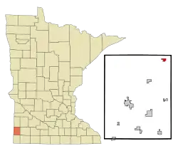 Location of Ruthton, Minnesota | |
| Coordinates: 44°10′34″N 96°6′12″W | |
| Country | United States |
| State | Minnesota |
| County | Pipestone |
| Government | |
| • Type | Mayor – Council |
| • Mayor | Stan Townsend |
| Area | |
| • Total | 0.58 sq mi (1.52 km2) |
| • Land | 0.58 sq mi (1.50 km2) |
| • Water | 0.01 sq mi (0.01 km2) |
| Elevation | 1,732 ft (528 m) |
| Population | |
| • Total | 241 |
| • Estimate (2019)[3] | 221 |
| • Density | 381.03/sq mi (147.02/km2) |
| Time zone | UTC-6 (Central (CST)) |
| • Summer (DST) | UTC-5 (CDT) |
| ZIP code | 56170 |
| Area code(s) | 507 |
| FIPS code | 27-56482[4] |
| GNIS feature ID | 0650431[5] |
The city is the home of Exelon Wind's Cowell Wind Project.[7]
History
Ruthton was platted in 1888, and named for the wife of a member of the town company.[8] A post office has been in operation at Ruthton since 1888.[9] Ruthton was incorporated in 1897.[8]
Geography
According to the United States Census Bureau, the city has a total area of 0.67 square miles (1.74 km2), of which 0.66 square miles (1.71 km2) is land and 0.01 square miles (0.03 km2) is water.[10]
The Redwood River flows through the city as an intermittent stream near its headwaters.[11][12]
Minnesota State Highway 23 serves as a main route in the community.
Demographics
| Historical population | |||
|---|---|---|---|
| Census | Pop. | %± | |
| 1900 | 323 | — | |
| 1910 | 290 | −10.2% | |
| 1920 | 403 | 39.0% | |
| 1930 | 387 | −4.0% | |
| 1940 | 480 | 24.0% | |
| 1950 | 534 | 11.3% | |
| 1960 | 476 | −10.9% | |
| 1970 | 405 | −14.9% | |
| 1980 | 328 | −19.0% | |
| 1990 | 328 | 0.0% | |
| 2000 | 284 | −13.4% | |
| 2010 | 241 | −15.1% | |
| 2019 (est.) | 221 | [3] | −8.3% |
| U.S. Decennial Census[13] | |||
2010 census
As of the census[2] of 2010, there were 241 people, 110 households, and 67 families residing in the city. The population density was 365.2 inhabitants per square mile (141.0/km2). There were 128 housing units at an average density of 193.9 per square mile (74.9/km2). The racial makeup of the city was 99.2% White and 0.8% from two or more races. Hispanic or Latino of any race were 0.8% of the population.
There were 110 households, of which 25.5% had children under the age of 18 living with them, 49.1% were married couples living together, 6.4% had a female householder with no husband present, 5.5% had a male householder with no wife present, and 39.1% were non-families. 30.9% of all households were made up of individuals, and 10.9% had someone living alone who was 65 years of age or older. The average household size was 2.19 and the average family size was 2.76.
The median age in the city was 43.3 years. 22.4% of residents were under the age of 18; 7.1% were between the ages of 18 and 24; 21.9% were from 25 to 44; 34.5% were from 45 to 64; and 14.1% were 65 years of age or older. The gender makeup of the city was 49.8% male and 50.2% female.
2000 census
As of the census[4] of 2000, there were 284 people, 129 households, and 82 families residing in the city. The population density was 419.8 people per square mile (161.3/km2). There were 145 housing units at an average density of 214.3 per square mile (82.3/km2). The racial makeup of the city was 97.54% White, 1.06% African American, 0.35% Native American, 0.35% Asian, and 0.70% from two or more races.
There were 129 households, out of which 27.9% had children under the age of 18 living with them, 53.5% were married couples living together, 8.5% had a female householder with no husband present, and 35.7% were non-families. 34.1% of all households were made up of individuals, and 18.6% had someone living alone who was 65 years of age or older. The average household size was 2.20 and the average family size was 2.80.
In the city, the population was spread out, with 23.6% under the age of 18, 7.7% from 18 to 24, 26.4% from 25 to 44, 23.9% from 45 to 64, and 18.3% who were 65 years of age or older. The median age was 38 years. For every 100 females, there were 97.2 males. For every 100 females age 18 and over, there were 88.7 males.
The median income for a household in the city was $26,250, and the median income for a family was $33,125. Males had a median income of $25,875 versus $18,125 for females. The per capita income for the city was $13,016. About 10.0% of families and 15.0% of the population were below the poverty line, including 23.7% of those under the age of eighteen and 27.3% of those 65 or over.
Politics
Ruthton is located in Minnesota's 7th congressional district, represented by Collin Peterson, a Democrat. At the state level, Ruthton is located in Senate District 22, represented by Republican Bill Weber, and in House District 22A, represented by Republican Joe Schomacker.
Ruthton murders
Final Harvest: An American Tragedy, by New York Times reporter Andrew H. Malcolm, is about the farm crisis of the 1970s and the murder of two Ruthton bankers by a man who had lost his farm, Jim Jenkins, on September 29, 1983. Jenkins, along with his son, Steve, managed to lure the president of the Buffalo Ridge State Bank in Ruthton, Rudy Blythe Jr., and the bank's loan officer, Toby Thulin, onto a lonely farmhouse road. Jenkins murdered both bankers, then fled to Texas, where he walked into an open field, carefully took his eyeglasses off, put a shotgun into his mouth and pulled the trigger. Steve Jenkins later stood trial in Minnesota on accessory charges.[14]
Notable people
- Todd Bouman, American football player.
References
- "2019 U.S. Gazetteer Files". United States Census Bureau. Retrieved July 26, 2020.
- "U.S. Census website". United States Census Bureau. Retrieved 2012-11-13.
- "Population and Housing Unit Estimates". United States Census Bureau. May 24, 2020. Retrieved May 27, 2020.
- "U.S. Census website". United States Census Bureau. Retrieved 2008-01-31.
- "US Board on Geographic Names". United States Geological Survey. 2007-10-25. Retrieved 2008-01-31.
- "2010 Census Redistricting Data (Public Law 94-171) Summary File". American FactFinder. United States Census Bureau. Retrieved 27 April 2011.
- http://www.exeloncorp.com/PowerPlants/exelonwind-minnesota/Pages/profile.aspx
- Upham, Warren (1920). Minnesota Geographic Names: Their Origin and Historic Significance. Minnesota Historical Society. p. 418.
- "Pipestone County". Jim Forte Postal History. Retrieved 31 July 2015.
- "US Gazetteer files 2010". United States Census Bureau. Archived from the original on 2012-01-25. Retrieved 2012-11-13.
- Waters, Thomas F. (2006). "The Southwest: Rivers of the Coteau des Prairies". The Streams and Rivers of Minnesota. Minneapolis: University of Minnesota Press. pp. 288–303. ISBN 0-8166-0960-8.
- Minnesota Atlas & Gazetteer. Yarmouth, Me.: DeLorme. 1994. p. 28. ISBN 0-89933-222-6.
- "Census of Population and Housing". Census.gov. Retrieved June 4, 2015.
- Martin F Nolan (1986-04-17). "Books: A Midwest Tale". NY Times. Retrieved 2013-04-27.
External links
Municipalities and communities of Pipestone County, Minnesota, United States | ||
|---|---|---|
| Cities | 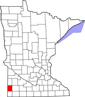 Map of Minnesota highlighting Pipestone County | |
| Townships | ||
| Unincorporated communities | ||
| Footnotes | ‡This populated place also has portions in an adjacent county or counties | |
| ||