Ryūō, Shiga
Ryūō (竜王町, Ryūō-chō) is a town located in Gamō District, Shiga Prefecture, Japan.
Ryūō
竜王町 | |||||||||
|---|---|---|---|---|---|---|---|---|---|
Town | |||||||||
 Flag | |||||||||
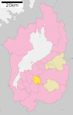 Location of Ryūō in Shiga Prefecture | |||||||||
 Ryūō Location in Japan | |||||||||
| Coordinates: 35°4′N 136°7′E | |||||||||
| Country | Japan | ||||||||
| Region | Kansai | ||||||||
| Prefecture | Shiga Prefecture | ||||||||
| Government | |||||||||
| • Mayor | Kiyoji Yamaguchi (2004–present) | ||||||||
| Area | |||||||||
| • Total | 44.52 km2 (17.19 sq mi) | ||||||||
| Population (October 1, 2016) | |||||||||
| • Total | 12,130 | ||||||||
| • Density | 270/km2 (710/sq mi) | ||||||||
| Time zone | UTC+09:00 (JST) | ||||||||
| City hall address | 3 Oguchi, Ryūō-chō, Gamō-gun, Shiga-ken 520-2592 | ||||||||
| Website | www | ||||||||
| |||||||||
As of 2016, the town has an estimated population of 12,130 and a density of 270 persons per km². The total area is 44.52 km².
Geography
Ryūō is located in the center of Shiga. The Hino River and its 3 tributaries, Zenkōji-gawa, Sofu-gawa, and Sōshirō-gawa, run on the flat land between Mount Kagami on the West and Mount Yukino on the East. Hilly regions cover the southern area in and out of Ryūō.
- Mountains: Kagami-yama (also called Western Ryūō-zan), Yukinoyama (also called Eastern Ryūō-zan)
- Rivers: Hino, Zenkōji, Sofu, Sōshirō
Nearby cities
- Ōmihachiman
- Higashiōmi
- Yasu
- Koka
- Konan
History
- April 1, 1889
- Kawamori (川守村), Iwai (岩井村), Yamanoue (山之上村), Hayashi (林村), Shō (庄村), Shinano (信濃村), Kayochō (駕輿丁村), Shima (島村), and Ayado (綾戸村) (all from Gamō District) merged to form Na (苗村).
- Kagami (鏡村), Yamazura (山面村), Ukawa (鵜川村), Oguchi (小口村), Kuzushi (薬師村), Shichiri (七里村), Kawakami (川上村), Hashimoto (橋本村), Yuge (弓削村), Sue (須恵村), Nishikawa (西川村), Nishiyokozeki (西横関村), Yamanaka (山中村), and Okaya (岡屋村) (all from Gamō District) merged to form Kagamiyama (鏡山村).
- April 29, 1955 — Kagamiyama and Na merged to form Ryūō.
Economy
Industry
- Car Industry - Daihatsu Motor Co., Ltd.
- Industry Ratio
- Farmer 6.3%
- Industry 52.4%
- Service 41.3%
Sister cities
- Sault Ste. Marie, Michigan, United States Since September 9, 1974
Local
Education
- Elementary Schools
- Ryūō Elementary School
- Ryūō-Nishi Elementary School
- Junior High Schools
- Ryūō Junior High School
Previously the city hosted a Brazilian school, Colégio Latino de Shiga.[1] It moved to Omihachiman and changed its name to Colégio Latino do Japão.[2]
Traffic
Railway
There are no railways in Ryūō. The nearest station is Shinohara Station, but many people find the Ōmi-Hachiman Station or Yasu Station to be more convenient.
Road
- Toll Road
- Meishin Expressway
- Ryūō Interchange
- Ryūō Bus stop
- National Highway
- Prefecture Route
- Trunk Line
- Pref. No. 13
- Pref. No. 14
- Pref. No. 22
- General Line
- Pref. No. 164
- Pref. No. 165
- Pref. No. 166
- Pref. No. 176
- Pref. No. 541
Bus
- Ōmi Bus
References
- "Escolas Brasileiras Homologadas no Japão" (Archive). Embassy of Brazil in Tokyo. February 7, 2008. Retrieved on October 13, 2015.
- "Escolas Brasileiras Homologadas no Japão" (Archive). Embassy of Brazil in Tokyo. Retrieved on October 13, 2015.
External links
 Media related to Ryūō, Shiga at Wikimedia Commons
- Ryūō Official Website (in Japanese)
| Authority control |
|---|