Saint-Gabriel, Quebec
Saint-Gabriel is a town in the Lanaudière region of Quebec, Canada, part of the D'Autray Regional County Municipality. It is located on the shores of Lake Maskinongé, in the shadows of the Laurentian Mountains.
- For other places named Saint-Gabriel in Quebec, see Saint Gabriel (disambiguation).
Saint-Gabriel | |
|---|---|
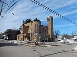 Town hall of Saint-Gabriel | |
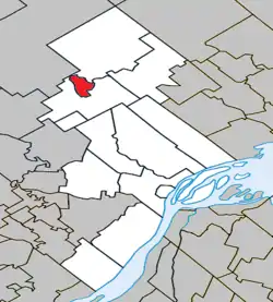 Location within D'Autray RCM | |
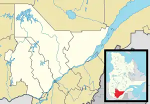 Saint-Gabriel Location in central Quebec | |
| Coordinates: 46°18′N 73°23′W[1] | |
| Country | |
| Province | |
| Region | Lanaudière |
| RCM | D'Autray |
| Settled | 1825 |
| Constituted | December 17, 1892 |
| Government | |
| • Mayor | Gaétan Gravel |
| • Federal riding | Berthier—Maskinongé |
| • Prov. riding | Berthier |
| Area | |
| • Total | 12.90 km2 (4.98 sq mi) |
| • Land | 2.81 km2 (1.08 sq mi) |
| Population (2011)[3] | |
| • Total | 2,844 |
| • Density | 1,012.3/km2 (2,622/sq mi) |
| • Pop 2006-2011 | |
| • Dwellings | 1,578 |
| Time zone | UTC−5 (EST) |
| • Summer (DST) | UTC−4 (EDT) |
| Postal code(s) | J0K 2N0 |
| Area code(s) | 450 and 579 |
| Highways | |
History
The first settlers were Loyalists, Irish, and Scottish, arriving around 1825 to the shores of Lake Maskinongé, where they formed a community that was known as Lake Maskinongé Settlement by 1827, and later as the Mission of Lac-Maskinongé. In 1837, the name Saint-Gabriel-du-Lac-Maskinongé came in use but was changed to Saint-Gabriel-de-Brandon in 1840. This name refers to the angel Gabriel and the geographic township of Brandon that was proclaimed in 1827 and in which it is located.[4]
In 1851, the Parish of Saint-Gabriel-de-Brandon was founded and the post office opened that same year. In 1855, the Saint-Gabriel-de-Brandon Parish Municipality was established [4] and the town of Saint-Gabriel remained part of this parish municipality until 1892, when it separated and became the Village Municipality of Saint-Gabriel-de-Brandon. In 1967, it changed its status and name to Ville de Saint-Gabriel by then Mayor Yvan Comeau.[1]
Demographics
Population trend:[5]
- Population in 2011: 2844 (2006 to 2011 population change: 0.6%)
- Population in 2006: 2828
- Population in 2001: 2775
- Population in 1996: 2862
- Population in 1991: 2710
Private dwellings occupied by usual residents: 1340 (total dwellings: 1578)
Mother tongue:
- English as first language: 3.5%
- French as first language: 96.1%
- English and French as first language: 0%
- Other as first language: 0.4%
Education
The Sir Wilfrid Laurier School Board operates anglophone public schools, including:
- Joliette Elementary School in Saint-Charles-Borromée[6]
- Joliette High School in Joliette[7]
See also
References
- "Saint-Gabriel (Ville)" (in French). Commission de toponymie du Québec. Retrieved 2009-11-20.
- Geographic code 52080 in the official Répertoire des municipalités (in French)
- Statistics Canada 2011 Census - Saint-Gabriel census profile
- "Saint-Gabriel-de-Brandon (Municipalité de paroisse)" (in French). Commission de toponymie du Québec. Retrieved 2009-11-20.
- Statistics Canada: 1996, 2001, 2006, 2011 census
- "JOLIETTE ELEMENTARY ZONE." Sir Wilfrid Laurier School Board. Retrieved on September 17, 2017.
- "Joliette High School Zone Sec 1-5." Sir Wilfrid Laurier School Board. Retrieved on September 5, 2017.
External links
 Media related to Saint-Gabriel, Quebec at Wikimedia Commons
- Saint-Gabriel - MRC d'Autray
Adjacent Municipal Subdivisions | ||||||||||
|---|---|---|---|---|---|---|---|---|---|---|
| ||||||||||
| Cities & Towns | |
|---|---|
| Municipalities | |
| Parishes | |
| |
| Authority control |
|
|---|