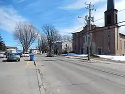
Sainte-Élisabeth, Quebec
Sainte-Élisabeth is a parish municipality in the Lanaudière region of Quebec, Canada, part of the D'Autray Regional County Municipality.
Sainte-Élisabeth | |
|---|---|
 | |
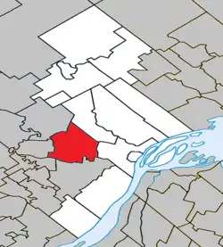 Location within D'Autray RCM | |
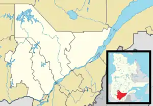 Sainte-Élisabeth Location in central Quebec | |
| Coordinates: 46°05′N 73°21′W[1] | |
| Country | |
| Province | |
| Region | Lanaudière |
| RCM | D'Autray |
| Constituted | July 1, 1855 |
| Government | |
| • Mayor | Robert Bérard |
| • Federal riding | Berthier—Maskinongé |
| • Prov. riding | Berthier |
| Area | |
| • Total | 83.20 km2 (32.12 sq mi) |
| • Land | 82.77 km2 (31.96 sq mi) |
| Population (2011)[3] | |
| • Total | 1,559 |
| • Density | 18.8/km2 (49/sq mi) |
| • Pop 2006-2011 | |
| • Dwellings | 628 |
| Time zone | UTC−5 (EST) |
| • Summer (DST) | UTC−4 (EDT) |
| Postal code(s) | J0K 2J0 |
| Area code(s) | 450 and 579 |
| Highways | |
| Website | www |
Demographics
Population trend:[4]
- Population in 2011: 1559 (2006 to 2011 population change: 8.3%)
- Population in 2006: 1440
- Population in 2001: 1474
- Population in 1996: 1559 (or 1564 when adjusted for 2001 boundaries)
- Population in 1991: 1508
Private dwellings occupied by usual residents: 601 (total dwellings: 628)
Mother tongue:
- English as first language: 0.75%
- French as first language: 98.5%
- English and French as first language: 0%
- Other as first language: 0.75%
Education
Commission scolaire des Samares operates francophone public schools, including:
- École Emmélie-Caron[5]
The Sir Wilfrid Laurier School Board operates anglophone public schools, including:
- Joliette Elementary School in Saint-Charles-Borromée[6]
- Joliette High School in Joliette[7]
See also
References
- Reference number 418078 of the Commission de toponymie du Québec (in French)
- Geographic code 52030 in the official Répertoire des municipalités (in French)
- Statistics Canada 2011 Census - Sainte-Élisabeth census profile
- Statistics Canada: 1996, 2001, 2006, 2011 census
- "Emmélie-Caron." Commission scolaire des Samares. Retrieved on September 23, 2017.
- "JOLIETTE ELEMENTARY ZONE." Sir Wilfrid Laurier School Board. Retrieved on September 17, 2017.
- "Joliette High School Zone Sec 1-5." Sir Wilfrid Laurier School Board. Retrieved on September 5, 2017.
External links
 Media related to Sainte-Élisabeth at Wikimedia Commons
- Sainte-Élisabeth - MRC d'Autray
Adjacent Municipal Subdivisions | |
|---|---|
| Cities & Towns | |
|---|---|
| Municipalities | |
| Parishes | |
| |
| Authority control |
|---|
This article is issued from Wikipedia. The text is licensed under Creative Commons - Attribution - Sharealike. Additional terms may apply for the media files.