Salem, Utah
Salem is a city in Utah County, Utah, United States. It is part of the Provo–Orem Metropolitan Statistical Area. The population was 8,469 at the 2017 U.S. census. [5] Landmark locations in Salem include the Dream Mine of John Hyrum Koyle and the Salem Pond.
Salem, Utah | |
|---|---|
.jpg.webp) Welcome to Salem sign, March 2017 | |
| Nickname(s): City of peace | |
| Motto(s): Making Life Better | |
 Location in Utah County and the state of Utah | |
| Coordinates: 40°3′2″N 111°40′21″W | |
| Country | United States |
| State | Utah |
| County | Utah |
| Settled | 1851 |
| Incorporated | May 10, 1920 |
| Named for | Salem, Massachusetts |
| Government | |
| • Type | Strong Mayor Municipal Format |
| • Mayor | Kurt Christensen |
| Area | |
| • Total | 10.53 sq mi (27.26 km2) |
| • Land | 10.50 sq mi (27.21 km2) |
| • Water | 0.02 sq mi (0.06 km2) |
| Elevation | 4,610 ft (1,405 m) |
| Population (2010) | |
| • Total | 6,423 |
| • Estimate (2019)[2] | 8,621 |
| • Density | 820.73/sq mi (316.89/km2) |
| Time zone | UTC-7 (Mountain (MST)) |
| • Summer (DST) | UTC-6 (MDT) |
| ZIP code | 84653 |
| Area code(s) | 385, 801 |
| FIPS code | 49-65770[3] |
| GNIS feature ID | 1445262[4] |
| Website | Salem City |
History

Known as "Summer Spring" by the Indians, and "Pond Town" by early settlers. Pond Town was first settled in 1851.
Salem was later named after New Salem, Massachusetts, the birthplace of Lyman Curtis, to honor his contributions to the community.[6] Curtis was good with a gun and a bodyguard for Joseph Smith. He was later among the earliest Latter-day Saint settlers in Utah. Curtis also was important in central Utah for founding a lumber mill and being involved in important irrigation efforts.
Demographics
| Historical population | |||
|---|---|---|---|
| Census | Pop. | %± | |
| 1860 | 179 | — | |
| 1870 | 353 | 97.2% | |
| 1880 | 510 | 44.5% | |
| 1890 | 527 | 3.3% | |
| 1900 | 894 | 69.6% | |
| 1910 | 693 | −22.5% | |
| 1920 | 609 | −12.1% | |
| 1930 | 610 | 0.2% | |
| 1940 | 659 | 8.0% | |
| 1950 | 781 | 18.5% | |
| 1960 | 920 | 17.8% | |
| 1970 | 1,081 | 17.5% | |
| 1980 | 2,233 | 106.6% | |
| 1990 | 2,284 | 2.3% | |
| 2000 | 4,372 | 91.4% | |
| 2010 | 6,423 | 46.9% | |
| 2019 (est.) | 8,621 | [2] | 34.2% |
| U.S. Decennial Census[7] | |||

As of the census[3] of 2000, there were 4,372 people, 1,128 households, and 1,009 families residing in the city. The population density was 825.0 people per square mile (318.5/km2). There were 1,166 housing units at an average density of 220.0 per square mile (84.9/km2). The racial makeup of the city was 97.07% White, 0.07% African American, 0.09% Native American, 0.14% Asian, 0.27% Pacific Islander, 1.40% from other races, and 0.96% from two or more races. Hispanic or Latino of any race were 2.79% of the population.
There were 1,128 households, out of which 56.0% had children under the age of 18 living with them, 82.3% were married couples living together, 5.1% had a female householder with no husband present, and 10.5% were non-families. 9.7% of all households were made up of individuals, and 5.1% had someone living alone who was 65 years of age or older. The average household size was 3.86 and the average family size was 4.14.
In the city, the population was spread out, with 40.6% under the age of 18, 10.2% from 18 to 24, 25.0% from 25 to 44, 16.4% from 45 to 64, and 7.8% who were 65 years of age or older. The median age was 24 years. For every 100 females, there were 102.3 males. For every 100 females age 18 and over, there were 98.2 males.
The median income for a household in the city was $54,813, and the median income for a family was $57,557. Males had a median income of $40,116 versus $22,798 for females. The per capita income for the city was $16,507. About 3.1% of families and 4.1% of the population were below the poverty line, including 5.2% of those under age 18 and 5.7% of those age 65 or over.
Geography
According to the United States Census Bureau, the city has a total area of 10.2 square miles (26.4 km2), of which 10.2 square miles (26.3 km2) is land and 0.04 square miles (0.1 km2), or 0.23%, is water.[8] Salem is located 4.5 miles south of neighboring Spanish Fork, and 3.3 miles northeast of Payson. [9]
Climate
This climatic region is typified by large seasonal temperature differences, with warm to hot (and often humid) summers and cold (sometimes severely cold) winters. According to the Köppen Climate Classification system, Salem has a humid continental climate, abbreviated "Dfb" on climate maps.[10]
Education
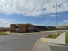
Public schools in Salem are part of the Nebo School District. Salem has three elementary schools, one junior high school, and one high school. Rick Nielsen is the Superintendent of Schools.[11]
Salem Days
Salem Days is a week-long city celebration held in either the first or second week of August every year and are a collective of many activities, including a baby contest, car show, cardboard boat regatta, grand parade, firework show, pageant, children's parade, and movie in the park.[12] It has been going on since 1949 when The Church of Jesus Christ of Latter-day Saints asked the cities of Utah to celebrate their towns yearly.
See also
- List of cities and towns in Utah
References
- "2019 U.S. Gazetteer Files". United States Census Bureau. Retrieved August 7, 2020.
- "Population and Housing Unit Estimates". United States Census Bureau. May 24, 2020. Retrieved May 27, 2020.
- "U.S. Census website". United States Census Bureau. Retrieved January 31, 2008.
- "US Board on Geographic Names". United States Geological Survey. October 25, 2007. Retrieved January 31, 2008.
- http://worldpopulationreview.com/us-cities/salem-ut-population/
- Arlene Despain Wilson. "Short History of Salem". Retrieved March 28, 2011.
- "Census of Population and Housing". Census.gov. Retrieved June 4, 2015.
- "Geographic Identifiers: 2010 Demographic Profile Data (G001): Salem city, Utah". United States Census Bureau. Retrieved March 8, 2012.
- https://www.distance-cities.com/distance-salem-ut-to-payson-ut
- Climate Summary for Salem, Utah
- "Nebo School District". Nebo School District. Retrieved June 17, 2012.
- "Salem Days 2018 Schedule of Events". Daily Herald. Retrieved July 31, 2019.
External links
| Wikimedia Commons has media related to Salem, Utah. |
- Official website
- Koyle Relief Mine map, MSS 8030 at L. Tom Perry Special Collections, Brigham Young University. Map of Salem's "Dream Mine."
Places adjacent to Salem, Utah | |
|---|---|
Municipalities and communities of Utah County, Utah, United States | ||
|---|---|---|
| Cities | 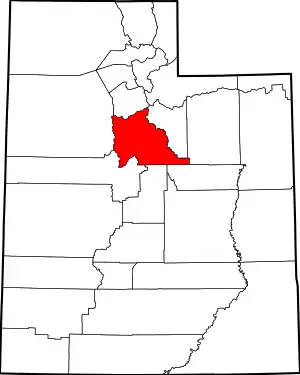 Map of Utah highlighting Utah County | |
| Towns | ||
| CDPs | ||
| Unincorporated communities |
| |
| Indian reservation | ||
| Ghost towns | ||
| Footnotes | ‡This populated place also has portions in an adjacent county or counties | |
| ||